Colorado
Looking for the best hiking in Colorado? We've got you covered with the top trails, trips, hiking, backpacking, camping and more around Colorado. The detailed guides, photos, and reviews are all submitted by the Outbound community.
Top Hiking Spots in and near Colorado
-
Buena Vista, Colorado
Mt. Belford and Mt. Oxford
4.510.34 mi / 5856 ft gainYou'll being your ascent at the Missouri Gulch Trailhead, which is located a few miles up Chaffee County Road 390, at around 9,600 feet. The trail is very clear and very well maintained, but is steeper than most trails (even quite a few of the 14er trails I've done) right from the get-go. Remembe...Read more -
Larimer County, Colorado
Lake Haiyaha
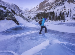
5.03.64 mi / 800 ft gainBegin the hike at the Bear Lake trailhead, this will be the same for any season you chose to hike to the lake. From the Bear Lake trailhead follow the Dream Lake trail for ~1.05 miles to just before Dream Lake itself. The trail is very easy to follow up to this point in all seasons. In winter the...Read more -
Estes Park, Colorado
Ptarmigan Lake via Bear Lake Trailhead
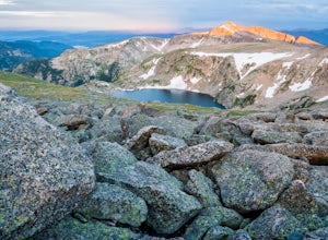
11.33 mi / 3850 ft gainThe hike to Ptarmigan Lake has plenty of elevation gain for mountain lovers and views for miles from the Continental Divide. If you want to reach this spot for sunrise you'll need a very early start in the morning, but that also means you won't have to use the shuttle system to Bear Lake. The las...Read more -
Idaho Springs, Colorado
Bierstadt, Evans, and The Sawtooth Loop
4.59.76 mi / 3438 ft gainStarting from the oddly poorly marked Guanella Pass Trailhead (Google maps directions to Guanella Campground and then drive about two miles past it to the south), the trail heads southeast toward Bierstadt, and much of your route to the first summit is visible from the parking lot. The trail to ...Read more -
Silver Plume, Colorado
Torrey's Peak via Kelso Ridge
5.05.79 mi / 2982 ft gainThe start of this route up the Kelso Ridge is the same as doing the standard route of Gray's and Torrey's peaks. From the trailhead cross the large metal bridge and continue on the great trail as it slowly climbs away from the parking lot and trailhead. This first section is not steep, but prov...Read more -
Evergreen, Colorado
Hike the Resthouse/Lincoln Lake Trail
4.5While the Mt. Evans Wilderness never has a shortage of visitors, thanks to its proximity to Denver, it is possible to find a more private hike if you know where to look. Lincoln Lake Trail, accessible from Echo Lake year-round, is not as glamorous as its sister trail, Chicago Lakes, but is a wond...Read more -
Estes Park, Colorado
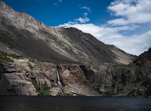
Peacock Pool
7.9 mi / 2438 ft gainThe peacock pool is a cool little tarn below the outlet to Chasm Lake. Please note that this adventure is best done in the winter/spring when snow is present to prevent erosion in the sensitive area. That is how the description will be written, assuming winter conditions. The approach is the sa...Read more -
Ridgway, Colorado
Explore Twin Falls in Yankee Boy Basin
While small, Twin Falls sits in the extremely photogenic backdrop of Yankee Boy Basin. To reach the falls 7.5 miles outside of Ouray follow Camp Bird road for 4.7 miles before taking a right onto Yankee Boy Basin Road. After 2.8 miles you'll reach one of several small parking areas on the left ...Read more -
Golden, Colorado
Hike to Forgotten Valley
4.33.6 mi / 852 ft gainThere are over 35 miles of hiking trails in the park. The twelve trails in Golden Gate Canyon State Park are named after an animal and marked with the animal’s footprint.For a 2.6 round trip hike, start at the Burro Trailhead in Golden Gate Canyon State Park. You’ll immediately cross over a lit...Read more -
Aspen, Colorado
Hike Lost Man Loop
5.08.8 mi / 1290 ft gainThis 8.8 mile "loop" is not a true loop and the trail ends 4 miles apart along Independence Pass, so a car shuttle is recommended. I would recommend starting at the west trailhead (closer to Aspen) but will describe both trailheads so you can set up another car or shuttle at the other one.1) West...Read more -
Basalt, Colorado
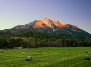
Camp at Thomas Lake and Summit Mt. Sopris
5.013 mi / 4400 ft gainWith the Elk Mountain range behind it, It appears to be standing by itself, and has the resemblance of a grand volcano.From Hwy 133 out of Carbondale, turn down Prince Creek Road and drive 6 miles to the trailhead. The trail is a nice mixture of meadows and woods, with excellent views of the vall...Read more -
Estes Park, Colorado
Twin Sisters Peak
5.07.48 mi / 2470 ft gainThe trailhead starts close to 9,000 ft elevation. It continues at a gradual slope through the forest for a long way. The trail does not exit the tree line until close to the top, where there is a boulder field, of sorts (slightly over 11,000 ft). Don't worry, there is a nice trail all the way to ...Read more -
Westcliffe, Colorado
Hike to Willow Lake, CO
5.09 mi / 2800 ft gainNestled in the Sangre de Cristo Wilderness, Willow Lake offers a stunning destination to a rigorous hike. The hike is approximately 9 miles out and back with 2800 feet of elevation gain. The trail is well marked and maintained. However, the hike rarely levels off. Be prepared for a steady incline...Read more -
Estes Park, Colorado
Flattop Mountain and Hallett Peak
4.49.73 mi / 3240 ft gainArrive at the Bear Lake Trailhead. Follow abundant signage toward Flattop Peak. Once you arrive at the summit of Flattop identify the unnamed unmaintained trail leading south toward Hallett Peak. Round the head of Tyndall Gorge and ascend the rocky slopes toward the summit by connecting short use...Read more -
Salida, Colorado
Hike Mount Shavano and Tabeguache Peak
4.09.25 mi / 4600 ft gainStart out on the Shavano and Tabeguache Trailhead off of FR 252 outside of Poncha Springs, at about 9,700 feet, and begin your trek into the forest. In the first half of a mile there are a few trail marker signs that should be read carefully to insure the right path is followed, but these signs ...Read more -
Littleton, Colorado
Hike the South Rim Trail at Roxborough State Park
3.83 mi / 300 ft gainRoxborough State Park is one of the closest parks to the Denver metro area and is the perfect place to go if you're looking to experience the great outdoors without having to drive too far from the city.One of my favorite trails in the park is the South Rim Trail which takes you on an easy to mod...Read more

