Hartsel, Colorado
Looking for the best mountain biking in Hartsel? We've got you covered with the top trails, trips, hiking, backpacking, camping and more around Hartsel. The detailed guides, photos, and reviews are all submitted by the Outbound community.
Top Mountain Biking Spots in and near Hartsel
-
Idaho Springs, Colorado
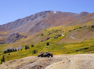
ATV Leavenworth Creek Road (Guanella Pass)
16.6 mi / 3655 ft gainSeptember is famous in Colorado for clear, deep blue skies,sublimely perfect temperatures, and gold-digging – of the leaf variety, thatis. On September 9, wildflower season was recently past and the best of theleaves were yet to come, but it was the perfect, clear and sunny day to checkout the hi...Read more -
Salida, Colorado
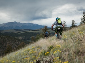
Ride the Monarch Crest Trail
5.0The Monarch Crest Trail has been rated as an IMBA Epic ride and is for sure an epic ride especially ending the ride with the Rainbow Trail. The Monarch Crest Trail is best ridden as a shuttle and begins at the very top of Monarch Pass just outside of Salida or Poncha Springs, Colorado on highway ...Read more -
Silver Plume, Colorado
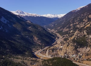
Argentine Railroad Grade
5.05.35 mi / 863 ft gainThe Argentine Central Railroad Grade trail is just what it says: it follows the old rail bed of the Argentine Central line. All railway remnants have long since been removed, and in its place is a wide, well-defined trail with an easy grade. With just a 900-foot incline over the course of about t...Read more -
Evergreen, Colorado
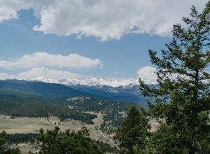
Evergreen Mountain Loop
4.75.89 mi / 0 ft gainThe way up Evergreen Mountain is actually a few different trails stitched together throughout Alderfer/Three Sisters Park. The trail connects to both parking lots in the park, so if one is full you can just start from the other one, giving you lots of options for a quick day-hike. If you start ...Read more -
Littleton, Colorado
Hike the Meadowlark Plymouth Trail
4.06 mi / 1197 ft gainFrom the parking lot, you can take the Meadowlark trail to the west or the Plymouth Creek Trail to the southeast. It does not matter which trail you take because it ends up becoming loop. For a more gradual slope up the hill, take the Meadowlark trail. After a little more than a mile, it intersec...Read more

