Gunnison County, Colorado
Top Spots in and near Gunnison County
-
Aspen, Colorado
*The 4-Pass Loop likely won't be doable until July due to the heavy snowpack this year and wet slide danger on the steep pass approaches.Taking on the 4-pass Loop is no easy feat but completely worth the training and effort. The run starts at Maroon Lake and heads up to Crater Lake where the loo...
Read more
-
Aspen, Colorado
4.3
16.53 mi
/ 5023 ft gain
For the adventurous backpacker looking to get backcountry in central Colorado, the stunning beauty of the Maroon Bells-Snowmass Wilderness cannot be beaten. While the Maroon Bells just outside of Aspen might be the most photographed mountains in North America, the beauty is definitely rivaled by ...
Read more
-
Pitkin County, Colorado
4.8
25.99 mi
/ 7566 ft gain
Updates will be posted here.
The Four Pass Loop begins at Maroon Lake, famous for its iconic view of the Maroon Bells (Maroon Peak and North Maroon Peak), deemed the “most-photographed spot in Colorado.” After taking in this majestic view, continue to walk down the Maroon Lake Scenic Trail unti...
Read more
-
Carbondale, Colorado
We began our hike at the beginning of the afternoon after about two-three hours driving up the 14 mile road. The first mile of the trail was mild, turning into an uphill adventure. Lots of switchbacks, winding paths, and some tree coverage. By mile 2, we were on a steep grade the rest of the way....
Read more
-
Carbondale, Colorado
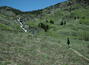
This is an intermediate hike with scenic views, even before reaching the lake and waterfall. Note that access to the trailhead does require 4WD, as the final section of road is difficult and steep in sections.
Read more
-
Somerset, Colorado
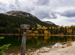
The Three Lakes trail near Crested Butte is a great loop if you're looking to hit up a couple mountain lakes. At 4.5 miles with moderate incline, this trail can easily be knocked out in under 2 hours. It also is a great hike to admire fall colors as you'll get great views of the Ruby Range and th...
Read more
-
Somerset, Colorado
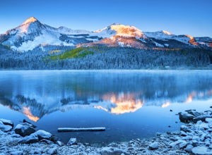
Lost Lake Slough offers camping, hiking, photography, kayaking, and more in a remote and beautiful part of Colorado. At an elevation of over 9,600 ft., the lake typically opens in mid-June after the snow is melted, and closes in October after the first significant snowfall. The campground is on...
Read more
-
Aspen, Colorado
4.3
16.77 mi
/ 2717 ft gain
After picking up your required overnight permit, start your morning with a coffee in Aspen, then drive out 15 min to the trailhead at the end of Conundrum Creek road. The trail is a straight shot 9 miles up the valley, through expansive meadows and an always incredible view of the mountains and ...
Read more
-
Aspen, Colorado
To start it off, head out from Aspen on Maroon Creek Road. Once you get to the park, you will either have to pay the charge at the booth or if you get there after 5pm, you can self pay at the cash box, which is $10. You'll also want to get an overnight parking pass set up which doesn't cost extra...
Read more
-
Carbondale, Colorado
Although the iconic Crystal Mill is the main attraction on this hike, the river that leads you there through the magnificent mountains of the White River National Forest is nothing short of extraordinary.Getting ThereThe hike is located in the small town of Marble, about 40 minutes east of Carbon...
Read more
-
Aspen, Colorado
Escape the bustle of town and head out of Aspen on Maroon Creek Road. Follow the signs to Maroon-Bells Snowmass Wilderness Area. There is a $10 entrance fee (unless you are a national parks pass cardholder) plus an additional fee to camp.
Continue down the road to Silver Bell Campground. With a t...
Read more
-
Aspen, Colorado
From Aspen drive down Maroon Creek Road until it comes to its winter closure located by T Lazy 7 Ranch. The Ranch offers snowmobile tours and keeps the six mile snow covered road to the Bells groomed. Most popular with cross country skiers, the snow road can also be hiked, fat biked, and skinned....
Read more
-
Aspen, Colorado
This is a great backup campground if all of Maroon Bells campgrounds are full, which in all reality is highly likely. If you're looking to beat the crowds, this is a good number campground to consider. This campground is right off the highway, 5 miles away from the town of Aspen, easy to find, an...
Read more
-
Aspen, Colorado
4.0
1.17 mi
/ 312 ft gain
Weller Lake Trail is an out-and-back trail that takes you by a lake located near Aspen, Colorado.
Read more
-
Aspen, Colorado
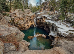
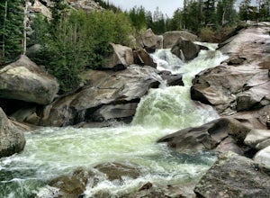
The Roaring Fork River has several little waterfalls that end up in a deep swimming hole called The Devil's Punch Bowl. This is a must-see if you are driving up to the Independence Pass. I have never seen such blue water before (outside of an amusement park).
While Driving from Aspen on CO82 to...
Read more
-
Aspen, Colorado
Just nine miles east of Aspen on Highway 82, Independence Pass, are grottos. A grotto is a geological term for a cave or cavern. The Grottos near Aspen were formed by rushing water of the Roaring Fork River. There is only an elevation gain of 300 feet on the three-quarters of a mile loop making...
Read more

