Grand County, Colorado
Top Spots in and near Grand County
-
Boulder, Colorado
Hike or Bike the Walker Ranch Loop
4.77.7 mi / 1740 ft gainWhen it comes to hiking trails in Boulder, the standard response usually consists of either Chautauqua Park or Mt. Sanitas, and while both offer excellent hiking options, they are both usually jam packed on the weekends. If you’re looking to stay close to the city, but want a little more seclusio...Read more -
Boulder, Colorado
Mountain Bike the Betasso Preserve
4.03.3 mi / 564 ft gainThe Betasso Preserve features two loop trails that are accessible to both hikers and mountain bikers. Drive up (west) Boulder Canyon about 15 minutes outside of Boulder and turn right (north) on Sugarloaf Dr. After another 5 or so minutes you'll see a sign on the right-hand (northeast) side of...Read more -
Georgetown, Colorado
Hike to Square Top Lakes
4.3 mi / 1080 ft gainStarting from Guanella Pass, right across from the Bierstadt trailhead, Square Top Lakes is definitely a hidden gem. Most people here are attempting to do the 14er, but if you've already bagged that one (or are just looking for some high altitude hiking to get you ready for it), Square Top Lakes ...Read more -
Dillon, Colorado
Mount Bierstadt
4.67.18 mi / 2697 ft gainIf you’re ready for your first 14er, Mount Bierstadt holds a reputation for a great “starter” 14er. Of course, experienced climbers will enjoy this (relatively speaking) easy mountain as well. Besides the joy of the hike itself, Bierstadt is a stunning wildflower hike in July and August. Thanks t...Read more -
Idaho Springs, Colorado
Bierstadt, Evans, and The Sawtooth Loop
4.59.76 mi / 3438 ft gainStarting from the oddly poorly marked Guanella Pass Trailhead (Google maps directions to Guanella Campground and then drive about two miles past it to the south), the trail heads southeast toward Bierstadt, and much of your route to the first summit is visible from the parking lot. The trail to ...Read more -
Idaho Springs, Colorado
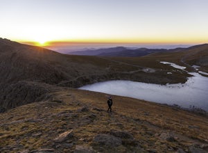
Watch the Sunrise at Guanella Pass
5.01 mi / 100 ft gainFrom Denver, take i70 to Georgetown and simply follow the signs through town to the top. This pass can also be accessed from the south via US Highway 285 at the town of Grant. Guanella Pass is closed in the winter, typically from about the last week in November through the last week of May. Watch...Read more -
Dillon, Colorado
Sunset Views from Morgan Peak
8.42 mi / 2900 ft gainHow you get to Morgan Peak and the other 13ers in the area depends on if you have a 4-wheel drive with good clearance or not. If so, drive the rough Santa Fe road from the small town of Montezuma (just outside Keystone). The road is also known as Forest Service 264 and is a left at the stop sign ...Read more -
Boulder, Colorado
Green Mountain via West Ridge Trail
3.23 mi / 607 ft gainStarting at 7,600 ft this 1.35 mile (one-way) hike is the shortest, and by far the least strenuous, hike to summit one of Boulder's iconic peaks. Parking for this trail-head is available along the road a short drive, 4.5 miles, up Flagstaff Rd. The trail gently slopes along a ridge for the firs...Read more -
Evergreen, Colorado
Mount Evans and Mount Spalding Loop
4.38.47 mi / 1706 ft gainMount Evans is a simple, yet drop dead gorgeous 14er. That being said, no 14er is easy by any means. However as far as 14er's go, this is a cake walk. Coming in at a rating of class 2, there tends to be some scrambling but nothing a well balanced person can't handle. To begin this adventure, we ...Read more -
Silverthorne, Colorado
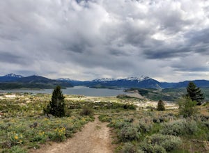
Ptarmigan Trail
4.57 mi / 1201 ft gainPtarmigan Trail, not to be confused with Ptarmigan Peak, is a 5 mile out-and-back, scenic trail that offers unparalleled vistas of Summit County, Dillon Reservoir and the surrounding mountains(including Quandary Peak, Red Mountain, and the Decalibron Loop). Located just outside of Silverthorne a...Read more -
Boulder, Colorado
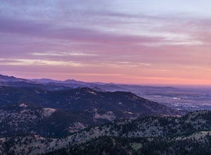
Watch Sunset from the Lost Gulch Overlook
From Boulder, drive west on Baseline road. Continue up for about 5.5 miles past the Flagstaff Summit (Realization Point) pull off. After some more steep and very tight switchbacks there will be a dirt parking lot on the north side of the road. From here you can head northwest towards the cliff...Read more -
Dillon, Colorado
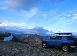
Off-Road to Glacier Mountain
5.07.4 mi / 2100 ft gainThe trail begins just past historical Main Street Montezuma. You will see a sign on your right for St. Johns road. This road is officially marked as 275 on a map. The original road lead to St. Johns but not much of the town remains.You will cross the Snake River almost immediately after you turn ...Read more -
Grand Lake, Colorado
Hike to Big Meadows and Granite Falls
5.010.3 miThe Green Mountain Trail is part of the Continental Divide National Scenic Trail (CDT) which is a foot path from Mexico to Canada. Big Meadows is a great place to view elk, moose, and deer. Other animals you can see in the area are abert squirrels, river otters, weasels, and black bear.Big Meadow...Read more -
Golden, Colorado
Hike the Elk Range Trail
2.5This is an incredible and beautiful hike that is just off of Route 6 but feels a million miles away. Drive up Douglas Mountain Road for the west park access (and I do mean UP - it's a quick elevation gain), and you'll run right into the Centennial Cone Park entrance. There is a bathroom and a dec...Read more -
Silverthorne, Colorado
Backpack to Upper Slate Lake
5.028 mi / 1386 ft gainStarting from the Rock Creek Trailhead parking lot, it is an up and down trek to Upper Slate Lake. The trail map states 10 miles each way, but accounting for switchbacks it ends up being closer to 14 long, hard miles.You will be among aspens and pines for the first half as you have a few moderate...Read more -
Boulder, Colorado
Hike the Tenderfoot Trail
4.32.1 mi / 400 ft gainFrom Chautauqua Park in Boulder, follow Baseline Road west (if you are driving up the mountain, you are golden). Drive 3.4 miles up Flagstaff Road and look for the sign for Realization Point on your right. It’s a little tricky to see from the road, so keep an eye on your odometer. The trail star...Read more

