Granby, Colorado
Looking for the best hiking in Granby? We've got you covered with the top trails, trips, hiking, backpacking, camping and more around Granby. The detailed guides, photos, and reviews are all submitted by the Outbound community.
Top Hiking Spots in and near Granby
-
Frisco, Colorado
Hike or Snowshoe to Rainbow Lakes
5.03 mi / 250 ft gainYou can do this hike two different ways: 1- Start from the Peaks Trail Trailhead for an out and back hike, distance is a little over 2 miles roundtrip. 2- Start along the Summit County Recreational Trail (as marked on this map), also out and back hike, total distance just over 3 miles, and provid...Read more -
Frisco, Colorado
Climb Mount Royal
4.7To access the trailhead, drive 4 blocks South to the end of 2nd Avenue from Frisco's Main Street. The trailhead is located around 9,075 feet.Being a popular hike, the trail is clear in the summer months and usually populated by boot prints and snowshoe tracks in the winter. Follow the trail from ...Read more -
Bellvue, Colorado
Hike to Comanche Lake in Pingree Park
3.58 mi / 700 ft gainYou start out hiking through the average Colorado forest for the first 4 miles of the 7-8 mile trip at about 6,500 feet. The trail is largely downhill for the first couple miles until it levels out and you are headed North. A little more than halfway, you come to Comanche Reservoir and hike up al...Read more -
Boulder, Colorado
Boulder's Skyline Traverse
5.014.77 mi / 4583 ft gainHave you ever reached the bottom of a hike with some friends and thought, 'That was nice, but I'd still like to hike more... a lot more.'? Then the Skyline Traverse is for you. Instead of hiking just Green Mountain or Bear Peak, the Skyline Traverse links South Boulder Peak, Bear Peak, Green Mou...Read more -
Boulder, Colorado
Shanahan Ridge Trail
4.03.84 mi / 715 ft gainStarting on the edge of a neighborhood in South Boulder, this 3.8 mile loop begins its 869 foot elevation gain by meandering through a pine forest. You can 'choose your own adventure' by exploring the handful of trails that meet up with the Shanahan Ridge Trail, such as the South Mesa Trail, Shad...Read more -
Boulder, Colorado
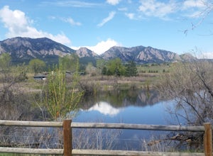
Hike the Eagle Sage Loop
4.33.75 mi / 205 ft gainThis is a great trail if you are in the Boulder area and want something fairly easy or quick. This 3.75 loop can be hiked in about an hour and a half since it is fairly flat. The elevation gain is minimal. You start out at the Eagle Trailhead located west of the Boulder Reservoir.Start out at the...Read more -
Evergreen, Colorado
Mount Evans and Mount Spalding Loop
4.38.47 mi / 1706 ft gainMount Evans is a simple, yet drop dead gorgeous 14er. That being said, no 14er is easy by any means. However as far as 14er's go, this is a cake walk. Coming in at a rating of class 2, there tends to be some scrambling but nothing a well balanced person can't handle. To begin this adventure, we ...Read more -
Boulder, Colorado
Hike South Boulder Peak
4.56.7 mi / 2900 ft gainStarting at the Mesa trailhead, continue a half a mile through a relatively even grade before arriving at the North Fork Shanahan trailhead, which will take you another half a mile on much steeper grade up to Fern Canyon where you will start a much harder portion of the hike; here, you'll head st...Read more -
Boulder, Colorado
Hike the Big Bluestem Trail Loop
4.04.35 mi / 841 ft gainThis is a great spot for an easy/moderate hike or trail run. The trail is accessible year round and can often be hiked in winter as well as other seasons. You start out at the Mesa Trailhead parking lot off of Hwy 170. There is a parking lot here but this is a starting spot for several hikes into...Read more -
Boulder, Colorado
Hike Bear Peak
4.87 mi / 2810 ft gainThe best advice I can give you? Wake up early to start this hike.Even though the Bear Peak hike will only take you about 4-5 hours round trip, it will still be advantageous to get off the mountain before afternoon and evening storms might pass through. This is a steep 7-mile out and back trail.St...Read more -
Golden, Colorado
Hike the Elk Range Trail
2.5This is an incredible and beautiful hike that is just off of Route 6 but feels a million miles away. Drive up Douglas Mountain Road for the west park access (and I do mean UP - it's a quick elevation gain), and you'll run right into the Centennial Cone Park entrance. There is a bathroom and a dec...Read more -
Boulder, Colorado
Doudy Draw Trail
4.37 mi / 433 ft gainDoudy Draw Trail is an out-and-back trail where you may see beautiful wildflowers located near Boulder, Colorado.Read more -
Evergreen, Colorado
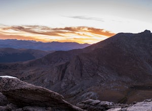
Watch the Sunset from Mt Evans Road
5.0Leave Evergreen, CO and access the Mount Evans Road and Mount Evans Recreation Area from Squaw Pass, CO 103 at Echo Lake.Drive along the slopes of Mount Evans, a Colorado 14er standing at 14,264 ft. 5 switchbacks down from the summit, on a tight hairpin turn, is a small parking area near 13,900f...Read more -
Boulder, Colorado
South Boulder Creek - Mesa Trail - Lower Big Bluestem Loop
4.04.46 mi / 453 ft gainThis 4 mile loop ascends only a slight amount in elevation, making for a pleasant loop in which opportunities for appreciation of the nature around you and broad vista photography are in plentiful supply. A great hike for those who may still be building their fitness, as so many trails in Boulder...Read more -
Evergreen, Colorado
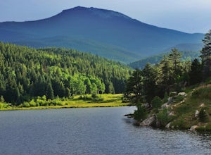
Private and Tranquil Retreat at Beaver Brook Watershed
4.0Note: This is NOT the Beaver Brook Trail in Genesee Park/Lookout Mountain! If you enjoy the scenery and ambiance of Evergreen, but Evergreen Lake has become too crowded for your tastes, Beaver Brook Watershed (owned by the City of Golden) is an excellent alternative. It’s a small, secluded area a...Read more -
Vail, Colorado
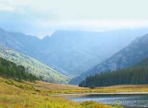
Hike the Upper Piney River Trail
4.05.6 mi / 350 ft gainBeginning at an elevation of 9,397 feet, this hike provides an easy 2.8 mile (one way) trip through the gorgeous meadows against the distant aspens and alpines. Wildflowers and wildlife are abundant, which make this trip a fantastic education and play experience for kids.Coordinates for the trail...Read more

