Georgetown, Colorado
Top Spots in and near Georgetown
-
Golden, Colorado
Mountain Bike the North Table Mountain Loop
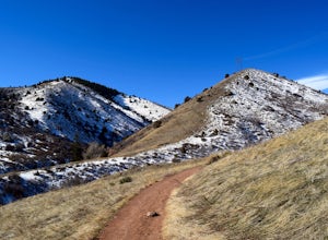
4.57.5 mi / 890 ft gainOnce you're parked, you can choose to ride this trail either counterclockwise or clockwise. My personal recommendation is CCW, which entails you head up the steep paved road on the east-southeast corner of the parking lot first. The climb is about 10 minutes of grunt work and then on to flat grou...Read more -
Nederland, Colorado
Climb in Boulder Canyon
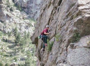
5.0Heading west from Boulder, take CO 119/Boulder Canyon Drive into Boulder Canyon. Once you're in the canyon, there are many areas that all have great climbing. For the more traditional climber, there are areas such as Castle Rock (39.9787, -105.4551) and the Happy Hour Crag (40.0033, -105.3939). P...Read more -
Boulder, Colorado
Hike or Bike the Walker Ranch Loop
4.77.7 mi / 1740 ft gainWhen it comes to hiking trails in Boulder, the standard response usually consists of either Chautauqua Park or Mt. Sanitas, and while both offer excellent hiking options, they are both usually jam packed on the weekends. If you’re looking to stay close to the city, but want a little more seclusio...Read more -
Nederland, Colorado
Explore Boulder Falls, CO
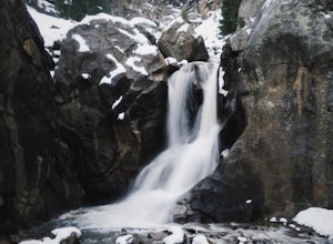
4.20.1 miWhile the narrow trail is often popular, it's only 100 yards to see this 70-ft tall waterfall, set against a beautiful canyon backdrop. Keep in mind there's no climbing allowed on or around the falls. It is also a good idea to check if the trail is closed for maintenance, ahead of time.Read more -
Golden, Colorado
Argos Trail & Magic Mountain Trail Loop
5.01.91 mi / 397 ft gainArgos Trail & Magic Mountain Trail Loop is a scenic loop that's great for stretching your legs in Apex Park near Golden Colorado. This trail is fun for the family (baby carrier needed for families with newborns) and for your pup (on-leash). NOTEOdd days of the month (1st, 3rd, 5th, etc.) are...Read more -
Golden, Colorado
Hike the Morrison Slide in Matthews / Winters Park
4.24.7 mi / 600 ft gainStart at the trailhead located at 1103 County Hwy. 93 and enjoy a little warm up time by the creek that winds past wild plum, chokecherry, and willow trees. Matthews-Winters Park is filled with red rock formations that make for amazing scenery. It also has the remnants of a historic cemetery. The...Read more -
Golden, Colorado
Matthews/Winters Park Loop
4.04.99 mi / 827 ft gainMatthews/Winters Park, which is part of the Jefferson County Open Space system, is proof that you do not have to go far from the city to enjoy the mountains. Nestled in the foothills between Golden and Morrison just off I-70 and C-470, Matthews/Winters is easy to access from Denver and any of the...Read more -
Golden, Colorado
Hike South Table Mountain
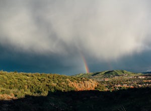
4.03.3 mi / 1500 ft gainWant to see a rainbow? Possibly some coyotes or other Colorado wildlife?This hike is full of twists and turns, mostly involving the trail, but also in surprises along the way.Drive into downtown Golden (grab some food if you're hungry) and then park at the base of the Golden Summit trail. Startin...Read more -
Morrison, Colorado
Hike the Red Rocks Trail
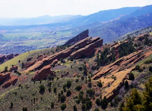
4.06 miWhile this is a 6 mile hike, it is relatively easy to add mileage to it and tailor it to fit your needs. Instead of simply doing the Red Rocks Trail/Morrison Slide loop, you can head all the way to the Village Walk trail in Matthews-Winters. You can also park along Red Rocks Trail Road and elimin...Read more -
Boulder, Colorado
Catch the Sunrise on Sugarloaf
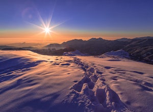
4.51 mi / 400 ft gainTo get there from downtown Boulder, head west on CO 119 and almost 4.5 miles after you have left Boulder, turn right onto Sugarloaf Road. 4 miles after the turn from CO 119, turn right onto Sugarloaf Mountain road (located at the top of the road). If the road starts descending, you've gone too fa...Read more -
Ward, Colorado
Lake Isabelle via Long Lake Trailhead
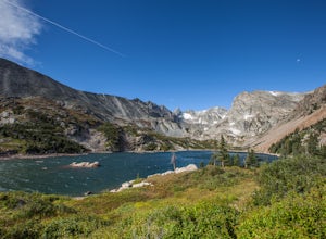
4.54.09 mi / 374 ft gainStart at the Pawnee Pass Trail No. 907 Trailhead. Long Lake is about 2 tenths of a mile and Lake Isabelle is 2 miles from the trailhead. Keep an eye out for moose grazing in the bushes or in the water near Long Lake. This is a 4 mile out and back hike with well marked trails. For an 8.75 mile hi...Read more -
Ward, Colorado
Isabelle Glacier
5.08.62 mi / 1578 ft gainGetting There The trailhead can be reached from Boulder by driving west through Boulder Canyon on Highway 42 to Nederland, then going north on the Peak-to-Peak Highway 72 to the town of Ward. From there, a National Forest Sign on the west side of the highway provides directions to the ranger stat...Read more -
Ward, Colorado
Snowshoe or Ski Lake Isabelle
10 miSpeechless. That’s how this hike will leave you. And not just because of its length. At over 10 miles, this snowshoe exploration is not for the faint of heart. But the language-defying beauty of this hike will make every sore muscle worth it.The Brainard Lake Recreational Area near Ward, Colorado...Read more -
Ward, Colorado
Shoshoni Peak
5.010.61 mi / 2470 ft gainHike one of the most scenic 12ers in Colorado's front range, Shoshoni Peak, with an elevation of 12,967 feet. You can easily combine a summit of Pawnee Peak for wonderful views of multiple alpine cirques. Enjoy wonderful views of the Long Lake Valley, Isabelle Glacier, and Pawnee Pass regions. Fo...Read more -
Ward, Colorado
Climb Apache Peak
10 mi / 3280 ft gainStart at the Long Lake Trailhead ($10 parking fee) and head up the trail towards Isabell Lake. You'll pass both Long Lake and Isabelle lake, with spectacular views at both. At Lake Isabelle, be sure to continue straight on the trail, further up the valley, not the right turn up to Pawnee Pass.Con...Read more -
Ward, Colorado
Pawnee & Buchanan Pass Loop
5.026.98 mi / 6978 ft gainBefore you start your trip, get a camping permit from the Boulder Ranger Station. Plan to spend your first night in the Crater Lake BZ (Backcountry Zone), and your second in Buchanan BZ. If you're feeling particularly sedate, you can easily spend a third night in Coney Creek. Start early in the ...Read more

