Fraser, Colorado
Looking for the best rock climbing in Fraser? We've got you covered with the top trails, trips, hiking, backpacking, camping and more around Fraser. The detailed guides, photos, and reviews are all submitted by the Outbound community.
Top Rock Climbing Spots in and near Fraser
-
Granby, Colorado
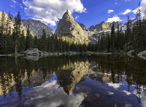
Mirror and Crater Lakes via Cascade Creek Trail
4.614.94 mi / 2421 ft gainStart at the Monarch Lake trailhead (where there is a $5 parking fee unless you have one of the national lands passes) and follow the cascade creek trail around the north side of the lake. After about 1.5 miles the trail splits with the Arapaho pass trail, follow the cascade trail to the left as ...Read more -
Ward, Colorado
Climb Apache Peak
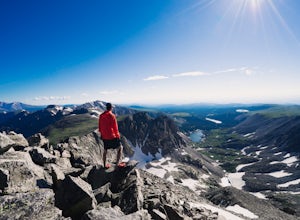
10 mi / 3280 ft gainStart at the Long Lake Trailhead ($10 parking fee) and head up the trail towards Isabell Lake. You'll pass both Long Lake and Isabelle lake, with spectacular views at both. At Lake Isabelle, be sure to continue straight on the trail, further up the valley, not the right turn up to Pawnee Pass.Con...Read more -
Ward, Colorado
Pawnee & Buchanan Pass Loop
5.026.98 mi / 6978 ft gainBefore you start your trip, get a camping permit from the Boulder Ranger Station. Plan to spend your first night in the Crater Lake BZ (Backcountry Zone), and your second in Buchanan BZ. If you're feeling particularly sedate, you can easily spend a third night in Coney Creek. Start early in the ...Read more -
Dillon, Colorado
Hike the 7:30 Mine Road in Silver Plume
4.05 mi / 1200 ft gainWith a name like 7:30 Mine Road, this is one hike I had to investigate to see if it lives up to its name. Even though this is an easier hike than I normally choose, what it lacks in challenging terrain, it makes up for in historic interest. The view isn’t too bad, either.7:30 Mine Road is about t...Read more -
Silver Plume, Colorado
Torrey's Peak via Kelso Ridge
5.05.79 mi / 2982 ft gainThe start of this route up the Kelso Ridge is the same as doing the standard route of Gray's and Torrey's peaks. From the trailhead cross the large metal bridge and continue on the great trail as it slowly climbs away from the parking lot and trailhead. This first section is not steep, but prov...Read more -
Nederland, Colorado
Climb the Avalon Crag in Boulder Canyon
From Boulder, the pullout that is best to park at for the Avalon crag is 8.4 miles up the canyon. You will walk down the side of the road past the talus field, where if the river is too high to wade you can use the tyrolean traverse. Otherwise, you can wade or hop across rocks according to the da...Read more -
Nederland, Colorado
Climb in Boulder Canyon
5.0Heading west from Boulder, take CO 119/Boulder Canyon Drive into Boulder Canyon. Once you're in the canyon, there are many areas that all have great climbing. For the more traditional climber, there are areas such as Castle Rock (39.9787, -105.4551) and the Happy Hour Crag (40.0033, -105.3939). P...Read more -
Silverthorne, Colorado
Backpack to Upper Slate Lake
5.028 mi / 1386 ft gainStarting from the Rock Creek Trailhead parking lot, it is an up and down trek to Upper Slate Lake. The trail map states 10 miles each way, but accounting for switchbacks it ends up being closer to 14 long, hard miles.You will be among aspens and pines for the first half as you have a few moderate...Read more -
Dillon, Colorado
Mount Bierstadt
4.67.18 mi / 2697 ft gainIf you’re ready for your first 14er, Mount Bierstadt holds a reputation for a great “starter” 14er. Of course, experienced climbers will enjoy this (relatively speaking) easy mountain as well. Besides the joy of the hike itself, Bierstadt is a stunning wildflower hike in July and August. Thanks t...Read more -
Idaho Springs, Colorado
Bierstadt, Evans, and The Sawtooth Loop
4.59.76 mi / 3438 ft gainStarting from the oddly poorly marked Guanella Pass Trailhead (Google maps directions to Guanella Campground and then drive about two miles past it to the south), the trail heads southeast toward Bierstadt, and much of your route to the first summit is visible from the parking lot. The trail to ...Read more -
Estes Park, Colorado
Longs Peak
5.013.3 mi / 5100 ft gainFor the most part, this hike is very straightforward, so I'll essentially skip over the first 5.5 or so miles of the hike, but, in case you don't know: Start (very early so you get a parking spot) from the trailhead right next to the parking lot (the road to it is paved - seriously this mountain...Read more -
Estes Park, Colorado
Peacock Pool
7.9 mi / 2438 ft gainThe peacock pool is a cool little tarn below the outlet to Chasm Lake. Please note that this adventure is best done in the winter/spring when snow is present to prevent erosion in the sensitive area. That is how the description will be written, assuming winter conditions. The approach is the sa...Read more -
Larimer County, Colorado
Lake Haiyaha
5.03.64 mi / 800 ft gainBegin the hike at the Bear Lake trailhead, this will be the same for any season you chose to hike to the lake. From the Bear Lake trailhead follow the Dream Lake trail for ~1.05 miles to just before Dream Lake itself. The trail is very easy to follow up to this point in all seasons. In winter the...Read more -
Estes Park, Colorado
Black Lake Trail
5.09.17 mi / 1400 ft gainThe Black lake hike begins at the very popular Glacier Gorge trailhead along Bear Lake road in Rocky Mountain National Park. During the summer and weekends, the park shuttle may be the best parking option as the lot is often full by 7am and can be difficult to find a spot throughout the day. Fr...Read more -
Estes Park, Colorado
Climb Notchtop Mountain in Rocky Mountain National Park
5.03.5 mi / 1550 ft gainPark at Bear Lake, and follow the signs north of the lake to Odessa Lake. However, do NOT go all the way to Odessa Lake; after about 3 miles, when Notchtop is in full view, the trail begins to descend to Odessa Lake. Find an unmarked spur trail to the left which leads to shallow Lake Helene, then...Read more -
Estes Park, Colorado
Dragon's Tail Couloir Climb
5.0Start your day at the Bear Lake parking lot, and head out on the short 2-mile approach that winds uphill past Nymph and Dream Lake. After arriving at Emerald Lake, skirt around the shore on the left side to reach the bottom of the couloir, clearly visibile on the far side of the lake.The 1500 ft ...Read more

