Fairplay, Colorado
Looking for the best fitness in Fairplay? We've got you covered with the top trails, trips, hiking, backpacking, camping and more around Fairplay. The detailed guides, photos, and reviews are all submitted by the Outbound community.
Top Fitness Spots in and near Fairplay
-
Buena Vista, Colorado
Hike Huron Peak
5.06.5 miIf you have a 4WD vehicle, drive 2 miles from Winfield along a dirt road to the trailhead. If you don't have a suitable vehicle, you can park before the road gets rough and hike the rest of the road to the trailhead.Starting at 10560 feet of elevation, this 6.5 mile roundtrip hike begins its 3500...Read more -
Dillon, Colorado
Hike Grizzly Peak at Loveland Pass
5.06 mi / 2900 ft gainWhile a typical Colorado hike may be an ascent to your destination followed by a descent back to your car, the hike to Grizzly Peak at Loveland Pass (Grizzly Peak "D") breaks that mold. At 13,427 feet, Grizzly Peak stands in the path to Torreys Peak’s west face (14,267’). Even though it is only ~...Read more -
Independence, Ohio
Hike Mountain Boy Ridge from the Top of Independence Pass
5.06 miThe trailhead is to the Independence Pass viewing deck is located at the Summit parking area, which is about 20 miles from Aspen and 24 miles west of Highway 24 on the Leadville side. At the parking area you will notice a paved walkway that takes you to the viewdeck, which is a easy five minute w...Read more -
Dillon, Colorado
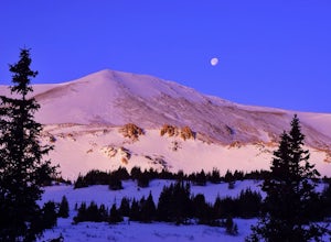
Snowshoe or Ski Watrous Gulch
4.04 mi / 1200 ft gainDespite sharing a trailhead with the popular Herman Gulch, I had not heard of Watrous Gulch until I stumbled across it while researching something else. Knowing that Herman Gulch is filled with spectacular views and deep snow ideal for snowshoeing/skiing, I had to discover if the smaller, lesser-...Read more -
Meredith, Colorado
Hike to Chapman Lake
1.6 miFrom downtown Basalt, drive up the Fryingpan River Road 28 miles and turn right on CR #504, also known as Elliot Way, just before Norrie Colony. Drive across the river and up the switchbacks for approximately 3 miles. Take the left fork, continue 1 mile and take the right fork approximately 1/2 m...Read more -
Nathrop, Colorado
Hike Mt. Princeton
4.513.25 miStarting at 8900 feet of elevation, this 13.25 mile roundtrip hike begins its 5400 foot elevation gain on a dirt road that winds for 3 miles until you break the treeline. If you have 4WD and good clearance you can drive most of the way up this road, shortening your entire hike by about 6 miles. J...Read more -
Silver Plume, Colorado
Argentine Railroad Grade
5.05.35 mi / 863 ft gainThe Argentine Central Railroad Grade trail is just what it says: it follows the old rail bed of the Argentine Central line. All railway remnants have long since been removed, and in its place is a wide, well-defined trail with an easy grade. With just a 900-foot incline over the course of about t...Read more -
Dillon, Colorado
Hike the 7:30 Mine Road in Silver Plume
4.05 mi / 1200 ft gainWith a name like 7:30 Mine Road, this is one hike I had to investigate to see if it lives up to its name. Even though this is an easier hike than I normally choose, what it lacks in challenging terrain, it makes up for in historic interest. The view isn’t too bad, either.7:30 Mine Road is about t...Read more -
Vail, Colorado
Hike the Upper Piney River Trail
4.05.6 mi / 350 ft gainBeginning at an elevation of 9,397 feet, this hike provides an easy 2.8 mile (one way) trip through the gorgeous meadows against the distant aspens and alpines. Wildflowers and wildlife are abundant, which make this trip a fantastic education and play experience for kids.Coordinates for the trail...Read more -
Idaho Springs, Colorado
Hike to Hell's Hole
4.5The name is uninviting, but Hell’s Hole is a scenic, shallow basin in the Mount Evans Wilderness near Idaho Springs. Starting elevation is about 9500 feet. Right after the trailhead, you pass through a few camping sites in the Chicago Creek Picnic Area. About five minutes into the hike is the per...Read more -
Evergreen, Colorado
Hike the Resthouse/Lincoln Lake Trail
4.5While the Mt. Evans Wilderness never has a shortage of visitors, thanks to its proximity to Denver, it is possible to find a more private hike if you know where to look. Lincoln Lake Trail, accessible from Echo Lake year-round, is not as glamorous as its sister trail, Chicago Lakes, but is a wond...Read more -
Basalt, Colorado
Hike to Eagle Lake, Colorado
5.05.5 mi / 1036 ft gainIf you find yourself back in the Lime Creek area just outside of Eagle, Colorado and south of Sylvan Lake State Park - you should make the time to get yourself up to Eagle Lake! The hike starts off of Brush Creek Road and follows a property line in the forest of Aspens and towering wildflowers fo...Read more -
Parshall, Colorado
Ski or Snowshoe Jones Pass
4.06 mi / 1600 ft gainIts sister trail, Butler Gulch, is an all-time favorite hike (both summer and winter), and since they share a trailhead, I knew Jones Pass would be special as well.Jones Pass is not the type of trail I normally take, since it is actually a 4x4 road that is used for Jeeping in the summer and snowm...Read more -
Evergreen, Colorado
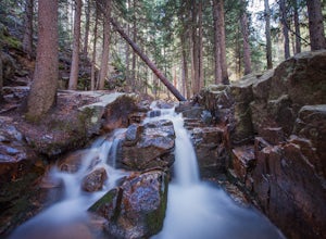
Maxwell Falls
3.43.95 mi / 928 ft gainLocated just outside of Evergreen, this beginner hike is a great escape from the city for a few hours. There are three different options to hike to the falls: Maxwell Falls Lower Trail (4 miles), Upper Maxwell Falls Trail (1.1 miles), and Maxwell Falls Bluffs Cliffside Trail Loop (5 miles). On th...Read more -
Aspen, Colorado
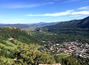
Ute Trail to Ute Rock
4.71.75 mi / 1122 ft gainThis shady trail of switchbacks ascends steadily (over a thousand feet in under a mile) to a rock outcropping at 9,185 feet. Yes, you can expect your heart to be pounding and to be huffing and puffing as you climb Ute Trail. But the view of Aspen that rewards you is spectacular. The trail is pre...Read more -
Aspen, Colorado
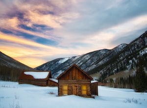
Hike or Snowshoe Castle Creek
6 miAt the round-a-bout that leads into the town of Aspen, take the Castle Creek Road exit. Follow this road for 12 miles until you get to the ghost town of Ashcroft. The road itself is very scenic, so be prepared to pull over and whip out your camera!During winter, the road ends at Ashcroft and a cr...Read more

