Estes Park, Colorado
Looking for the best fitness in Estes Park? We've got you covered with the top trails, trips, hiking, backpacking, camping and more around Estes Park. The detailed guides, photos, and reviews are all submitted by the Outbound community.
Top Fitness Spots in and near Estes Park
-
Fort Collins, Colorado
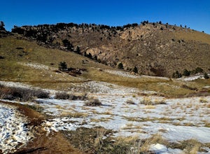
Hike to Horsetooth Falls
4.52.22 mi / 101 ft gainHorsetooth Mountain Park is an outdoor trail haven just minutes from downtown Ft. Collins. The 2711 acre area has 29 miles of trails of varying length and difficulty for all levels of adventurers to explore. Horsetooth Falls is one of the shortest (yet stunning) trails in the area. This hike is i...Read more -
Ward, Colorado
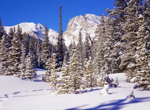
Snowshoe or Ski Lake Isabelle
10 miSpeechless. That’s how this hike will leave you. And not just because of its length. At over 10 miles, this snowshoe exploration is not for the faint of heart. But the language-defying beauty of this hike will make every sore muscle worth it.The Brainard Lake Recreational Area near Ward, Colorado...Read more -
Bellvue, Colorado
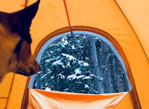
Winter camp at Zimmerman Lake
2.7 mi / 518 ft gainThis is a fairly popular snowshoeing and cross country skiing trail in the winter and offers a variety of additional trail options from the lake. Starting at the parking lot, the trailhead is easily accessed and begins the very gradual assent to Lake Zimmerman. Once at the lake, there are beautif...Read more -
Bellvue, Colorado
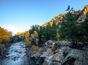
Poudre Canyon Run
5.026.2 mi / 1800 ft gainStretching 126 miles from its source in the Rocky Mountain National Park, the Cache La Poudre (pronounced: Poo-ter) river provides host to an entire treasure trove of outdoor recreational activities. From Fly Fishing and rafting to camping and photography. Carved away by thousands of years of flo...Read more -
Longmont, Colorado
McIntosh Lake Loop
4.53.6 mi / 72 ft gainMcIntosh Lake is in northwest Longmont. The 3.6-mile loop extends all the way around the lake, with the first half being on a paved cement trail with neighborhood playgrounds, basketball, volleyball, and a seasonally open restroom. The trail turns to dirt on the western half of the loop, and here...Read more -
Bellvue, Colorado
Trail Run the Hewlett Gulch Trail
5.08.5 mi / 800 ft gainHewlett Gulch Trailhead is located about 20 minutes from Fort Collins and offers easy hiking in the Poudre Canyon.From Fort Collins, take 287 to Ted's Place. Take a left onto CO 14 and follow 14 through the canyon just past Poudre Park where you see the trailhead sign. Turn left onto the road tha...Read more -
Bellvue, Colorado
Climb Greyrock Mountain
5.07.1 mi / 3000 ft gainThe main trail begins at the Cache La Poudre river on the Poudre Canyon Highway about 30 minutes from Fort Collins. After about .75 miles the trail splits. To go left on Greyrock Meadows trail adds 2 miles to your trip and provides excellent views of Greyrock Mountain and Meadows from the south, ...Read more -
Boulder, Colorado
Hike the Eagle Sage Loop
4.33.75 mi / 205 ft gainThis is a great trail if you are in the Boulder area and want something fairly easy or quick. This 3.75 loop can be hiked in about an hour and a half since it is fairly flat. The elevation gain is minimal. You start out at the Eagle Trailhead located west of the Boulder Reservoir.Start out at the...Read more -
Fort Collins, Colorado
Hike the North Loop via Foothills Trail
5.06.5 mi / 700 ft gainDespite its singular name, the Foothills Trail in Fort Collins is an interconnected series of trails that follows the ridges and hogsbacks which comprise the majority of the eastern side of the Horsetooth Reservoir. The trail can be accessed at several points along its length (by trails also call...Read more -
Nederland, Colorado
Hike to Columbine Lake
5.07 mi / 1200 ft gainThe hike is about seven miles, give or take, however it feels longer. The elevation gain is little over 1000 feet. The drive here is about 45 minutes from both Granby and Winter Park, and is definitely worth it. You follow a trail dusted with wildflowers for the majority of the hike, and occasio...Read more -
Laporte, Colorado
Hike the Bellvue Dome
2.81.75 mi / 600 ft gainThe Bellvue Dome, known locally as "Goat Hill", was created by the same geological forces that made the Rocky Mountains, but what makes this structure unique is its shape, the steep cliff on its western edge carved by the Cache la Poudre River at the base, and its prominent location dominating th...Read more -
Bellvue, Colorado
Hike the Black Powder Trail
1.5 mi / 450 ft gainThe Gateway Natural Area, part of the City of Fort Collins public lands system, is a wonderful (and close to the city) place to begin exploring the many outdoor assets and activities found in the greater Fort Collins area. The Black Powder Trail is a relatively easy, well-marked 1.5 mile out and ...Read more -
Boulder, Colorado
Mount Sanitas Loop & Settlers Park
4.43.83 mi / 1371 ft gainFirst off, these are two different hikes but both stem from the same parking lot and Settlers Park is a mere 5 minutes away from where you park so why not kill two birds with one stone? One of the more popular hikes in Boulder, Mount Sanitas is a 3 mile hike that quickly scales nearly 1,350 feet...Read more -
Boulder, Colorado
Hike the Red Rocks Loop Trail
3.71 miParking is available on either Canyon or Sunshine Roads. During the weekends it tends to get crowded around sunset so plan accordingly. The entire trail is a loop and is a little over 1 mile in length so it doesn't take too long. The main feature is the massive red sand stone rocks that jut out o...Read more -
Boulder, Colorado
Royal Arch Trail
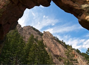
4.43.32 mi / 1220 ft gainRoyal Arch Trail climbs up Boulder's famous Chautauqua Park to an archway formed by sandstone rocks that tower over thirty feet high. Start at the Chautauqua Trail Station by the Ranger Station, and continue up Bluebell Road for 0.7 miles. You will then arrive at a more forested area, where you ...Read more -
Boulder, Colorado
Hike to the 1st Flatiron
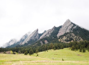
4.62.4 mi / 1422 ft gainStarting at the ever-popular and ever-populated Chautauqua Trailhead, take the main trail (a highway version of a dirt trail) straight towards the Flatirons. Continue going straight passed the Ski Jump trail to your right (0.2 mi.), then at a crossroads with the Bluebell-Baird trail (0.3 mi.) tur...Read more

