Eagle County, Colorado
Looking for the best hiking in Eagle County? We've got you covered with the top trails, trips, hiking, backpacking, camping and more around Eagle County. The detailed guides, photos, and reviews are all submitted by the Outbound community.
Top Hiking Spots in and near Eagle County
-
Frisco, Colorado
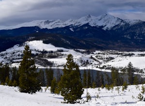
Climb Mount Royal
4.7To access the trailhead, drive 4 blocks South to the end of 2nd Avenue from Frisco's Main Street. The trailhead is located around 9,075 feet.Being a popular hike, the trail is clear in the summer months and usually populated by boot prints and snowshoe tracks in the winter. Follow the trail from ...Read more -
Frisco, Colorado
Frisco to Vail through Hike
5.013.55 mi / 3430 ft gainStarting at the Meadow Creek Trail head just off the turn off to Frisco this hike connects the stunning Eccles Pass and Gore Creek trails.Passing over Eccles Pass (11,917') and Red Buffalo Pass (11,742') this spectacular hike passes through dense forest, serene lakes and bubbling creeks.The Vail ...Read more -
Frisco, Colorado
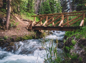
Hike to Eccles Pass
10 mi / 3000 ft gainStarting at just over 9,000ft the Meadow Creek trail follows the path of the similarly named Meadow Creek. Through a canopy of aspens and pines the trail climbs at a steady, moderate rate. After a few water crossings the trees give way to an alpine meadow that offer a view of the final approach t...Read more -
Frisco, Colorado
Hike Red Buffalo Pass, Frisco to East Vail
13.2 mi / 3400 ft gainStarting at the Meadow Creek trailhead in Frisco, you'll find yourself ending up in East Vail at Gore Lake Trailhead. See all photos here. The trail in Meadow Creek starts to climb at a gradual pace for the 3-4 miles, after a mile or so, take a look back upon the views of Lake Dillion. You'll ar...Read more -
Silverthorne, Colorado
Hike to Old Dillon Reservoir
4.51.7 mi / 137 ft gainToday, Lake Dillon is one of the biggest attractions in the Dillon Valley, attracting boaters, anglers, and campers. However, the large reservoir we know today was not the first one in the area. The Old Dillon Reservoir was built in the 1930s to supply water to the original town of Dillon, which...Read more -
Minturn, Colorado
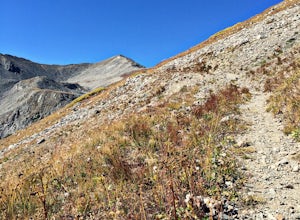
Hike to Fancy Pass
5.06 mi / 2373 ft gainThe Fancy Pass Trail near Red Cliff is an excellent option for those looking to experience hiking in the rugged and pristine conditions of a wilderness area. This 6 mile roundtrip trail will take you into the Holy Cross Wilderness and up close and personal with towering peaks, verdant meadows, an...Read more -
Silverthorne, Colorado
Ptarmigan Trail
4.57 mi / 1201 ft gainPtarmigan Trail, not to be confused with Ptarmigan Peak, is a 5 mile out-and-back, scenic trail that offers unparalleled vistas of Summit County, Dillon Reservoir and the surrounding mountains(including Quandary Peak, Red Mountain, and the Decalibron Loop). Located just outside of Silverthorne a...Read more -
Basalt, Colorado
Backpack & Fish at Lake Charles
11 mi / 1700 ft gainI decided to make an Outbound listing for this because the AllTrails listing is incredibly inaccurate. Hopefully you're reading this one! Your adventure starts at the trailhead of Fulford Cave / Fulford Cave Campground in Yeoman Park. Yeoman Park is just past Sylvan Lake State Park and is consid...Read more -
Frisco, Colorado
Hike to Mayflower Gulch
4.74 mi / 1000 ft gainGetting to the Mayflower Gulch is pretty easy, you can either hike an easy 2 mile forest road or drive all the way to end (you need decent clearance for the drive). At the end of the hike you are greeted with a stunning view of the Old Boston mining site. During the summer, wildflowers are abunda...Read more -
Swan Mountain Road, Colorado
Sapphire Point Overlook
3.30.62 mi / 49 ft gainThis short, 0.6 mile loop hike gives a beautiful view of Lake Dillon and is an easy, family-friendly hike. Dogs are allowed but must be kept on leash. The trail is clear cut and descends a few feet while looping around the side of the mountain to the overlook point. It is definitely a worthwhil...Read more -
Summit County, Colorado
Hike to Crystal Peak
5.08.6 mi / 2482 ft gainOnce you turn off of Colorado hwy 9 onto dirt, your GPS will lead you to a gravel lot. At the end of that lot there's a pretty steep gravel road that heads NNW (GPS coords: 39°25'43.01"N 106° 4'11.30"W | Map Link if you want to plug that into your GPS for parking). From this lot you'll walk up t...Read more -
Leadville, Colorado
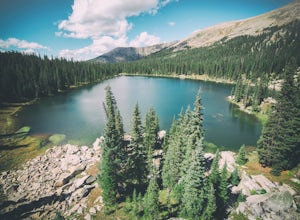
Savage Lakes Trail
5.03.97 mi / 1299 ft gainThe majority of this hike traverses through the beautiful forest that is part of the Holy Cross Wilderness. No significant views are to be had until you've climbed 1,300 ft over 2. miles and reach lower Savage Lake. The trail is easy enough to follow with no junctions along the way, and is adjace...Read more -
Breckenridge, Colorado
Hike the Sawmill Trail to Fairy Forest
3.01.5 mi / 250 ft gainIf you brought the family to Breckenridge chances are you're probably not bringing the little ones on your next 14'er summit. Are you looking for an easy hike to let the kiddos experience some nature and run around a bit? Well then this short hike is perfect for you and the family. Plus, it's rig...Read more -
Basalt, Colorado
Hike to Eagle Lake, Colorado
5.05.5 mi / 1036 ft gainIf you find yourself back in the Lime Creek area just outside of Eagle, Colorado and south of Sylvan Lake State Park - you should make the time to get yourself up to Eagle Lake! The hike starts off of Brush Creek Road and follows a property line in the forest of Aspens and towering wildflowers fo...Read more -
Breckenridge, Colorado
Breckenridge Troll
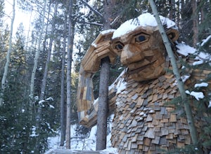
5.00.2 mi / 26 ft gainIsak Heartstone, otherwise known as the Breckenridge troll, can be accessed from the Illinois Gulch Trailhead. This trailhead can be full for much of the day, so it is advisable to find parking in town and then take a bus, walk, or bike to the starting point of this short walk. Once at the trai...Read more -
Leadville, Colorado
Backcountry Ski at Fremont Pass
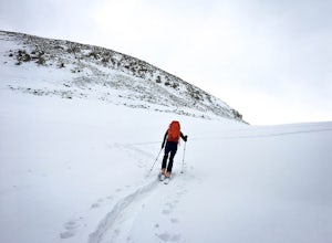
Starting at 11,319 feet of elevation, you can choose which direction to head into the backcountry. Park at the pull-off area at the bend in the road. From here, you can head into the woods to the right (there are usually tracks from other skiers to follow) or follow Trail Rd. to reach some peaks ...Read more

