Dillon, Colorado
Looking for the best mountain biking in Dillon? We've got you covered with the top trails, trips, hiking, backpacking, camping and more around Dillon. The detailed guides, photos, and reviews are all submitted by the Outbound community.
Top Mountain Biking Spots in and near Dillon
-
Golden, Colorado
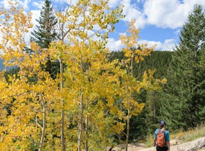
Hike the Mountain Lion Trail
6.7 mi / 1230 ft gainThere are three parking lots with direct access to the Mountain Lion Trail. The main one is off of Crawford Gulch Road, but any of them are good starting points! This loop has pretty similar elevation gain and loss profiles no matter which way you go, so you can go any direction. This adventure ...Read more -
Evergreen, Colorado
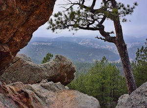
Hike Panorama Point at Corwina Park
4.72.7 mi / 640 ft gainJefferson County, the "Gateway to the Rockies" has dozens of great parks and trails. One of the best, however, is often overlooked, as it is sandwiched between bigger and more popular parks. Corwina Park is a small section located off Hwy. 74, near the village of Kittredge. Sitting between the po...Read more -
Leadville, Colorado
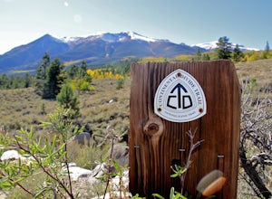
Mountain Bike the Colorado Trail near Mount Elbert
This is the way to see fall colors if you're into empty trails and endorphins. Grind up the trail starting from South Elbert Trailhead. You'll turn right onto the Colorado Trail at .3 miles and stay here for as long as you like, or 7.3 miles to the Mount Elbert Trailhead. Turn around and go back ...Read more -
Buena Vista, Colorado
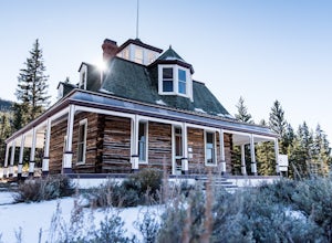
Hike to the Historical Interlaken Resort
5.06 mi / 500 ft gainFollow Colorado Highway 24 South from Leadville for 14 miles, then turn right onto Colorado 82 towards Aspen. Turn left onto County Road 25, then follow the road for 1 mile to a small parking area for the Colorado Trail. You have arrived!This trail starts near 9,200 feet of elevation and while yo...Read more -
Twin Lakes, Colorado
Camp at Twin Lakes' White Star Campground
4.5This area is located on the other side of Independence Pass from Aspen, which is only accessible during the summer, or can be reached year-round via Leadville, which is about 20 miles away along Highway 24. From Twin Lakes Village drive approximately 1.5 miles east on Highway 82 and take the exit...Read more -
Golden, Colorado
Hike the Sawmill to Maverick Loop
4.32 mi / 450 ft gainFor this adventure, you'll be completing the Sawmill to Maverick loop. It is a short, but gentle trail that will take you through open meadows, to pine forests, and great views of Denver and Golden.Starting from the west parking area, cross the road and hit the Sawmill Trail. This trail starts ou...Read more -
Golden, Colorado
Hike Beaver Brook Trail at Windy Saddle Park
5.05 mi / 500 ft gainJust outside of Golden, CO is Lookout Mountain. If you’ve ever driven westbound on i70 from Denver to the mountains, you’ve undoubtedly seen this mountain to your right with antennas on the top. On the north side of Lookout Mountain lies Windy Saddle Park, about a 30 minute drive from Denver. Thi...Read more -
Golden, Colorado
Hike Chimney Gulch Trail at Windy Saddle Park
4.05 mi / 1000 ft gainJust outside of Golden, CO is Lookout Mountain. If you’ve ever driven westbound on i70 from Denver to the mountains, you’ve undoubtedly seen this mountain to your right with antennas on the top. On the north side of Lookout Mountain lies Windy Saddle Park, about a 30 minute drive from Denver. Thi...Read more -
Golden, Colorado
Hike Lookout Mountain Trail at Windy Saddle Park
4.02.6 mi / 500 ft gainJust outside of Golden, CO is Lookout Mountain. If you’ve ever driven westbound on i70 from Denver to the mountains, you’ve undoubtedly seen this mountain to your right with antennas on the top. On the north side of Lookout Mountain lies Windy Saddle Park, about a 30 minute drive from Denver. Thi...Read more -
Boulder, Colorado
Hike or Bike the Walker Ranch Loop
4.77.7 mi / 1740 ft gainWhen it comes to hiking trails in Boulder, the standard response usually consists of either Chautauqua Park or Mt. Sanitas, and while both offer excellent hiking options, they are both usually jam packed on the weekends. If you’re looking to stay close to the city, but want a little more seclusio...Read more -
Golden, Colorado
Mountain Bike the North Table Mountain Loop
4.57.5 mi / 890 ft gainOnce you're parked, you can choose to ride this trail either counterclockwise or clockwise. My personal recommendation is CCW, which entails you head up the steep paved road on the east-southeast corner of the parking lot first. The climb is about 10 minutes of grunt work and then on to flat grou...Read more -
Golden, Colorado
Argos Trail & Magic Mountain Trail Loop
5.01.91 mi / 397 ft gainArgos Trail & Magic Mountain Trail Loop is a scenic loop that's great for stretching your legs in Apex Park near Golden Colorado. This trail is fun for the family (baby carrier needed for families with newborns) and for your pup (on-leash). NOTEOdd days of the month (1st, 3rd, 5th, etc.) are...Read more -
Golden, Colorado
Matthews/Winters Park Loop
4.04.99 mi / 827 ft gainMatthews/Winters Park, which is part of the Jefferson County Open Space system, is proof that you do not have to go far from the city to enjoy the mountains. Nestled in the foothills between Golden and Morrison just off I-70 and C-470, Matthews/Winters is easy to access from Denver and any of the...Read more -
Golden, Colorado
Hike South Table Mountain
4.03.3 mi / 1500 ft gainWant to see a rainbow? Possibly some coyotes or other Colorado wildlife?This hike is full of twists and turns, mostly involving the trail, but also in surprises along the way.Drive into downtown Golden (grab some food if you're hungry) and then park at the base of the Golden Summit trail. Startin...Read more -
Boulder, Colorado
Mountain Bike the Betasso Preserve
4.03.3 mi / 564 ft gainThe Betasso Preserve features two loop trails that are accessible to both hikers and mountain bikers. Drive up (west) Boulder Canyon about 15 minutes outside of Boulder and turn right (north) on Sugarloaf Dr. After another 5 or so minutes you'll see a sign on the right-hand (northeast) side of...Read more -
Pine, Colorado
Little Scraggy Peak Loop
5.012.18 mi / 1621 ft gainLittle Scraggy Peak Loop is a loop trail that takes you past scenic surroundings located near Buffalo Creek, Colorado.Read more

