Crawford, Colorado
Looking for the best hiking in Crawford? We've got you covered with the top trails, trips, hiking, backpacking, camping and more around Crawford. The detailed guides, photos, and reviews are all submitted by the Outbound community.
Top Hiking Spots in and near Crawford
-
Carbondale, Colorado
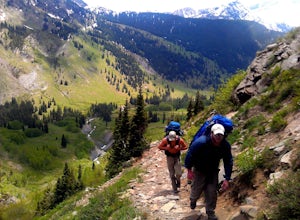
Backpack the Lead King Basin Trail
4.5 mi / 2000 ft gainWe began our hike at the beginning of the afternoon after about two-three hours driving up the 14 mile road. The first mile of the trail was mild, turning into an uphill adventure. Lots of switchbacks, winding paths, and some tree coverage. By mile 2, we were on a steep grade the rest of the way....Read more -
Lake City, Colorado
Backpack to Wetterhorn Basin
13 mi / 3000 ft gainThis trip is for the lover of solitude and the appreciator of the unscathed backcountry. Wetterhorn Basin is in the heart of the beautiful San Juan Mountain range in Southwestern Colorado.With a 4WD high clearance vehicle start at the West Cimarron Trailhead at 10,750 feet (38.1117N -107.5533W),...Read more -
Aspen, Colorado
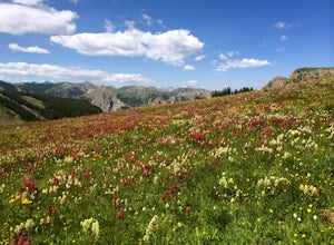
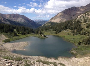
Backpack to Copper Lake
10 miLooking for a wildflower hike, we decided on Copper Lake in the Maroon Bells Wilderness as a place to base camp for 4 nights. It is 5 miles from the Trailhead, which is off Gothic Road above Crested Butte (2WD Accessible).Copper Lake is this beautiful alpine lake, situated right at treeline, with...Read more -
Mesa County, Colorado
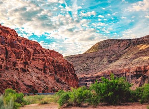
Backpack along the Gunnison River in the Dominguez-Escalante NCA
5.03.4 miIf you're looking to take your first backpacking adventure, but want something that is manageable yet thrilling, this is what you're looking for. Located along the Gunnison River in Western Colorado, the Dominguez-Escalante National Conservation area is easy to access yet full of adventure and be...Read more -
Ouray, Colorado
Backpack to Dragon's Back via Horsethief Trail
5.016 mi / 3520 ft gainThe Uncompahgre Wilderness stretches out through the mountains and forests of southwestern Colorado, with worn trails lingering beside abandoned 19th-century mines and crossing old alpine sheep pastures. Dragon's Back is the unofficial name for Point 12,968', a small but beautiful summit at the b...Read more -
Pitkin County, Colorado
Four Pass Loop in the Maroon Bells
4.825.99 mi / 7566 ft gainUpdates will be posted here. The Four Pass Loop begins at Maroon Lake, famous for its iconic view of the Maroon Bells (Maroon Peak and North Maroon Peak), deemed the “most-photographed spot in Colorado.” After taking in this majestic view, continue to walk down the Maroon Lake Scenic Trail unti...Read more -
Aspen, Colorado
Crater Lake via Maroon-Snowmass Trail
4.63.77 mi / 722 ft gainThe crater lake trail begins at Maroon Lake and quickly breaks off from the scenic trail at .3 miles. Be sure to follow the signs to crater lake, which will be heading higher into the valley. The trail passes through a beautiful Aspen grove most of the way with wonderful views of 14ers, the Maroo...Read more -
Aspen, Colorado
The Maroon Bells Traverse
14 mi / 5000 ft gainI do not want to encourage those who are not capable mentally or physically to go on this hike, that is how accidents happen. Confidence is a must. This route is loose, long, chossy and complicated. The exposure and shear milage covered make for a heck of a day! That being said, I suggest you do ...Read more -
Aspen, Colorado
Backpack to Snowmass Creek in the Maroon Bells-Snowmass Wilderness
13 miFor beginner backpackers or just those who can't take off 3-4 days to do the Four Pass Loop, there's still options near the iconic Maroon Bells. If you are planning to do an overnight at the Bells, you need to get there early or late - before 7:30 am or after 5 pm. The overnight lot fills quickl...Read more -
Aspen, Colorado
Explore the Maroon Bells & Snowmass Wilderness
5.0The beautiful and iconic Maroon Bells-Snowmass wilderness is home to some of the most amazing scenery and adventures to be had in all of Colorado. It is world-famous for the Maroon Bells, two challenging 14ers just outside of Aspen, Colorado. The third 14er, Pyramid Peak is also considered a clas...Read more -
Aspen, Colorado
Relax at Maroon Lake
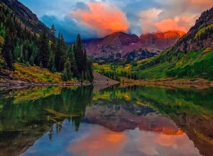
4.9The Maroon Bells are known around the world for being some of the most iconic, beautiful mountains in all of the United States. Even if you haven't heard of them, there's a chance you've seen them. And if you've seen them in person, it's likely you were there with 800+ of your closest friends.If ...Read more -
Aspen, Colorado
Car Camp at Maroon Lake
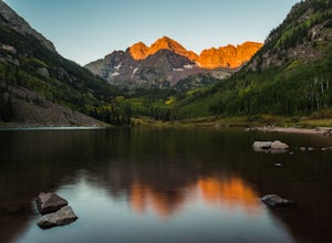
5.00.3 mi / 0 ft gainMaybe you've seen the photos a million times before - it's for good reason. Maroon Bells is just stunning. Watching the first rays of sunlight scratch the very top of Maroon Bells and slowly crawl their way down the massive slabs of granite is simply a must for the checklist. Taking in the sunris...Read more -
Aspen, Colorado
North Maroon Peak
8.08 mi / 4298 ft gainStart your hike at the parking lot/trailhead at the end of Maroon Creek Rd. Keep in mind that the road is closed from about 9am-8pm to traffic and is only accessible by shuttle bus during that time. You'll be wanting to get a very early start anyways, so it shouldn't be an issue. Your path begin...Read more -
Lake City, Colorado
Uncompahgre Peak (14,309')
5.07.3 mi / 2881 ft gainAt 14,309 feet, the summit of Uncompahgre Peak is the highest point in the entire San Juan range, but getting to it requires only good hiking skills, good physical shape, and a four-wheel-drive, high-clearance vehicle to get to the trailhead. From Lake City, head west along the Alpine Loop about...Read more -
Snowmass, Colorado
Capitol Lake via Capitol Ditch
5.012.28 mi / 2575 ft gainThe route to Capitol Lake is fairly straightforward, but not without its minor hardships. The route begins at the end of Capitol Creek Road, 9 miles from the small "town" of Snowmass (NOT Snowmass Village - that's the high-class ski resort). The last few miles of this road provide the first min...Read more -
Ouray, Colorado
Lower Cascade Falls
3.00.5 miLocated within the picturesque town of Ouray, Colorado, Cascade Falls is what most city parks strive to be. This park and amazing waterfall are located on the edge of town along the longer 5+ mile Perimeter Trail and provides a place for picnics, relaxing, and further days hikes through connector...Read more

