Cortez, Colorado
Top Spots in and near Cortez
-
Teec Nos Pos, Utah
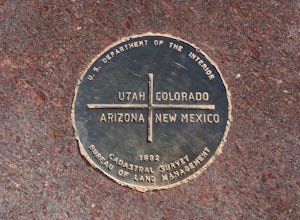
Visit Four Corners Monument
4.0Pretty cool spot to check out if you are in the area. Not a hike or anything like that. Just a cool landmark that will let you grab some pretty nice pictures. Enjoy!Read more -
Durango, Colorado
Hike the Colorado Trail to Gudy's Rest
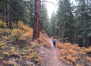
4.08.1 mi / 1400 ft gainThis hike, a local favorite is less than five miles from downtown Durango. The entire hike offers beautiful views especially once your reach the top of Gudy's Rest. The trail starts off with a gradual uphill along Junction Creek. On this section of the trail, you will likely run into locals proba...Read more -
Durango, Colorado
Mountain Bike in Dalla Mountain Park
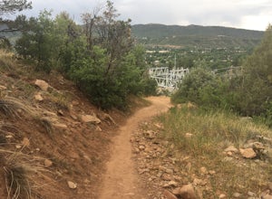
4 miThe Dalla Park shares a trailhead and parking lot with the Animas Mountain trail, frequently used for hiking and trail running. There is plenty of room in this lot, as well as several picnic tables. Immediately after crossing through the gate, the trail divides. The bike park takes up the south a...Read more -
Durango, Colorado
Hike the Animas Mountain Trail
5.9 mi / 1535 ft gainThe Animas Mountain Trail is a 6 mile loop trail, easily accessible from town, and best used from March until October. In the early spring and late fall, it is advised to bring YakTrax or similar in case there are icy patches on the trail. This trail is located in the San Juan National Forest nea...Read more -
Durango, Colorado
Hike the Falls Creek Loop
4.54.1 mi / 393 ft gainThe Falls Creek Loop is a 4.1 mile trail in the San Juan National Forest, just outside of Durango, Colorado. Lots of side trails jut out from the main trail, and it is easy to lose your way. Take the middle trail at the first split, and keep following the main splits. You will find yourself on a ...Read more -
Durango, Colorado
Drive the San Juan Skyway from Durango to Ouray
4.7The drive from Durango to Ouray via Colorado 550 (The San Juan Skyway) is one of the most gorgeous roads in the country. The drive itself is worth your time, but if you have time be sure to make stops along the way at the many waterfalls, hiking trails, and lakes along the road. This drive passes...Read more -
Durango, Colorado
Trimble Hot Springs
4.3The Trimble Spa and Natural Hot Springs offers a 101-105 degree, Olympic size swimming pool, in addition to two mineral pools, saunas, and a spa. Lodging is available as well, including a 'couple's hideaway' package.Read more -
La Plata County, Colorado
Soak at Pinkerton Hot Spring
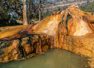
5.0The Million Dollar Highway in Southern Colorado is a scenic mountain drive with many beautiful sights. Pinkerton hot springs is located on the side of the highway just outside of Durango, Colorado. There is a small pullout area for parking with a plaque explaining the history of the area and th...Read more -
Durango, Colorado
Hike Goulding Creek
4.05.9 mi / 2122 ft gainThis trailhead is only about 15 miles from Durango on Highway 550. Look out for Glacier Club/Tamarron on your right, and soon after (about a mile) there is a small dirt turn-off on the opposite side of the highway. There is one other turn off on the west side of the highway in this stretch, but i...Read more -
Durango, Colorado
Hike the First Fork/Red Creek Loop
9.8 mi / 2195 ft gainLeaving from Durango, head north on Florida Road/CR 240. From the intersection with County Road 250 (the last stoplight), drive about 8 miles until you reach Colvig Summer Camp. Turn northwest here. The road will soon narrow and turn to dirt - continue straight. 1 mile further, there will be a la...Read more -
Durango, Colorado
Columbine Pass via Purgatory Flats
5.034.52 mi / 6932 ft gainThis hike begins at the Purgatory Flats Trailhead across from the Purgatory resort. The register is about a hundred yards from the Trailhead and is located next to a trail map. From here you will begin your descent down into the flats, which is roughly a 600-700 foot descent over the course of ju...Read more -
Ship Rock, New Mexico
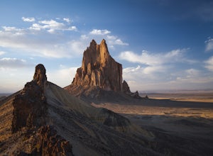
Explore Shiprock
5.0Situated on the border of Arizona and New Mexico is an ancient throat of a volcano. You can see Shiprock for miles, as you approach the quiet New Mexico town. It's jagged edges and large spine, that extends to the South, cut straight out of vast flat landscape that surrounds it. You cannot miss i...Read more -
Aztec, New Mexico
Explore Aztec Ruins National Monument
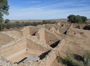
Stop at the visitor center first then take your time walking the trails and exploring the different rooms, especially the great house. This National Monument is a Unesco World Heritage site.Read more -
Placerville, Colorado
Hike Wilson Peak aka Coors Peak
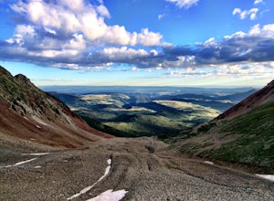
4.0The mountain peak that turns blue when Coors and Coors Light bottles and cans are ice cold is real. No, it is not called Coors Peak. But it is in Colorado, where Coors was born. The snow-capped mountain in the Coors logo is really Wilson Peak near Telluride, Colorado.If you want to crack a Coo...Read more -
Ophir, Colorado
Mountain Bike Galloping Goose
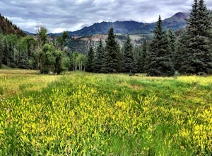
The Galloping Goose Trail near Telluride, Colorado is a bike ride along what once was a historic train route. Plus it’s family friendly and the scenery is phenomenal.The starting point is at the top of Lizard Head Pass at an elevation of 10,200 feet. The scenery, from wildflowers to colorful moun...Read more -
Egnar, Colorado
Raft the Dolores River
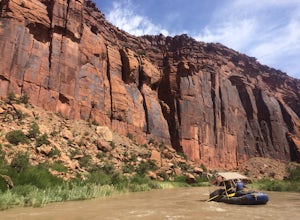
On years with enough moisture and runoff, kayakers, rafters, tubers and SUP-ers all take to the Dolores River. This section of water from Slick Rock to Bed Rock provides a two night, three day float through red canyon walls, meandering bends in the river, a a few notable side canyons. The water l...Read more

