Breckenridge, Colorado
Looking for the best mountain biking in Breckenridge? We've got you covered with the top trails, trips, hiking, backpacking, camping and more around Breckenridge. The detailed guides, photos, and reviews are all submitted by the Outbound community.
Top Mountain Biking Spots in and near Breckenridge
-
Evergreen, Colorado
Evergreen Mountain Loop
4.75.89 mi / 0 ft gainThe way up Evergreen Mountain is actually a few different trails stitched together throughout Alderfer/Three Sisters Park. The trail connects to both parking lots in the park, so if one is full you can just start from the other one, giving you lots of options for a quick day-hike. If you start ...Read more -
Buena Vista, Colorado
Hike Davis Meadow
5.08.6 mi / 800 ft gainThis is a great hike that is very close to Buena Vista, CO. This trail is on the east side of town and is accessible in the spring. The hardest part of the hike is locating the trail-head. It is located in the northern part of Four Mile Canyon and is in San Isabel National forest. Starting in Bue...Read more -
Aspen, Colorado
Hike Lost Man Loop
5.08.8 mi / 1290 ft gainThis 8.8 mile "loop" is not a true loop and the trail ends 4 miles apart along Independence Pass, so a car shuttle is recommended. I would recommend starting at the west trailhead (closer to Aspen) but will describe both trailheads so you can set up another car or shuttle at the other one.1) West...Read more -
Golden, Colorado
Hike the Blue Grouse Trail Loop
3.06 mi / 400 ft gainStart the hike at the Blue Grouse Trailhead located next to Kriley Pond. Travel along Blue Grouse Trail for 0.7 miles until you reach a fork in the trail at Mule Trail where you will take a right. Along the Mule Trail you will travel up a series of switch backs before the trail levels out and you...Read more -
Evergreen, Colorado
Hike Panorama Point at Corwina Park
4.72.7 mi / 640 ft gainJefferson County, the "Gateway to the Rockies" has dozens of great parks and trails. One of the best, however, is often overlooked, as it is sandwiched between bigger and more popular parks. Corwina Park is a small section located off Hwy. 74, near the village of Kittredge. Sitting between the po...Read more -
Pine, Colorado
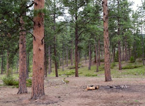
Dispersed Camp at the Buffalo Creek Area in Pike National Forest
3.850 miles from Denver, nestled in Pike National Forest, there are dozens of free dispersed camping sites. With quick access to the Colorado Trail and Buffalo Creek Mountain Bike Area, these campsites make for a perfect weekend getaway. The campsites begin on Forest Road 550, and are clearly marked...Read more -
Pine, Colorado
Little Scraggy Peak Loop
5.012.18 mi / 1621 ft gainLittle Scraggy Peak Loop is a loop trail that takes you past scenic surroundings located near Buffalo Creek, Colorado.Read more -
Golden, Colorado
Hike the Mountain Lion Trail
6.7 mi / 1230 ft gainThere are three parking lots with direct access to the Mountain Lion Trail. The main one is off of Crawford Gulch Road, but any of them are good starting points! This loop has pretty similar elevation gain and loss profiles no matter which way you go, so you can go any direction. This adventure ...Read more -
Golden, Colorado
Hike Beaver Brook Trail at Windy Saddle Park
5.05 mi / 500 ft gainJust outside of Golden, CO is Lookout Mountain. If you’ve ever driven westbound on i70 from Denver to the mountains, you’ve undoubtedly seen this mountain to your right with antennas on the top. On the north side of Lookout Mountain lies Windy Saddle Park, about a 30 minute drive from Denver. Thi...Read more -
Golden, Colorado
Hike Chimney Gulch Trail at Windy Saddle Park
4.05 mi / 1000 ft gainJust outside of Golden, CO is Lookout Mountain. If you’ve ever driven westbound on i70 from Denver to the mountains, you’ve undoubtedly seen this mountain to your right with antennas on the top. On the north side of Lookout Mountain lies Windy Saddle Park, about a 30 minute drive from Denver. Thi...Read more -
Golden, Colorado
Hike Lookout Mountain Trail at Windy Saddle Park
4.02.6 mi / 500 ft gainJust outside of Golden, CO is Lookout Mountain. If you’ve ever driven westbound on i70 from Denver to the mountains, you’ve undoubtedly seen this mountain to your right with antennas on the top. On the north side of Lookout Mountain lies Windy Saddle Park, about a 30 minute drive from Denver. Thi...Read more -
Grand Lake, Colorado
Doe Creek Trail
7.13 mi / 1617 ft gainDoe Creek Trail is a loop trail that takes you by a lake located near Granby, Colorado.Read more -
Golden, Colorado
Hike the Sawmill to Maverick Loop
4.32 mi / 450 ft gainFor this adventure, you'll be completing the Sawmill to Maverick loop. It is a short, but gentle trail that will take you through open meadows, to pine forests, and great views of Denver and Golden.Starting from the west parking area, cross the road and hit the Sawmill Trail. This trail starts ou...Read more -
Golden, Colorado
Matthews/Winters Park Loop
4.04.99 mi / 827 ft gainMatthews/Winters Park, which is part of the Jefferson County Open Space system, is proof that you do not have to go far from the city to enjoy the mountains. Nestled in the foothills between Golden and Morrison just off I-70 and C-470, Matthews/Winters is easy to access from Denver and any of the...Read more -
Golden, Colorado
Argos Trail & Magic Mountain Trail Loop
5.01.91 mi / 397 ft gainArgos Trail & Magic Mountain Trail Loop is a scenic loop that's great for stretching your legs in Apex Park near Golden Colorado. This trail is fun for the family (baby carrier needed for families with newborns) and for your pup (on-leash). NOTEOdd days of the month (1st, 3rd, 5th, etc.) are...Read more -
Littleton, Colorado
Hike the Meadowlark Plymouth Trail
4.06 mi / 1197 ft gainFrom the parking lot, you can take the Meadowlark trail to the west or the Plymouth Creek Trail to the southeast. It does not matter which trail you take because it ends up becoming loop. For a more gradual slope up the hill, take the Meadowlark trail. After a little more than a mile, it intersec...Read more

