Avon, Colorado
Top Spots in and near Avon
-
Leadville, Colorado
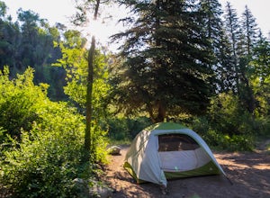
Camp at Kite Lake
5.0Kite Lake is a beautiful little lake that is surrounded plenty of fourteeners. Just outside of Alma, Colorado, Kite lake can be accessed from Buckskin Street. Buckskin is a simple left turn after the only bar in Alma, or a right turn before the only bar in Alma... Do note, this road is not drivab...Read more -
Leadville, Colorado
Decalibron Loop (CLOSED)
4.87.5 mi / 3000 ft gainNOTE: As of March 2023, access to parts of this loop that are on private property (including Mt. Democrat & Mt. Lincoln) are closed to the public indefinitely. (Source) Start your hike at the Kite Lake trailhead, where you can find overnight camping for a small fee, or park a bit down the ro...Read more -
Leadville, Colorado
Mt. Democrat (CLOSED)
4.84 mi / 2150 ft gainNOTE: As of March 2023, access to parts of this loop that are on private property (including Mt. Democrat & Mt. Lincoln) are closed to the public indefinitely. (Source) To begin this wonderful hike, drive from the town of Alma, Colorado and head up Buckskin Street for about 6 miles. I would ...Read more -
Leadville, Colorado
Mounts Democrat, Lincoln, Cameron and Bross (CLOSED)
4.08 mi / 3500 ft gainNOTE: As of March 2023, access to parts of this loop that are on private property (including Mt. Democrat & Mt. Lincoln) are closed to the public indefinitely. (Source) Find your way to the Kite Lake trailhead near Alma, Colorado. The road up to the trailhead is suitable for most vehicles, i...Read more -
Breckenridge, Colorado
Winter Hike to Quandary Peak (14,265')
4.67 mi / 3500 ft gainQuandary Peak is a popular winter 14er because of its easy access near Breckenridge, its Class 1 designation, and its low avalanche risk. While the access roads to many 14ers are closed in winter, adding extra mileage to an already grueling hike, Quandary Peak’s access is just off Hwy. 9, and the...Read more -
Breckenridge, Colorado
Ski or Snowshoe McCullough Gulch
5.06 mi / 1300 ft gainIf the snow is not coming to you, you go where the snow is. Breckenridge is a good place to start; this beautiful ski area gets more than its fair share of snow, and is full of stunning trails. Why pay big bucks at one of the Nordic centers, when you can access acres and acres of the White River ...Read more -
Gypsum, Colorado
Camp at Deep Creek Campground
I was driving from Denver to Telluride and wanted a camping spot along the way so I decided to make a random turn off of 70 and sure enough found some beautiful BLM land to camp on. The Deep Creek Campground is along a dirt road about 2 miles off of a paved road. There are 6 camping sites along t...Read more -
Breckenridge, Colorado
Winter Climb of North Star Mountain
4.08 mi / 2400 ft gainFrom the west parking lot at the top of Hoosier Pass, take the 4x4 road as it climbs through a forest west of the pass. Before long, the trees thin and you'll stay on the road through treeline and reach a gate at just over 12,000 feet.Stay right at the gate and continue on this old mining road as...Read more -
Leadville, Colorado
Fly Fish Crystal Lake
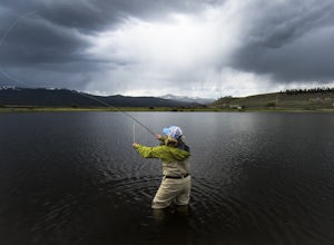
Crystal Lake is a beautiful lake (or could it be called a pond?), set in the shadow of the Rocky Mountain’s highest peaks, Mt. Elbert and Mt. Massive, can be found about six miles south of Leadville, CO on the west side of US 24. This lake holds a healthy trout population and is stocked regularly...Read more -
Breckenridge, Colorado
Discover Ancient Trees on Windy Ridge
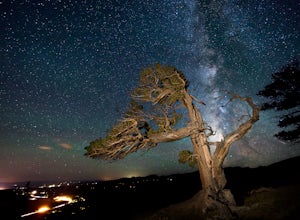
The Windy Ridge Bristlecone Pine Scenic Area is a remote stand of trees off a 4WD road near Alma, Colorado. This grove of bristlecone pines was given protected status in 1964 due to its uniquely shaped trees influenced by the winds blasting off nearby 14er, Mount Bross. The area sits at 11,700 ...Read more -
Breckenridge, Colorado
Camp at Boreas Pass
9 mi / 1500 ft gainBoreas pass is a high mountain pass in the Rocky Mountains that sits on the Continental Divide at 11,481'. Forest Service Road 33 goes over the pass and has numerous campsites all along its length, with several near the summit that feature breathtaking views of the Tenmile Range and the Breckenri...Read more -
Breckenridge, Colorado
MTB Boreas Pass
Boreas Pass is a scenic route that lies between Como (north of Fairplay on Hwy 285) and Breckenridge. It is 21 miles of low maintenance, rough gravel road that follows the Continental Divide and summits at 11,481 feet. Other than the altitude, the ride is not difficult, as the grade is not steep ...Read more -
Aspen, Colorado
McNamara Hut
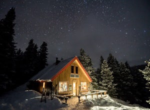
5.012.46 mi / 2631 ft gainMcNamara Hut sits in the national forest on the slope of Bald Knob, with easy access to intermediate backcountry skiing and more challenging terrain further away. Built in 1982, it's one of the original huts in the 10th Mountain Division system along with Margy's Hut. The hut comes stocked with...Read more -
Leadville, Colorado
Hike Mount Massive
4.8Starting from the Mt Massive Trailhead off of Halfmoon Creek Road (a half mile past the more popular Mt Elbert Trailhead), follow the excellent and easy trail into the woods. This trail is wide and abnormally flat for a 14er trail for the first three miles. During these first 3 miles the only rea...Read more -
Leadville, Colorado
Colorado Trail: Mount Elbert Trailhead to Twin Lakes
8.49 mi / 1099 ft gainColorado Trail: Mount Elbert Trailhead to Twin Lakes is a point-to-point trail that takes you by a lake located near Leadville, Colorado.Read more -
Leadville, Colorado
North Mount Elbert Trail
4.59.07 mi / 4432 ft gainStart your trip at the North Elbert Creek trailhead, reached by taking Colorado 300 just south of Leadville, and then a left on County road 11 and a right on Halfmoon Creek road. The dirt road to the trailhead is well traveled. The trail begins from the parking lot and winds upwards past 2 clear...Read more

