Allenspark, Colorado
Looking for the best hiking in Allenspark? We've got you covered with the top trails, trips, hiking, backpacking, camping and more around Allenspark. The detailed guides, photos, and reviews are all submitted by the Outbound community.
Top Hiking Spots in and near Allenspark
-
Estes Park, Colorado
Hike Deer Mountain
6.03 mi / 1200 ft gainBeginning in Rocky Mountain National Park near the Deer Ridge Junction (where US 34 & US 36 meet), park your car in one of the 20 spots on either side of the road. Start at the trailhead booth and head north, keeping to the right-side trail at the first intersection about a tenth of a mile fr...Read more -
Nederland, Colorado
Camping at Brainard Lake
5.0Pawnee Campground has 47 sites for suited for tents, RVs, or trailers with eight that are walk in and tent only. These can fill up quick so get there early if you don't have a reservation, which can be tough to come by but will be well worth it.Brainard Lake has been one of the most popular hikin...Read more -
Ward, Colorado
Hike to Mitchell Lake
4.04 miLocated in the Brainard Lake Recreation Area, Mitchell Lake is a good quick hike for an afternoon getaway. With just two miles to go till you reach the lake itself, it's easy for the whole family and the pups (the recreation area is super popular, so this is assuming the lots are full and you hav...Read more -
Grand Lake, Colorado
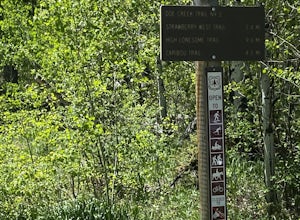
Doe Creek Trail
7.13 mi / 1617 ft gainDoe Creek Trail is a loop trail that takes you by a lake located near Granby, Colorado.Read more -
Estes Park, Colorado
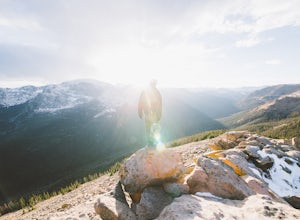
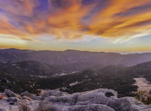
Watch the Sunset at Forest Canyon Overlook
5.00.2 mi / 32 ft gainTrail Ridge Road is an incredible highway that crosses the mountains between Grand Lake and Estes Park, one of the most famous parts of Rocky Mountain National Park. It features incredible views of the Rockies and the Front Range, as well as the unforgettable experience of being immersed in the t...Read more -
Ward, Colorado
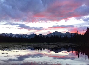
Explore Red Rock Lake, CO
3.0If you are looking for great reflections, color and mountain peaks for your photos, this lake is a great place to start. The Brainard Lake Recreational Area has so much to do, but this is a stop not to miss.It seems that everyone drives on by this little gem to get to Brainard Lake and the hiking...Read more -
Grand Lake, Colorado
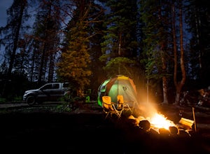
Camp at Stillwater Pass
4.6Some of my best nights in Colorado were spent in Stillwater Pass. There are numerous campsites with remade fire pits. I found this site when the Timber Creek Campground in Rocky Mountain National Park was full and I did not want to head back to Denver. There is a photo of a white plastic horse a...Read more -
Ward, Colorado
Snowshoe Mount Audubon
13.9 mi / 2715 ft gainWant to start snowshoeing peaks?! Of course you do! If you don't already have snowshoes, you can rent a pair at your local REI (the one in Boulder, CO is closest to this hike). Check the snow conditions and if there is a fair amount of snow, I would recommend renting the larger of the two kinds o...Read more -
Ward, Colorado
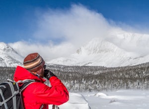
Snowshoe Long Lake
8 mi / 200 ft gainA long but extremely scenic hike tucked in Colorado's Indian Peaks wilderness. The entire Long Lake trail says 2.3 mile but due to winter conditions and snow pack you can really only make it the east edge of the lake. Exit Long lake loop back on to Brainard Lake Road (currently under construction...Read more -
Estes Park, Colorado
Hike The Mummy Kill (a.k.a. Mummy Mania)
14.31 mi / 5600 ft gainWanna kill some mummies!? Of course you do! Who doesn't? Mount Chapin: 12,454 feet; Mount Chiquita: 13,069 feet; Ypsilon Mountain: 13,514 feet; Fairchild Mountain: 13,502 feet; Hagues Peak: 13,560 feet; Mummy Mountain: 13,425 feet The Mummy Kill is the perfect all-day hike for those seasoned h...Read more -
Estes Park, Colorado
Camp at Aspenglen Campground
5.0Aspenglen is one of the four main campgrounds within the park boundaries. The campground is for car camping and there are areas just for tents and then broader areas for tents and campers. There are 53 sites at this campground and it fills up quickly each year. Reservations are available six mont...Read more -
40.407117,-105.626146
Hike to Lawn Lake, Rocky Mountain NP
12.9 mi / 2558 ft gainThis 4 to 8 hour day hike leads to Lawn Lake, located inside a large basin at tree line, and surrounded by Fairchild Mountain, Hagues Peak, and Mummy Mountain. Lawn Lake is among the largest subapline lakes in Rocky Mountain National Park. As you ascend into the sub-alpine zone, you will be gree...Read more -
Estes Park, Colorado
Hike the Ypsilon Lake Trail
5.08.38 mi / 2000 ft gainTo get to the trailhead, enter Rocky Mountain National Park on the 36. Keep right at the fork with the 34 and then you'll take your next left and the parking for the trailhead is the first parking area on your right. There is an outhouse at the trailhead too, so if you need to take a pit stop b...Read more -
Lyons, Colorado
Hike the Kruger Rock Trail
4 mi / 1000 ft gainCutting through the forested hills surrounding Estes Valley, the Kruger Rock Trail is a well-marked 4 mile loop to the top of Kruger Rock. The trail begins in Hermit Park Open Space, located just a few miles southeast of Estes Park and is a moderate hike with around 1000 feet of elevation gain. C...Read more -
Estes Park, Colorado
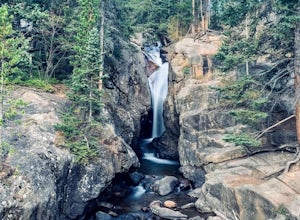
Chasm Falls
3.02.57 mi / 132 ft gainParking in Rocky Mountain National Park is tricky for Chasm Falls. Depending on where you are able to park, the hike will be a 0.1 mile, 2.8 mile, or 4.8 mile round-trip hike. It’s also important to know that Old Fall River Road is closed during the winter months from Nov 30th until the end of Ma...Read more -
Estes Park, Colorado
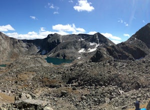
Backpack the Gorge Lakes
11.5 mi / 3200 ft gainStart at the Rock Cut Parking Area. Head east on Trail Ridge Road 0.25 miles to a more gradual and bald western slope leading down into Forest Canyon. This bald is located between two creeks which merge before joining the Big Thompson River (a small creek in mid September). Use the creeks to navi...Read more

