Yountville, California
Looking for the best photography in Yountville? We've got you covered with the top trails, trips, hiking, backpacking, camping and more around Yountville. The detailed guides, photos, and reviews are all submitted by the Outbound community.
Top Photography Spots in and near Yountville
-
Mill Valley, California
Temelpa Trail
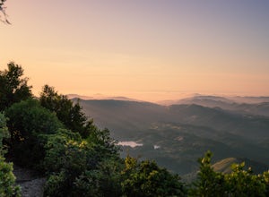
4.52.94 mi / 1929 ft gainThe Mt. Tam Hill Climb via Temelpa Trail is an iconic, "best-of" climb in the trail running community, drawing some of the world's greatest athletes to experience its breathtaking views and technical downhill. Surprisingly though, outside of locals and the running community, the trail remains lar...Read more -
Point Reyes Station, California
Sky Trail Loop
5.09.55 mi / 1818 ft gainSky Trail in Point Reyes National Seashore is a dramatic, mostly single-track trail that runs along the main spine of the Inverness Ridge and across highest mountains in Point Reyes, looming above the Olema Valley and Highway 1 which mark the San Andreas Fault rift zone and the dividing line betw...Read more -
Point Reyes Station, California
Sky Campground via Sky Trail
2.66 mi / 495 ft gainEntering Point Reyes National Seashore from Bear Valley Road the Sky Trailhead is a 4.9 mile drive. Camping in Sky Camp requires a Camping Permit. Once at the Sky Trailhead parking lot. The Sky Trailhead will be on the left side pulling in. The hike is not very strenuous and not all that lo...Read more -
Stinson Beach, California
Cataract Falls
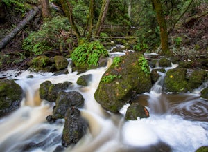
4.22.81 mi / 1184 ft gainThe Bay Area is home to many beautiful waterfalls, but Cataract Falls located about an hour north of San Francisco is one of the most stunning. Be sure to head out on this hike after a recent rain. Cataract Falls is a picturesque waterfall located in the Mt. Tamalpais Watershed near Stinson Be...Read more -
Inverness, California
McClures Beach
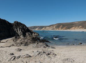
1.44 mi / 243 ft gainThis beach is really easy to get to. Just follow Pierce Point Road until you see the sign to the beach. It's an easy hike down from the parking lot. There is very little shade, so make sure to bring some sunscreen. Be extremely cautious with getting into the water. There is likely underwater cu...Read more -
Berkeley, California
Hidden Waterfall in Codornices Park
4.00.5 miPark along the street in front of Codornices Park in Berkeley. Follow the stream to the left of the playground. Take the path up the hill to the right (don't head over the bridge on the left). Keep walking up multiple concrete stairs. After the first flight of stairs you'll see a path on the left...Read more -
Berkeley, California
Berkeley Rose Garden
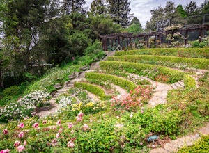
4.0I'm always surprised at how few people know of this beautiful garden. I'm often alone when I visit, which allows for perfect serenity. Visit in early spring for maximum blooms. Park on Euclid Ave, which is where you'll find the entrance to the amphitheater (you can't miss the giant sign). Spend ...Read more -
Guerneville, California
Parson Jones and Colonial Armstrong Redwood Trees
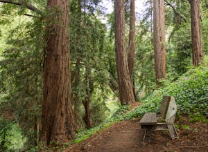
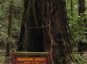
5.0The Parson Jones Tree is the tallest tree in the reserve, measuring more than 310 feet (94 m) in height. This is longer than the length of a football field! Named after a lumberman who chose to preserve this portion of the park in the 1870s, the Colonel Armstrong Tree is the oldest tree in the ...Read more -
Bootjack Campground, California
Bootjack Campground to Muir Woods
8.61 mi / 1594 ft gainGetting permits into Muir Woods can be hard, but if you want to work for it, there's a much better way to visit the National Monument. To do this loop into Muir Woods National Monument, first drive to the Bootjack Parking Area in Mt. Tamalpais State Park. The Bootjack Parking Area should be fou...Read more -
Mill Valley, California
Camp at Bootjack Campground in Mount Tamalpais State Park
4.0Bootjack Campground is located within California's Mount Tamalpais State Park. There are a couple of campsites within the park, but if you are driving on the Panoramic Highway from Mill Valley, this will be the first campground you pass. The fee is $25 fee to camp, but they have bathrooms and ru...Read more -
Mill Valley, California
Steep Ravine and Bootjack Trails Loop
5.06.66 mi / 2083 ft gainThis hike is best done in the winter and spring in order for the creeks and waterfalls to be flowing. Park at the Bootjack Campground in Mount Tamalpais State Park. Cross the road to reach the Bootjack trail. Continue on this until you reach the Alpine trail. Go right towards the Pantoll Ranger ...Read more -
Marin County, California
Picturesque Views from Mt. Tam's East Ridge
5.0This road provides one of the most scenic views of the pacific from north of the Golden Gate. It's a little bit of a windy drive or ride along Highway 1 or Panoramic Highway (depending on which way you choose) to get to East Ridgecrest. But, if you remembered to pack a picnic, brought your friend...Read more -
Stinson Beach, California
Cataract Trail Loop
4.58.7 mi / 1670 ft gainDuration: 3.5-4 hour hike at a moderate to quick pace with a short break for lunch. Starting at an elevation of 1989ft and maxing at 2001ft, you achieve 1428 of elevation gain through a beautiful peak and valley hike. From the free Rock Springs Parking Area, the basic trailheads to follow along...Read more -
Inverness, California
Abbotts Lagoon Trail
4.63.43 mi / 102 ft gainIf you like beaches, headlands, scenic landscapes, wildflowers, and tons of wildlife viewing, you should give this hike a try. Although it only takes about an hour to complete the out-and-back, the vibe surrounding this area is just begging you to slow down and enjoy your natural surroundings. T...Read more -
Oakland, California
Grizzly Peak
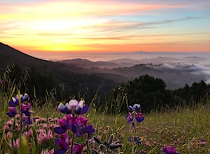
4.8A well-known sunset spot in the East Bay, and rightfully so - the views from Grizzly Peak are stunning. You have several pull-offs to pick from. The larger ones have logs to sit upon. The smaller pull-offs offer benches and sturdy rocks. Take your pick! You will share the sunset with some strang...Read more -
Point Reyes Station, California
Hike the Laguna Trail & Coast Trail Loop
5.05.2 mi / 300 ft gainLeave your car on a side of the road. When navigating there, put "HI Hostel Point Reyes" in your navigation - you park literally on the other side of the road, opposite to the hostel. Go to the west and soon you'll find the start of Coast Trail with a tsunami warning sign. During first 1.8 mile y...Read more

