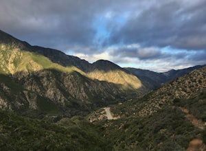
Whittier, California
Looking for the best hiking in Whittier? We've got you covered with the top trails, trips, hiking, backpacking, camping and more around Whittier. The detailed guides, photos, and reviews are all submitted by the Outbound community.
Top Hiking Spots in and near Whittier
-
Los Angeles, California
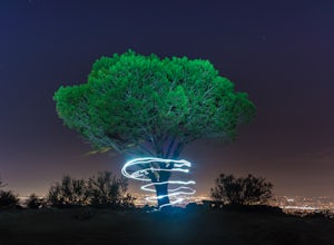
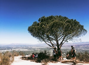
Wisdom Tree
4.80.95 mi / 528 ft gainIn Griffith Park, park along Lake Hollywood Drive and walk the paved quarter mile up Wonder View Drive to the start of Wonder View Trail. Here, walk through the yellow gate and make the first right after the road turns to dirt. Head up this unmarked single track path heading east up the mountain....Read more -
Los Angeles, California
Cahuenga Peak Loop Trail
3.88 mi / 1237 ft gainThe Cahuenga Peak Loop is perfect for trail runners and hikers. The trailhead is in Hollywood Hills - park off to the side on a street. This trail features beautiful wildflowers in the spring. Dogs are allowed on the trail if kept on leash. The trail can be dusty and dirty, so watch your step. Ke...Read more -
Los Angeles, California
Cahuenga Peak via Burbank Peak Trail
2.23 mi / 719 ft gainCahuenga Peak via Burbank Peak Trail is an out-and-back trail that takes you past scenic surroundings located near Los Angeles, California.Read more -
Altadena, California
Gabrieleno Trail: Switzer Falls to Hahamonga Watershed
5.010.14 mi / 814 ft gainGabrieleno Trail: Switzer Falls to Hahamonga Watershed is a point-to-point trail that takes you by a waterfall located near La Canada Flintridge, California.Read more -
Los Angeles County, California
Switzer Falls
3.43.66 mi / 728 ft gainJust off the Angeles Crest highway, you’ll find one of LA’s best waterfalls, Switzer Falls. There is a parking lot just next to the trailhead. If you go on the weekend and run into a crowd, there’s parking near the highway, adding a little distance to your trek. Once you’ve walked through the Sw...Read more -
Los Angeles County, California
Bear Canyon via Switzer Falls Trailhead
6.67 mi / 1273 ft gainParking: Parking is available at the Switzer Falls Picnic Area, or in the two overflow lots on the hill. You will need an Adventure Pass to leave your car parked here. Make sure to follow posted signs - there are some parking spots that do not allow overnight parking. Amenities: Bear Canyon has...Read more -
Chino Hills, California
Adobe Loop
3.01.92 mi / 312 ft gainThe best place to park for this hike is at Hunter's Hill park. From there, the trailhead is located on Natalie Road just South of the park. There is a large sign marking the start of the trail, but it does not give a name for either the trail head or the trail itself. For reference, it is the But...Read more -
Burbank, California
Wildwood Canyon Loop
3.98 mi / 1680 ft gainThe Vital Link Trail is a steep and narrow out-and-back trail accessed though the Wildwood Canyon Park located in Burbank, CA. Parking at Wildwood Canyon is free and easy, and will be determined by which of the four trailheads you choose to start from. For the shortest and most direct route you...Read more -
Burbank, California
Vital Link Trail
4.03.72 mi / 1775 ft gainFrom I-5, take the Burbank Blvd exit. Drive north on Burbank Blvd. and take a right on N 3rd. Left on E Harvard. Right on Wildwood Canyon after 1.5 miles. There are a few ways you can begin your hike: from the parking lot, the entrance will be to the left past the gate. Here you were have a stee...Read more -
Claremont, California
Claremont Wilderness Loop
4.85.03 mi / 1020 ft gainDrive to the top of Mills Ave in Claremont. There is a main parking area to the left and overflow parking a block south on the right. It costs $3 to park for 4hrs. As the name implies, the Wilderness Loop is a loop that connects to other trails in the Claremont Hills Wilderness. You can choose t...Read more -
Palmdale, California
Hike to Vetter Mountain and the Fire Lookout Tower
2.8 mi / 550 ft gainIf you're looking for an easy mountain to hike, and perhaps give the kids something interesting to learn about at the top, then Vetter Mountain may fit the bill. At 5,908', and with a trailhead at about 5,350', this 1.4 mile (one way) hike only climbs about 550' vertical. The trailhead is loca...Read more -
Burbank, California
Old Youth Camp Loop
2.59 mi / 732 ft gainThe Old Youth Camp Loop is a 2.6-mile loop with over 700 feet of elevation gain that can be ran, hiked, or even mountain biked if you prefer. While not completely empty the area receives very little visitors and is a great place to enjoy a little more solitude than near by hiking locations. The l...Read more -
La Verne, California
Cattle Canyon Trail
6.7 mi / 1066 ft gainWithin the San Gabriel Mountains from Highway 39 and along East Fork Road is Cattle Canyon. To go through Cattle Canyon, you can access the trail head just south of the Bridge to Nowhere trail head along East Fork Road right after it intersects with Glendora Mountain Road. There is a small parkin...Read more -
Los Angeles, California
Verdugo Peak via Hostetter Fire Road
5.07.39 mi / 1627 ft gainVerdugo Peak, at 3000 feet, is accessible from multiple directions and trails along the Verdugo Range. The most direct route to the top is Hostetter Fire Road, a 3.6-mile hard-packed dirt trail that climbs 1600 feet to the 3,126-foot summit. The hike begins at the dirt parking lot off of La Tuna ...Read more -
Los Angeles County, California
Big Tujunga Canyon Lookouts
1.22 mi / 453 ft gainPark at the Condor Peak Trailhead, please note that this trail head is unmarked so keep your eyes peeled on the right side of the turnout for a small single track trail. The trail gradually climbs along the side of the canyon until reaching a 4 way intersection. To your left and to your right wil...Read more -
La Verne, California
Bridge to Nowhere via East Fork Trail
4.49.65 mi / 1798 ft gainThe trail on this 10-mile hike is predominately slow and steady, but can be a little rocky, so be prepared to scramble. When you’re fording the river, the water level can range from knee to chest high, especially in the wet months. A good pair of waterproof hiking boots is helpful, but water shoe...Read more

