Vallejo, California
The best Trails and Outdoor Activities in Vallejo, California are a must-visit for anyone seeking top outdoor adventures. Blue Rock Springs Park offers scenic trails that wind around two beautiful lakes, perfect for leisurely walks or challenging runs. The Mare Island Shoreline Heritage Preserve is another top spot, with trails that take you past historic naval sites, stunning rock formations, and panoramic views of the San Pablo Bay. For a more relaxed outdoor activity, head to the Vallejo Marina and Waterfront Park, where you can fish, picnic, or just enjoy the stunning harbor views. All these attractions provide a unique blend of natural beauty and outdoor fun, making Vallejo a must-visit destination for anyone seeking the best in outdoor activities.
Top Spots in and near Vallejo
-
Pacifica, California
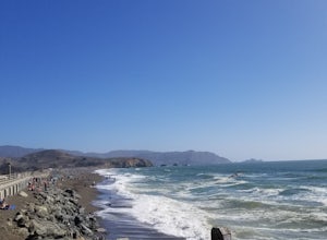
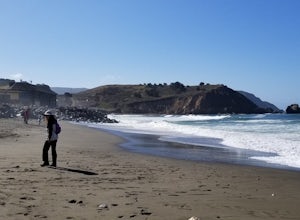
Picnic at Sharp Park Beach
4.0A medium size beach with darker sand with big rocks and a paved path for walkers and joggers. The beach is a great place to bring a picnic and watch the sunset. It is located next to Pacifica Pier, which is popular for fishing.Read more -
San Bruno, California
Sweeney Ridge via Sneath Lane
4.53.88 mi / 646 ft gainStarting from the parking lot on Sneath Lane Trail, you’ll head through the gate and continue on the path up Sweeney Ridge. This is a 5.7 mile out-and-back trek. There is a 600 ft. elevation gain, which comes mainly in the first 1.5 miles of the trail. Your legs and lungs may hurt a bit, but if t...Read more -
Inverness, California
Hike the Estero Trail
5.08 mi / 200 ft gainJune sunshine blazes on your shoulders during this scenic stroll through the Point Reyes Seashore. The trail is alive and awash with colorful wildflowers around every corner.Beginning at the trailhead, just off Home Ranch Road, with a convenient parking lot and bathroom, you'll wade through a hal...Read more -
Inverness, California
Marshall Beach Trail
5.02.41 mi / 305 ft gainMarshall Beach Trail is an out-and-back trail that provides a good opportunity to see wildlife located near Inverness, California.Read more -
Sebastopol, California
Laguna de Santa Rosa Loop Trail
4.03.95 mi / 115 ft gainLaguna de Santa Rosa Loop Trail is a loop trail that takes you by a lake located near Sebastopol, California.Read more -
Pleasanton, California
Courdet Trail and Schuhart Trail
5.24 mi / 1122 ft gainThis is a 5+ mile out and back trail through the hills in the South Bay. The beginning of the hike has a steeper incline and then becomes more gradual later on. There is a beautiful views of the South Bay that are enjoyable in the day, but are fantastic in the evening. Some areas of the trail hav...Read more -
Marshall, California
Kayak Tomales Bay
5.0Kayak Beautiful Tomales bay and experience the bioluminescence ecology of the bay. Timed during the lowest crescent of the moon, and starting around sunset, you will paddle into the sunset and wait until it is completely dark, continuing on around the bay to experience the bio-luminescence natur...Read more -
Pacifica, California
Mori Point Loop
4.82.54 mi / 276 ft gainStart at the parking lots close to the pier, where bathrooms are also available. Walk along the pier to watch the sunset as it begins. Next, walk along Sharp Park Beach to discover the plethora of wild flowers and friendly locals always ready to guide you on your walk. Take the stairs up to the...Read more -
Sebastopol, California
Ives Park
4.0Ives Park is the oldest park in Sebastopol, California, and is located only 2 blocks from downtown Sebastopol. The park has many picnic tables with barbecues, a baseball diamond, a playground, and a community pool. Amenities: Parking for the park is on the street surrounding the park. There is ...Read more -
Inverness, California
Abbotts Lagoon Trail
4.63.43 mi / 102 ft gainIf you like beaches, headlands, scenic landscapes, wildflowers, and tons of wildlife viewing, you should give this hike a try. Although it only takes about an hour to complete the out-and-back, the vibe surrounding this area is just begging you to slow down and enjoy your natural surroundings. T...Read more -
Pacifica, California
Rockaway Beach
5.0Rockaway is a dark sandy beach located in the south of Pacifica, CA. It has numerous hiking trails around it, most notably Mori Point. The Mori Point trail will take you through the hills and overlooks Rockaway Beach. There are paths to come down to the beach. There are biking paths and park...Read more -
Calistoga, California
Hike the Oat Hill Mine Trail
5.08.3 miThe incline on this trail begins pretty much right away and is fairly gradual for the entire hike, some of it is quite rocky, making this an easy to moderate level hike. However, with some shade (probably wouldn't attempt it on a hot summer day) and the sweeping views of the valley that get bette...Read more -
Calistoga, California
Hike Bald Hill in Robert Louis Stevenson State Park
3.2 mi / 1200 ft gainBald Hill is the first serious peak/summit that can be reached via the Oat Hill Mine Trail as it breaks from the more popular loop and heads into the heart of Robert Louis Stevenson State Park. To get there you can either begin at the less frequently used trailhead at Picket and Rosedale Roads he...Read more -
Inverness, California
Photograph the Cypress Tree Tunnel in Point Reyes
4.3Just north of San Francisco, there's a row of giant Monterey cypress trees that forms a “tree tunnel”. Loved by Bay Area locals, it's a tucked away spot in the Point Reyes National Seashore for photographers to capture early morning sun rays, or for anyone to get some moments of solitude. At the ...Read more -
Burlingame, California
Hike the Ed Taylor Loop Trail in Mills Canyon
4.01.4 mi / 300 ft gainThis hike can be done at any time of year. Hiking in winter and spring means that many varieties of wildflowers will be present, and the creek will have much more water. Summer and fall mean higher temperatures and drier conditions, but the hike is still a pleasant experience. Begin the hike at t...Read more -
Santa Rosa, California
Santa Rosa Creek Trail: Willowside Road to Fulton Road
4.2 mi / 46 ft gainSanta Rosa Creek Trail: Willowside Road to Fulton Road is an out-and-back trail that takes you by a river located near Sebastopol, California.Read more

