Truckee, California
Truckee, California, is an adventurer's paradise. With its stunning mountain scenery, meandering rivers, and lush forests, the area is a great destination for activities and attractions. From top-rated trails and scenic hikes to must-visit adventures, the area offers plenty of opportunities to explore the great outdoors. Popular attractions in and near Truckee include Donner Lake, Donner Memorial State Park, and the Truckee River. For those looking for an outdoor experience, the nearby Sierra Nevada Mountains offer a variety of activities, including rock climbing, mountain biking, and skiing. Additionally, the area is home to a number of smaller parks, perfect for a picnic or a leisurely stroll. With its abundance of activities and attractions, Truckee, California, is the perfect place to experience the best of nature.
Top Spots in and near Truckee
-
Twin Bridges, California
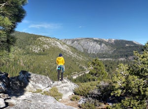
Climb Knapsack Crack & Deception at Lover's Leap
If you're just getting into outdoor climbing, it can be pretty daunting. There are so many amazing routes and so much to be worried about. Plus, you need a partner you trust to put the work in with you. To start, read a book or two, and if you can, work with a guide once or twice to make sure you...Read more -
Foresthill, California
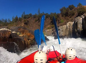
Rafting the Middle Fork American River
5.0The Middle Fork of the American River is a fun and full day of Class III/IV water rafting. You'll experience "Tunnel Chute". An very narrow 20 foot wide chute that drops you into gold miners tunnel. Other popular drops and rapids include, Kanaka Falls, Chunder, Bus Crash, Parallel Parking, 101 Ai...Read more -
South Lake Tahoe, California
Tahoe Rim Trail (TRT): Big Meadow to Echo Summit
17.51 mi / 2949 ft gainTahoe Rim Trail (TRT): Big Meadow to Echo Summit is a point-to-point trail that takes you by a lake located near South Lake Tahoe, California.Read more -
South Lake Tahoe, California
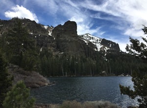
Hike to Round Lake through Big Meadow
3 mi / 1197 ft gainYou will start out at the Big Meadow trailhead at the Luther Pass parking lot. It's three miles one way. Near the end of the hike just before the lake the rock formations are prime...big trees, a crystal stream. The trail is well defined and easy going even though it's an 1100 foot gain in eleva...Read more -
South Lake Tahoe, California
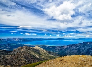
Hike to Freel Peak
5.07.3 mi / 2474 ft gainMt. Tallac may be one of the Lake Tahoe Basin's most famous peaks to hike because of its fantastic views of Lake Tahoe, but my personal favorite view in Tahoe is from the top of Freel Peak or Jobs Sister. Freel Peak is the tallest peak in the Lake Tahoe Basin at 10,881 feet.From the top of Freel...Read more -
Plumas County, California
Hike to Little Jamison Falls
3.02 mi / 500 ft gainTo get to the falls from the town of Graeagle, CA take Graeagle-Johnsville off Highway 89 towards the town of Johnsville. After 4.5 miles take a left on a dirt road to Jamison Mine Day Use Parking. If you go over the bridge and into the town of Johnsville, you have gone too far. Continue down th...Read more -
Nevada City, California
Hike the Diggins Loop Trail
5.02.7 miCheck in and pay for your parking or present California State Parks Pass at the museum building in North Bloomfield. After paying for parking there are several different options to get onto the Diggins Loop trail. Access to the Diggins Loop trail can be found by the Park Headcounters by jumping...Read more -
Nevada City, California
South Yuba River: Edwards Crossing to Purdon Crossing
5.04.2 mi / 639 ft gainSouth Yuba River: Edwards Crossing to Purdon Crossing is a point-to-point trail that takes you by a river located near North San Juan, California.Read more -
Nevada City, California
Swim at Edwards Crossing on the South Yuba River
5.02.74 mi / 1302 ft gainThere are endless swimming holes on the South Yuba River the feature crystal clear water, massive granite boulders and pristine pocket beaches, particularly those lower in the foothills. Many are separated by sections of rapids, but can be reached via the growing trail system of the South Yuba Ri...Read more -
Amador County, California
Hike to Thunder Mountain at Carson Pass
7 miThe trailhead begins on Rt 88 just past Kirkwood Resort or Silver Lake - depending on which way you are headed. There is plenty of parking but no other amenities. The trail begins at 7,900 ft and climbs steadily up Two Sentinels then along the ridge to Martins Point, ending at the 9,408ft summit ...Read more -
Markleeville, California
Caples Lake to Emigrant Lake
5.08.71 mi / 971 ft gainThis is an awesome out-and-back hike for the weekend warrior. The trail begins at the western-most point of Caples Lake, and takes you to Emigrant Lake. The first 2/3 of the trail is rather flat and appropriate for all skill levels. The last mile up to the lake schleps up the hill, and has some ...Read more -
Colfax, California
Hike The Historical Stevens Trail
5.08 mi / 3376 ft gainBest known as one of the most popular hiking and biking trails to the North Fork American River, in part because of the easy access from Colfax. However, this is a remote trail, and hikers are advised to bring plenty of fluids as well as carry a whistle. The entire trail is primarily shaded, pa...Read more -
Nevada City, California
Take a Family Ride
4.5Well if you start at Banner Lava Cap and Gracie Roads then you will see the canal at the top of Gracie Rd. Hop onto the berm of the canal and head north {upstream}. The trail is dirt and about 4 ft wide in the beginning and widens to 6 to 8 ft for most the way . Continue upstream on the canal and...Read more -
South Lake Tahoe, California
Meiss and Round Lake via Tahoe Rim Trail
10.5 mi / 1257 ft gainMeiss and Round Lake via Tahoe Rim Trail is an out-and-back trail that takes you by a lake located near Kirkwood, California.Read more -
Alpine County, California
Hike to Round Top Peak
5.09 mi / 1821 ft gainThis hike begins at Carson Pass which is accessible from Highway 88. The trail leaves from the parking lot (parking requires a fee of $5) and is easy to follow. After about a mile, you'll pass Frog Lake on the left, which is a nice place to stop for a quick snack.Continue along the trail and stay...Read more -
Alpine County, California
Hike Round Top Summit and Winnemucca Lake Loop
6.6 mi / 1272 ft gainThis hike begins near the Woods Lake campground. Start off by hiking towards Winnemucca Lake. You will begin your journey going through the forest beside a crystal-clear stream. Soon the trail opens up to become more open, full of all colours of wild flowers. You follow this breathtaking trail up...Read more

