Trabuco Canyon, California
Looking for the best hiking in Trabuco Canyon? We've got you covered with the top trails, trips, hiking, backpacking, camping and more around Trabuco Canyon. The detailed guides, photos, and reviews are all submitted by the Outbound community.
Top Hiking Spots in and near Trabuco Canyon
-
Avalon, California
Trans-Catalina Trail
5.037.67 mi / 8189 ft gainThis adventure is a great way to see the entire island of Santa Catalina. Catalina Island is situated less than 30 miles off the coast of Southern California, and can be reached by ferry from Dana Point, San Pedro, or Long Beach. Catalina Express in the company that operates the ferry. This adve...Read more -
Altadena, California
Thalehaha Falls
1.71 mi / 679 ft gainThe trails starts in a foothill neighborhood of Altadena CA at the corner of Pleasantridge Dr. and Rubio Vista Rd. This is one of the better entries into the Angeles National Forest because it is one of the lesser known. Find a place to park on the street and head out on the trail into Rubio Cany...Read more -
Altadena, California
San Gabriel via Sam Merrill and Mount Lowe Trails
17.55 mi / 5614 ft gainSan Gabriel via Sam Merrill and Mount Lowe Trails is a loop trail where you may see beautiful wildflowers located near Altadena, California.Read more -
Forest Falls, California
Summit Mt. San Bernardino from Angelus Oaks
16 mi / 4775 ft gainThe trailhead is somewhat 'interesting' to get to given the dirt roads are in questionable shape and some of the roads in Angelus Oaks are not easily identifiable but I didn't have any problems finding it by closely following Google Maps. Trailhead parking requires an Adventure Pass parking pe...Read more -
Angelus Oaks, California
San Bernardino Peak
3.015.82 mi / 4911 ft gainThe San Bernadino Peak Trail out of Angelus Oaks is a very challenging hike, which can either be done as a day hike or an overnight trip. Free permits are required for day hiking and overnights in the San Gorgonio Wilderness. These permits can be accessed via Sgwa.org/permits. If you choose to ...Read more -
Altadena, California
Echo Mountain and Inspiration Point Loop
4.110.16 mi / 3369 ft gainThe trail switchbacks up the mountain before reaching the first historic marker, in 3 miles. These are the remains of the Mount Lowe Railroad, which brought customers to Echo Mountain Resort, also in ruins, nearby. Explore the historic sites, then head up Castle Canyon Trail. A steep climb will ...Read more -
Los Angeles, California
Silver Lake Reservoir Trail
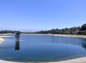
3.02.18 mi / 79 ft gainSilver Lake Reservoir Trail is a loop trail that takes you by a lake located in the Silver Lake neighborhood of Los Angeles, California. This urban escape is used by people running, walking, and birding. The trail is stroller-friendly, so you may see parents along the trail with their younger fam...Read more -
Los Angeles, California
Secret Stairs Astro Loop
2.34.21 mi / 600 ft gainI learned about these remnants of Los Angeles history, just a few months ago. When I found myself in L.A. this past month, I decided to find some of these stairs, and find out what they’re all about. Back in the 1920’s these stairs were created for pedestrians to have direct routes to the trans...Read more -
Solana Beach, California
Annie’s Canyon Trailhead
4.72 mi / 100 ft gainIf you're looking for a super short hike, this 10 minute flat walk couldn't be more ideal. Start at 840 N Rios Avenue, Solana beach and walk east towards the FWY 5 where you will see Annie’s Canyon on your right. There is only one way to go up the canyons and it gets pretty tight in places, but y...Read more -
Los Angeles County, California
San Gabriel Peak
4.02.79 mi / 1040 ft gainAt 6,000 feet, San Gabriel Peak gives you one of the best views of the Los Angeles basin on the front range of the San Gabriel Mountains National Monument. As you pass through Muller Tunnel, the trail will be littered with rocks and boulders. A little over 100 feet in, the road will fork in thre...Read more -
Los Angeles County, California
Idlehour Trail
4.014.89 mi / 4665 ft gainIdlehour Trail located near Mount Wilson, California, is an out-and-back trail that is strenuous and can take 8-10 hours if done all at once. There are opportunities to camp off the trail, making this a backpacking trail in the Angeles National Forest as well. To access the Idlehour Campground ...Read more -
Forest Falls, California
Vivian Creek Trail to San Gorgonio Peak
17.83 mi / 5627 ft gainVivian Creek Trail to San Gorgonio Peak is an out-and-back trail that takes you by a waterfall located near Forest Falls, California.Read more -
Valyermo, California
Blue Ridge Trail via Inspiration Point
4.97 mi / 692 ft gainThere are two trail heads for the Blue Ridge Trail, one via the Grassy Hollow Visitor Center, and the other across from Inspiration Point. When parking gets crowded over at Grassy Hollow Visitor Center, than parking at Inspiration Point is the better option. To access the Blue Ridge Trail from In...Read more -
Azusa, California
Little Jimmy Trail Camp
4.33.36 mi / 607 ft gainTake Hwy 2 out of La Canada north along Angeles Crest Highway. Follow this for quite some time enjoying the fine views in all directions. After traveling through two consecutive tunnels continue to the Islip Saddle parking lot (on left). There will be a vault toilet & a picnic table. Display ...Read more -
Forest Falls, California
Summit Mt. San Gorgonio
4.717 mi / 5840 ft gainA hiking permit is required to hike in the San Gorgonio Wilderness. Apply for the permit early as the Vivian Creek Trail is the second most popular trailhead for the area and quotas fill up in advance. The permits are free and the entire process can be handled via fax or mail. All the information...Read more -
San Bernardino County, California
Aztec Falls
3.31.23 mi / 16 ft gainFrom Lake Arrowhead, take the 173 to Hook Creek Road until you dead end onto Squint Ranch Road. Take a right at the first fork in the road, and park in the lot for Splinters Cabin. The dirt road can be a bit rocky and might not be the best for small cars. Once you're there, be sure to display you...Read more

