Temecula, California
Looking for the best photography in Temecula? We've got you covered with the top trails, trips, hiking, backpacking, camping and more around Temecula. The detailed guides, photos, and reviews are all submitted by the Outbound community.
Top Photography Spots in and near Temecula
-
Newport Beach, California
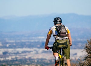
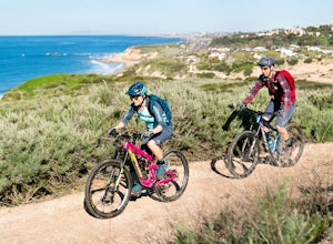
Bommer Ridge from the Pacific Ridge Trailhead
7.54 mi / 394 ft gainThe Bommer Ridge West Trailhead aka The Pacific Ridge Trailhead begins at the edge of Ridge Park Road, overlooking CA State Highway 73, and marks the northwest entrance to the Laguna Coast Wilderness and its neighbor, Crystal Cove State Park. From the well-marked trailhead follow the trail south...Read more -
Del Mar, California
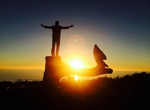
Sunset Seat in Del Mar
3.8In a place in our country where you can take an epic sunset picture nearly everyday, its hard say there is one location tin San Diego that is better than another. I'll let you in my new favorite secret spot to take amazing sunset pictures with a cool piece of art work at the location. Visit the t...Read more -
Palm Springs, California
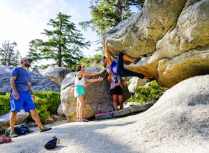
Climb at the Tramway of Mount San Jacinto
John Muir once wrote, "The view from San Jacinto is the most sublime spectacle to be found anywhere on this earth!" So it's no surprise that this is a sought after destination for hikers and climbers alike. Named after the fact that most climbers use the Palm Springs Aerial Tramway to reach this...Read more -
Palm Springs, California
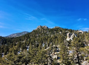
Scramble Cornell Peak
3.5 mi / 1000 ft gainEntering Mt San Jacinto State Park via the Palm Springs Aerial Tram is one of the easiest ways to get into the wilderness area. Purchase your ticket and ride to the station where you'll be able to walk out the backdoor and onto the trail. In order to get to Cornell, your route finding skills wil...Read more -
Laguna Beach, California
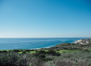
Photograph the Pacific Coast Highway over Crystal Cove Beach
4.4To get to the bluffs overlooking Crystal Cove State Park Beach to the south, you'll need to pull off onto the side of the Pacific Coast Highway *before* Morro Ridge Road.The easiest and most obvious turnoff is on the right side of the highway southbound, just past the "Adopt a Highway" sign and w...Read more -
Laguna Beach, California
B.F.I. Trail in Crystal Cove State Park
5.00.78 mi / 125 ft gainTo get to the trailhead, enter Crystal Cove State Park through the Crystal Cove El Moro Campground entrance immediately next to El Moro Elementary School. Follow the road behind the school which leads to the main gate where you will need to pay a day-use parking fee of $15. Drive past the Campgr...Read more -
Laguna Beach, California
Crystal Cove Loop Trail
4.04.05 mi / 676 ft gainThe trail begins and ends at the El Moro Visitor Center. Parking requires either a $15 day use parking pass, which is available in the visitor center. This hike we are focusing on is called the Difficult Loop Trail and it is the third most difficult trail the canyon offers. You take Moro Canyon,...Read more -
Palm Springs, California
Palm Canyon Trail
4.51.94 mi / 308 ft gainThe fifteen mile long Palm Canyon, one of the Indian Canyons, is among the most beautiful natural sites in Western North America. Its indigenous flora and fauna, expertly used by the Cahuilla people, and its abundant Washingtonia Filifera (California Fan Palm) stand in breathtaking contrast to th...Read more -
Palm Springs, California
Seven Falls via Murray Canyon Trail
4.01 mi / 587 ft gainA very scenic 4-mile round trip with a rewarding waterfall after a 2.5-mile hike/stroll. Lucky visitors may catch a glimpse of the Peninsula Big Horn Sheep (an endangered species), mule deer or other wild animals still roaming the high ground above the canyon. Less visited, Murray Canyon has its ...Read more -
Palm Springs, California
Andreas Canyon
5.01.03 mi / 154 ft gainAndreas Canyon in Indian Canyons is located very close to Palm Springs in the Agua Caliente band of Cahuilla Indians Reservation. It is one of the few places with abundant shade and running fresh water in an otherwise dry desert landscape. Enjoy a longer hike to a waterfall (Seven Falls) or stay ...Read more -
Laguna Beach, California
El Moro Canyon Trail to Lower Moro Campground
3.56.37 mi / 997 ft gainLocated off of Pacific Coast Highway in Laguna Beach is Crystal Cove State Park. There are three primitive sites located in Crystal Cove: Deer Canyon, Upper Moro, and Lower Moro. The site I stayed at was Lower Moro campground. All three of these sites require the backpacker to hike everything in...Read more -
Laguna Beach, California
El Moro Canyon Trail
5.04.94 mi / 814 ft gainThe trail features a waterfall and is open year-round, but is best used in the spring. Remember to bring $15 cash for the parking fee. The Laguna Beach trail is shared by trail runners, mountain bikers, hikers, and the occasional horseback rider. Dogs are not allowed in Crystal Cove State Park.Read more -
San Diego County, California
Hike Sheep Canyon
5.03 mi / 1000 ft gainSheep Canyon is probably the most remote palm canyon in Anza-Borrego Desert State Park in California. While Palm Canyon is easily accessed from the State Park campground, Sheep Canyon is on a dirt road that requires stream crossings and potentially a high-clearance 4WD vehicle. The canyon is nam...Read more -
San Diego, California
Guy Fleming Trail
5.00.76 mi / 95 ft gainThis trail is located in Torrey Pines State Natural Reserve, a beautiful area about 20-30 minutes north of San Diego. To access the reserve, park in the lot off of North Torrey Pines Road (pay $10 to park). If you don't want to walk up the huge hill at the beginning (it is steep and long), I beli...Read more -
San Diego, California
Torrey Pines Beach Trail Loop
4.72.15 mi / 374 ft gainThe beach trail brings you from the parking lot across the lodge from the bluff down to the beach. You can choose to visit the Red Butte, the Razor Point, and the Yucca Point trails along the way. Of the other trails, this trail seems to provide a complete walkthrough of geological features; it a...Read more -
San Diego, California
Razor Point, Beach Trail, & Broken Hill Trail Loop
5.03.21 mi / 440 ft gainThe parking area for all of Torrey Pines State Natural Reserve is located right off North Torrey Pines Road (where the location is for this hike), about 20-30 minutes north of San Diego. It's $10 to park, and there was also a smaller parking lot at the top of the hill if you want to avoid the ini...Read more

