Sebastopol, California
Sebastopol, California offers some of the best trails and outdoor activities. The Laguna de Santa Rosa Trail is a must-visit. This is a 1.8-mile trail that is perfect for all skill levels. It features a river and is primarily used for hiking, walking, bird watching, and horseback riding. It's a scenic trail with lots of wildlife to spot. Ragle Ranch Regional Park is another top spot for outdoor adventures. It boasts 157 acres of recreational activities, including hiking, bird watching, and picnicking. The park's peaceful West County Prairie trail offers views of rolling grasslands and oak woodlands. The park also has a children's playground and a peace garden. Sebastopol is the perfect place for those seeking scenic outdoor adventures.
Top Spots in and near Sebastopol
-
Guerneville, California
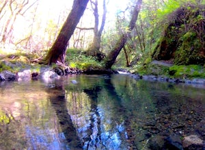
Austin Creek State Recreation Area Loop
5.08.65 mi / 1722 ft gainThe hike starts at the Gilliam Creek Trailhead, halfway up Armstrong Woods Road on the way to Bullfrog Pond. There is an $8 fee to enter the park, to be paid at the ranger kiosk as you enter Armstrong Woods. HIKING Begin hiking by descending the Gilliam Creek Trail. The descent is long and ste...Read more -
Santa Rosa, California
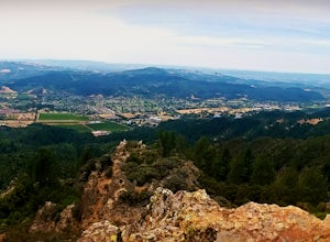
Gunsight Rock via Hood Mountain Trail
5.07.91 mi / 2372 ft gainHike to Gunsight Rock through Hood Mountain Regional Park to get a view overlooking Sonoma and Napa Valley. In order to get to the trailhead take Highway 12 to Los Alamos Rd, the road will then turn into Timberline Dr, this will take you to the trailhead. There is a parking fee of $8. From the p...Read more -
Marshall, California
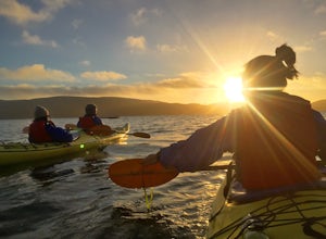
Kayak Tomales Bay
5.0Kayak Beautiful Tomales bay and experience the bioluminescence ecology of the bay. Timed during the lowest crescent of the moon, and starting around sunset, you will paddle into the sunset and wait until it is completely dark, continuing on around the bay to experience the bio-luminescence natur...Read more -
Sonoma County, California
Red Hill and Pomo Canyon Loop
4.84.73 mi / 981 ft gainPark in the Shell Beach parking lot, north of Bodega Bay proper but just south of Goat Rock State Beach on Highway 1. Cross the road to pick up the Dr. David C. Joseph Memorial Trail heading up away from the ocean. Follow the trail, staying right toward Red Hill. (The trail forks off down Pomo Ca...Read more -
Glen Ellen, California
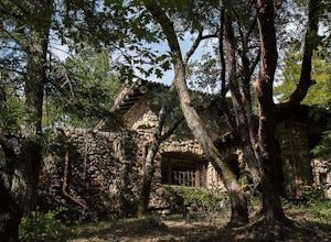
Wolf House in Jack London SP
There is a museum in "The House of Happy Walls" which Mrs. London built in redwood grove find park information, exhibits and a small sales area there. A nearby trail leads to Jack London’s grave and to the remains of "Wolf House," London’s dream house which was destroyed by fire in 1913. The par...Read more -
Glen Ellen, California
Sonoma Ridge Trail
9.2 mi / 1955 ft gainSonoma Ridge Trail is a beautiful 9.2-mile out-and-back hike located near Glen Ellen, California. This hike is moderately difficult, with about 1955 feet in elevation change. 95% of the trail is covered in forest shade. Important Notes:Bikes and Horses are permitted on the trails. Dogs are NOT p...Read more -
Petaluma, California
Hike Helen Putnam Regional Park
4.06 mi / 550 ft gainA 216-acre park, Helen Putnam offers 9 trails that are relatively short but can be combined however you wish. Go 2 miles or 10 miles. Loop in and out, up or around. I take a different route every time I hike here.For a good 6-mile hike, begin at the southwest corner, where the parking lot and res...Read more -
Jenner, California
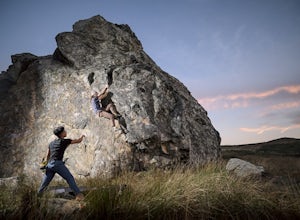
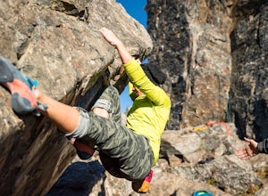
Bouldering at Sunset Boulders
5.00.6 miYou can see the boulders off the left side of the road. Couple of different pullouts you can park at to start your approach. It’s about half a mile from the road all downhill. It’s easy going when you’re on your way, but kind of a pain after you’re whooped from climbing. Bouldering, high balls, ...Read more -
Jenner, California
Bouldering at Lamb's Rock, Sunset Boulders
5.0Lamb Boulder, located within the "Sunset Boulders" collection, contains four fun and challenging V2 - V6 bouldering routes. They are: Calambity: V6Rock Scar: V3+Skullcracker: V2 RThe Specialist: V4 Lamb Boulder is located directly across from the Sunset Boulder itself and its trad routes. To get ...Read more -
Kenwood, California
Pony Gate-Canyon Loop
4.02.17 mi / 568 ft gainThe Pony Gate-Canyon Loop within Sugarloaf Ridge State Park is a new favorite of mine on my list of family and kid-friendly hikes. Our little girls did great with this hike and loved it. If you can get moving early in the day and begin your hike around breakfast time, you might find there are few...Read more -
Inverness, California
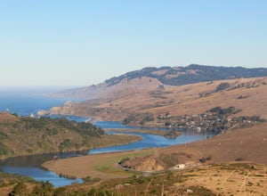
Tomales Point Trail
4.79.47 mi / 1165 ft gainThis hike will take you through the Tule Elk Preserve in Point Reyes Nation Seashore, and offers fantastic views of Bodega and Tomales Bay, as well as the Pacific Ocean. Start at the Tomales Point Trailhead near the Historic Pierce Point Ranch. Follow the trail for roughly three miles. This trai...Read more -
Inverness, California
McClures Beach
1.44 mi / 243 ft gainThis beach is really easy to get to. Just follow Pierce Point Road until you see the sign to the beach. It's an easy hike down from the parking lot. There is very little shade, so make sure to bring some sunscreen. Be extremely cautious with getting into the water. There is likely underwater cu...Read more -
Saint Helena, California
Hike Bald Mountain, Sugarloaf Ridge SP
5.06 mi / 1540 ft gainPark at the top of Adobe Canyon Road in the gravel parking lot to the left of the ranger kiosk. There is a $7.00 parking fee.There are many options for routes to the top; the easiest of which is mostly paved (although still steep in parts). To take this route, head north out of the trailhead park...Read more -
Glen Ellen, California
Corridor Ridge Loop Trail
4.02.48 mi / 289 ft gainCorridor Ridge Loop Trail is a loop trail where you may see wildflowers located near Glen Ellen, California.Read more -
Inverness, California
Marshall Beach Trail
5.02.41 mi / 305 ft gainMarshall Beach Trail is an out-and-back trail that provides a good opportunity to see wildlife located near Inverness, California.Read more -
Calistoga, California
Hike the Oat Hill Mine Trail
5.08.3 miThe incline on this trail begins pretty much right away and is fairly gradual for the entire hike, some of it is quite rocky, making this an easy to moderate level hike. However, with some shade (probably wouldn't attempt it on a hot summer day) and the sweeping views of the valley that get bette...Read more

