Seal Beach, California
Looking for the best hiking in Seal Beach? We've got you covered with the top trails, trips, hiking, backpacking, camping and more around Seal Beach. The detailed guides, photos, and reviews are all submitted by the Outbound community.
Top Hiking Spots in and near Seal Beach
-
Laguna Beach, California
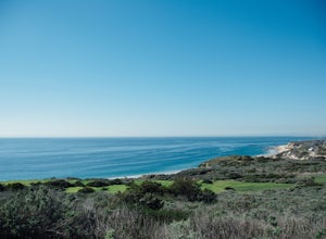
Crystal Cove Loop Trail
4.04.05 mi / 676 ft gainThe trail begins and ends at the El Moro Visitor Center. Parking requires either a $15 day use parking pass, which is available in the visitor center. This hike we are focusing on is called the Difficult Loop Trail and it is the third most difficult trail the canyon offers. You take Moro Canyon,...Read more -
Anaheim, California
Oak Canyon Bluebird and Wren Trail
1.42 mi / 187 ft gainThe Oak Canyon Bluebird and Wren Trail features beautiful wildflowers and is accessible year-round. The trail is well kept and offers lots of shady spots. The first portion of this hike will take you up a hill, and then to a fork. One direction will take you around a reservoir and another will ta...Read more -
Laguna Beach, California
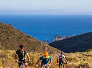
Emerald Canyon & Bommer Ridge Loop
5 mi / 873 ft gainThere a numerous trails in the Laguna Coast Wilderness that proceed up and along the ridges and down into the canyons (or the reverse), and are quite popular for mountain biking, hiking, and trail running. A great mountain biking loop begins in Emerald Canyon at the end of Emerald Canyon Road an...Read more -
Laguna Beach, California
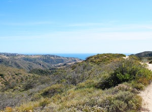
Trail Run the Boat Road and Laguna Ridge
4.34 mi / 600 ft gainThere a numerous trails in the Laguna Coast Wilderness that proceed up and along the ridges and down into the canyons (or the reverse), and most are excellent for trail running, hiking, and mountain biking. A classic out-and-back (with many options for loops) begins at the end of Dartmoor Street ...Read more -
Laguna Beach, California
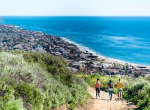
Hike Willow Canyon, Laguna Coast Wilderness Park
5.06.7 mi / 1208 ft gainThis hike has been a must do since I was young. Do you love scenic views of the ocean and wildlife? You'll see plenty of both, from hawks searching for food to squirrels and deer running through the brush. This is my favorite route in this area but there are plenty of other trails to shorten or a...Read more -
Laguna Beach, California
Water Tank Trail
4.33.05 mi / 502 ft gainThere a numerous trails in the Laguna Coast Wilderness that proceed up and along the ridges and down into the canyons (or the reverse), and most are excellent for hiking, trail running, and mountain biking. A classic out-and-back (with many options for loops) begins in Irvine Bowl Park at the en...Read more -
Aliso Viejo, California
Top of the World via West Ridge Trail
5.04.76 mi / 443 ft gainDirections to get here are pretty straight forward via the map. You park your car in a residential neighborhood along the street, and from there, you can't miss the entrance. The trail is paved for the first 100yds or so and after you make a right turn at the top, you'll be on dirt and sand the r...Read more -
Los Angeles, California
Sunset Hike in Ascot Hills
3.5Ascot Hills Park is a great hidden gem located a few miles east of Los Angeles. There is a parking lot with plenty of parking but the gates close at sunset, which is a great time to go, so if you plan on staying later, park outside the gates where there is ample street parking. Depending on the s...Read more -
Laguna Beach, California
Hike the West Ridge Trail
5.01.5 mi / 150 ft gainBeginning at Alta Laguna Park at Top of the World, the West Ridge Trail is a popular starting (and ending) point for adventures into the Laguna Coast Wilderness, leading to trails and areas like Car Wreck, Big Bend, and Willow Canyon. You can also do it in reverse from the north. The ridge itself...Read more -
Laguna Beach, California
West Ridge to Car Wreck Trail and Mathis Canyon Loop
4.53.31 mi / 856 ft gainThere are numerous ways to incorporate the Car Wreck trail into a larger loop through the Laguna Coast Wilderness and Aliso Canyon Park, but a common route is to begin at Alta Laguna Park at "Top of the World" in Laguna Beach. Take the West Ridge Trail .5 miles, bearing right onto the marked Car...Read more -
Los Angeles, California
Vista Hermosa Natural Park
4.20.58 mi / 36 ft gainVista Hermosa Natural Park is part of the Santa Monica Mountains Conservancy and the Mountains Recreation and Conservation Authority. Located in the western gateway to Downtown Los Angeles, it’s very easy to drive by this hidden gem if you’re not looking for it. This park is the perfect mix of ur...Read more -
Los Angeles, California
Kenneth Hahn Recreation Area Loop
2.85 mi / 328 ft gainThe Kenneth Hahn Recreation Area is just outside of downtown LA, a perfect location for hiking, trail running, and biking. The trail loops up to the top of a hill, where hikers get sweeping views of LA. Dogs are allowed, but must be kept on leash. This is also a great location for trail running...Read more -
Silverado, California
Hike to Black Star Canyon Falls
4.87.5 mi / 913 ft gainWaterfalls in Orange County are far and few between, with the best lying near and inside the Cleveland National Forest. Black Star Canyon Falls are some of the best just after a rain if you are heading out during a dry time of the season you should still expect to see some water. Free parking, ea...Read more -
Los Angeles, California
Secret Swing in Elysian Park
4.20.16 mi / 360 ft gainFor the most direct directions to the swing, plug in "Swing on top of Elysian Park" into google maps, which will take you directly to the trailhead. If you want to do it the more old fashion way, the swing is on top of a hill at the intersection of Angels Point Drive and Park Row Drive in Elysian...Read more -
Los Angeles, California
Elysian Park
4.01.88 mi / 282 ft gainThe trail at Elysian Park in Los Angeles, California, is a moderate difficulty hike that spans approximately 1.88 miles. The trail is well-marked and offers a variety of terrain, including dirt paths and paved roads. The trail is known for its panoramic views of the city, including the iconic Dod...Read more -
Los Angeles, California
City View and Walnut Forest Trails Loop
4.02.59 mi / 568 ft gainThe City View and Walnut Forest Trails in Ernest E. Debs Regional Park are just outside of downtown Los Angeles, and are perfect for all abilities. The trails are most commonly used by dog walkers, trail runners, mountain bikers and families. The top of the hike features a unique pond. Dogs are a...Read more

