Santa Cruz, California
Looking for the best photography in Santa Cruz? We've got you covered with the top trails, trips, hiking, backpacking, camping and more around Santa Cruz. The detailed guides, photos, and reviews are all submitted by the Outbound community.
Top Photography Spots in and near Santa Cruz
-
Carmel-by-the-Sea, California
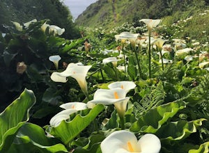
Calla Lily Valley
4.50.31 mi / 46 ft gainParking for Calla Lily Valley is available along the dirt pullout at Gate 19 for Garrapata State Park, near mile-marker 63. Signs are small and difficult to see. Follow the path between the guide wires and take the right fork, heading north to the bluff overlooking the beach. Continue north and f...Read more -
Carmel-by-the-Sea, California
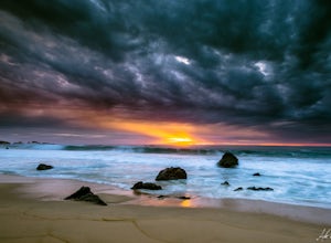
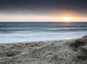
Garrapata Beach
4.6A wonderful roadside beach and state park. Easy parking on both sides of Hwy. 1 with short access trails. There are almost 2 miles of coastline trails heading north and south from the parking area. The north end of the beach is great for swimming and surfing when the sea is calm and the south ...Read more -
Sunol, California
Little Yosemite via Canyon View Trail
4.03.01 mi / 705 ft gainPlease note this is a fragile ecosystem and watershed. There is NO swimming allowed in Alameda Creek and trespassing is prohibited on Water Department lands that are not accessible to the public. You can learn more about the restrictions and the area at ebparks.org. After entering the kiosk you...Read more -
Half Moon Bay, California
Hike Along the Half Moon Bay Coastal Trail
4.65 mi / 104 ft gainStart at the visitor center along Kelly Avenue. Take note that the day parking fee is $10 in 2016 for each vehicle. You will then be able to enjoy both the Coastside Trail and Francis Beach (plus other beaches) with access to the amenities such as coin-operated showers and a semi-private beach.Th...Read more -
Monterey, California
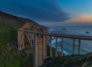
Bixby Bridge
4.7You can't miss this bridge if you are driving north on highway one. The best time for capturing sunsets behind the bridge is December. The positioning of the sun will better coincide with the location of the bridge.There are four main angles to capture the bridge: The first two are up close on ...Read more -
Carmel-by-the-Sea, California
Pat Springs via Skinners Ridge
3.513.18 mi / 3645 ft gainBackpacking to Pat Springs is a way to see Big Sur and the San Lucia mountains from a perspective that few get to experience. The Ventana Wilderness is rugged and remote, yet Pat Springs is one of the most beautiful campgrounds around that will allow you to take in this amazing terrain. To get ...Read more -
Half Moon Bay, California
Catch the Sunset at Maverick's Beach
5.01 miMaverick's beach is most well-known for the Maverick surf competition and the gnarly waves which surface here in the winter months. For the rest of the year, the beach is still a site to see. With huge waves crashing ¼ mile off shore and bluffs towering 100 feet above you, it’s a picturesque plac...Read more -
Moss Beach, California
Pillar Point Bluff Loop
4.71.84 mi / 154 ft gainSitting on a 140 acre bluff top, the Pillar Point Bluffs are a simple, easy hike with breathtaking views throughout. The bluffs are 22 miles from San Francisco – a 30 minute drive depending on the traffic. There is a small 10 car or so parking lot off of Airport Blvd, but there are two additional...Read more -
Moss Beach, California
Cypress Tree Tunnels at Moss Beach
4.50.79 mi / 105 ft gainThe Cypress Tree Tunnels are a quick jaunt from San Francisco (22 miles) and make for a great half-day trip. Getting here depends on traffic, but 30 minutes from the center of the city is doable. Parking is relatively easy. You can either park at the south end of the area at the Cypress Cove entr...Read more -
Burlingame, California
Hike the Ed Taylor Loop Trail in Mills Canyon
4.01.4 mi / 300 ft gainThis hike can be done at any time of year. Hiking in winter and spring means that many varieties of wildflowers will be present, and the creek will have much more water. Summer and fall mean higher temperatures and drier conditions, but the hike is still a pleasant experience. Begin the hike at t...Read more -
Moss Beach, California
Fitzgerald Marine Reserve
5.00.89 mi / 46 ft gainLocated beside a residential neighborhood, Fitzgerald Marine Reserve offers a rare glimpse of life in the northern California intertidal zones. There are parking spaces and restrooms available, as well as ranger-led guided tours. Be sure to check the tide charts and go during low tide (preferab...Read more -
Livermore, California
Hike the East Shore Trail Loop
3.7 mi / 1040 ft gainThis hike is best done during the spring, fall, or winter when moderate temperatures make the hike more comfortable. Be warned that this hike has a large elevation change despite being less than 4 miles. Starting at the Arroyo Road Staging Area, take the East Shore Trail east, heading towards a s...Read more -
Big Sur, California
Camp at Andrew Molera State Park
4.51 miAndrew Molera is about 27 miles south of Carmel and one of the first State Parks you'll hit heading down the coast. There will be signs for the Park as you approach and the main parking lot is only a couple hundred yards from Hwy 1. There are a number of hiking trails and activities to do around ...Read more -
Big Sur, California
Hike the Creamery Meadow Trail to Molera Beach
2 miEntrance to the parking lot is $10 per car, and once you get in be sure to use the restroom before you head for the trail, since you will likely spend a good amount of time out there.Look for the sign that says Creamery Meadow Trail. You'll know it's right when the very first thing you'll need to...Read more -
Big Sur, California
Hike the Andrew Molera State Park Loop
4.58.8 mi / 1100 ft gainThe loops starts at the Andrew Molera State Park parking lot (4.5 miles north of the entrance to Pfeiffer Big Sur State Park along Highway 1). Begin by crossing the Big Sur River using the seasonal bridge. If the bridge has been removed, you will need to cross the water by foot. Usually the water...Read more -
Big Sur, California
Hike the East Molera Trail
3.2 mi / 1390 ft gainHoused in Andrew Molera State Park, the East Molera Trail is easily accessible from Highway 1 with parking and restrooms available to hikers. A $10.00 entry fee is required but also provides entrance to Pfieffer Big Sur State Park just a few miles down the road.The trail head is located east of t...Read more

