Santa Ana, California
Looking for the best photography in Santa Ana? We've got you covered with the top trails, trips, hiking, backpacking, camping and more around Santa Ana. The detailed guides, photos, and reviews are all submitted by the Outbound community.
Top Photography Spots in and near Santa Ana
-
Dana Point, California
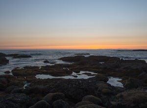
Explore Tide Pools at Dana Point
5.0If you're ever driving on the 5 between San Diego and Los Angeles and traffic is miserable (always), consider making a stop at Dana Point to check out the tide pools. The best place is behind the Ocean Institute which offers plenty of free parking and a short walk behind the building will quickly...Read more -
San Juan Capistrano, California
Hike the Pinhead Peak Trail at Ronald W. Caspers Wilderness Park
4.02 mi / 220 ft gainRonald W. Caspers Wilderness Park is the perfect place to getaway from the hubbub of LA. Enjoy the scenic drive north on Ortega Highway before reaching the entrance gate to the park. Parking Fees are currently $3 on Weekdays and $5 on Weekends. Camping Fees vary depending on your group size. The...Read more -
Los Angeles, California
Cabrillo Beach
Cabrillo Beach located in San Pedro, California is a great spot to bring the whole family. There are tide pools at the beach as well as the Cabrillo Marin Aquarium where the kiddos can get tours and more information about the sea life they're seeing. There is a parking lot at the Cabrillo Beach...Read more -
Lake Elsinore, California
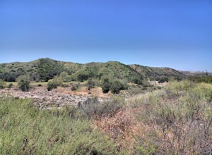
Hike Bear Canyon Trail to Sitton Peak
6.4 mi / 2200 ft gainA MUST hike for any orange country resident! The hike starts of off Ortega HWY 74 at the Bear Canyon Trail head on the same side of the road as the Ortega oaks candy store. Its recommended you park in the lot across the street from the trail head (tip:there is a working water spicket in the parki...Read more -
La Verne, California
Marshall Canyon Trail
4.05.99 mi / 722 ft gainFor this adventure you can choose to start in a multiple of places; for the easiest parking use Oak Mesa Park located next to Oak Mesa Elementary School. From the parking lot cross the soccer field towards the bridge on the north east end of the school. Once across the bridge follow Los Robles ea...Read more -
Lake Elsinore, California
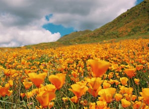
Explore Walker Canyon
4.3Walker canyon is within easy driving distance from most places in Orange County and San Diego which makes for a great day trip. While there is no official parking lot for the trail you will be able to find parking all along Lake Street and Walker Canyon Road. The trail begins at the corner of L...Read more -
Rancho Palos Verdes, California
Burma Road Trail & Ishibashi Trail Loop
4.35.09 mi / 1148 ft gainGetting There: The easiest way to get to Portuguese Bend Nature Reserve is by following Crenshaw Boulevard up Rancho Palos Verdes to the very end of the street. You can park on either side of the street near Del Cerro Park, which also happens to be a great place for picnics if you want to eat bef...Read more -
Los Angeles, California
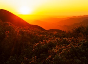
Sunset Hike in Ascot Hills
3.5Ascot Hills Park is a great hidden gem located a few miles east of Los Angeles. There is a parking lot with plenty of parking but the gates close at sunset, which is a great time to go, so if you plan on staying later, park outside the gates where there is ample street parking. Depending on the s...Read more -
Rancho Palos Verdes, California
Abalone Cove Shoreline Park
4.3Abalone Cove Shoreline Park is a Palos Verdes gem. This 64-acre reserve is a state ecological preserve. There is something for everyone here, whether you want to relax and lay out or be adventurous and swim across channels to get to sea caves. The large parking area is very easy to find and costs...Read more -
Los Angeles, California
Ord & Yale Street Park
4.0Recently opened in 2021, right behind the LA Library in Chinatown, you’ll find this secret gem, tucked away in the corner. Covered picnic tables, with checkerboard game boards in place, and all gender bathrooms with changing tables for the little ones. Two play areas as well as a small climbing w...Read more -
Monrovia, California
Monrovia Falls
3.71.46 mi / 459 ft gainMonrovia Falls is closed indefinitely due to the Bobcat Fire and mudslides. Read more on the CityofMonrovia.org website. The Monrovia Falls are at the end of the main trail located in Monrovia Canyon Park. The park is easy to locate and has ample parking. Keep in mind you do have to pay a fee of...Read more -
Rancho Palos Verdes, California
Terranea Beach Sea Cave
4.31.63 mi / 210 ft gainHead to the Pelican Cove parking lot where there’s plenty of free parking right at the trailhead. From the parking lot, take the Terranea Beach Trail and you will see views of the Point Vicente Lighthouse down the coast to your right. Continue on the trail through the luxury Terranea Resort whic...Read more -
Rancho Palos Verdes, California
Pelican Cove
0.38 mi / 95 ft gainGetting There Coming from San Pedro, make a U-turn at the Hawthorne Boulevard stoplight onto Palos Verdes Drive South. From here, you can access the parking lot for Pelican Cove, where you'll get a 120° view of the ocean. It might be tempting to take in the sunset from the car, but you should def...Read more -
Palos Verdes Estates, California
Bluff Cove
4.40.56 mi / 144 ft gainParking for Bluff Cove is located along the sides of the street of Paseo Del Mar, and the trailhead is located right next to the street. Bluff Cove is one of those unique locations in that there are a variety of activities you can do here. It is a great location for surfing, paddle boarding, bod...Read more -
Los Angeles, California
Vista Hermosa Natural Park
4.20.58 mi / 36 ft gainVista Hermosa Natural Park is part of the Santa Monica Mountains Conservancy and the Mountains Recreation and Conservation Authority. Located in the western gateway to Downtown Los Angeles, it’s very easy to drive by this hidden gem if you’re not looking for it. This park is the perfect mix of ur...Read more -
Los Angeles, California
Secret Swing in Elysian Park
4.20.16 mi / 360 ft gainFor the most direct directions to the swing, plug in "Swing on top of Elysian Park" into google maps, which will take you directly to the trailhead. If you want to do it the more old fashion way, the swing is on top of a hill at the intersection of Angels Point Drive and Park Row Drive in Elysian...Read more

