San Martin, California
Looking for the best hiking in San Martin? We've got you covered with the top trails, trips, hiking, backpacking, camping and more around San Martin. The detailed guides, photos, and reviews are all submitted by the Outbound community.
Top Hiking Spots in and near San Martin
-
Boulder Creek, California
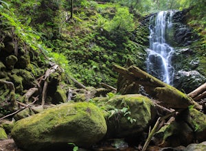
Hike the Berry Creek Falls Loop
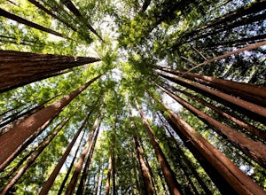
4.811 mi / 2000 ft gainNestled in California's oldest state park, the popular Berry Creek Falls Loop hike begins at the Big Basin park headquarters. If you're up for 11 miles, a thousand feet of elevation gain through towering redwoods and along serene creeks, and spread out over a half-day, then this is the hike for y...Read more -
Boulder Creek, California
Camp at Big Basin Redwoods State Park
4.00.5 miBig Basin is currently closed including the campgrounds. Please visit the Parks.ca.gov site for updated details. An hour away from the thrumming city of San Jose, ancient immense trees live in a forest full of vibrant ferns and rushing waterfalls. Big Basin Redwoods State Park encompasses 10,00...Read more -
Boulder Creek, California
Hike the Ocean View Summit Loop
4.06 mi / 600 ft gainThis hike begins at the Big Basin park headquarters. If you're up for 6 miles through giant redwoods and along serene creeks, and with an ocean view, then this is the hike for you. Ocean view summit loop starts on the Gazos Creek Road bridge, next turn right on to the Middle Ridge Fire Road, whic...Read more -
Boulder Creek, California
Hike the Old Growth Redwoods Trail
4.50.5 miQuick half-mile stroll through the old growth Redwoods that will show you the nature of the ever-living redwood tree.Redwoods are capable of withstanding storms, floods, fire, droughts, and even termites. These legendary trees can live for over 2,000 years and possess incredible strength, vigor, ...Read more -
Santa Clara County, California
Black Mountain via Rhus Ridge Trail
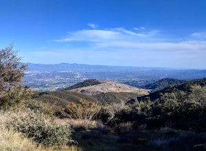
9.75 mi / 2992 ft gainJust outside of Los Altos is a very long ridge of mountains, one of which is Black Mountain. This is a very dry hike, with no tree canopy, so it can get very hot! Be aware that this can make the hike feel a lot more difficult with the sun beating down on you. Follow Rhus Ridge Trail to Black Mo...Read more -
La Honda, California
Hike through Portola Redwoods State Park
4.87 miLike redwood hikes? We do too, they're always very scenic and take you away from the hustle and bustle of the bay area. Not to mention, they also stay cool during the summer months. If you want a hike in the middle of the peninsula, this is a great bet.When starting this hike, head out from headq...Read more -
Los Altos, California
Hike to Black Mountain and Stevens Creek Canyon
4.06 mi / 950 ft gainThis hike can be done during any season, but for the creek to be running and for more comfortable temperatures, it is best to go on a cool winter or spring day. Starting at the preserve parking lot, take the Stevens Creek nature trail, allowing you to witness spectacular views of a large, foreste...Read more -
Los Altos, California
Hike the Monte Bello Open Space Preserve Loop
4.52.9 mi / 600 ft gainThis hike is best done in the late fall, winter, and spring so that the creek is running and the hills are green. Starting at the preserve parking lot, the first half of the hike is predominantly downhill. At the main trailhead, start in the direction of the Stevens Creek Nature Trail, as told by...Read more -
21600 Big Basin Way, California
Hike the Sequoia Trail at Big Basin Redwoods SP
4.04.3 mi / 600 ft gainThis 4.3 mile hike in Big Basin Redwoods SP is a peaceful break from the hustle and bustle of everyday life. In the first half, there is a quick detour you can take to Sempervirens Falls. Just listen for sounds of water, read the signs, and cross the road. The detour itself is as far as cross...Read more -
Redwood City, California
Hike Russian Ridge
4.54 miRussian Ridge offers a great place to jump on the trail and in the right season, see some of the best wildflowers blooming. On top of that, you get access to amazing views from the ridge. Once you hit your parking space, add a little extra warm up before jumping on the trail to make this 3.7-mil...Read more -
Davenport, California
Hike around Greyhound Beach and Climb Greyhound Rock
0.7 mi / 0 ft gainThe trailhead is at the Greyhound Rock State Marine Conservation Area which is directly off Highway 1. There is a large paved parking lot with a good amount of trees so finding a shady parking spot isn't that difficult (if that's important to you). The parking lot is located on the beach cliffs ...Read more -
Pacific Grove, California
Visit the Monarch Grove Butterfly Sanctuary
1 miThousands of monarchs can be found here October through February. It's a small park with a path through the center. Park near the Monarch Grove hotel at the sign that says "Caution: Butterflies present", and cross the street to walk down the short path (pink houses will be on your right) and to t...Read more -
Los Altos, California
Park Day at Foothills Park
1.7Disclaimer: Foothills Park requires proof of residence in Palo Alto or being accompanied by a resident of the city. Learn more here.Foothills Park is 2.7 miles west of 280 after exiting Page Mill. After exiting you take a short scenic drive up the hill and come to the park entrance on your right...Read more -
Pacific Grove, California
Spanish Bay Trail
5.02.8 mi / 78 ft gainSpanish Bay Trail is an out and back trail that takes you past scenic views located near Monterey, California.Read more -
Palo Alto, California
Hike the Arastradero Preserve Loop
3.04.5 mi / 600 ft gainGetting There: From Hwy 280, take the Page Mill Road exit and head West on Page Mill Road, away from Downtown Palo Alto (if you're taking 101, exit on Oregon Expressway). Then turn right on Arastradero Road. There will be a small sign indicating the dirt parking lot on the eastern side of the str...Read more -
Livermore, California
Hike the East Shore Trail Loop
3.7 mi / 1040 ft gainThis hike is best done during the spring, fall, or winter when moderate temperatures make the hike more comfortable. Be warned that this hike has a large elevation change despite being less than 4 miles. Starting at the Arroyo Road Staging Area, take the East Shore Trail east, heading towards a s...Read more

