San Marcos, California
Looking for the best hiking in San Marcos? We've got you covered with the top trails, trips, hiking, backpacking, camping and more around San Marcos. The detailed guides, photos, and reviews are all submitted by the Outbound community.
Top Hiking Spots in and near San Marcos
-
Lake Elsinore, California
Sitton Peak
9.36 mi / 2011 ft gainIt's amazing what you can find in your own backyard if you really do you research. In Orange County there are so many awesome hiking options that are often overlooked. The Bear Canyon to Sitton Peak Trail in the San Mateo Wilderness is one of those. Sitton tops out at 3,273 feet and it's a 5 mil...Read more -
San Juan Capistrano, California
Hike the Pinhead Peak Trail at Ronald W. Caspers Wilderness Park
4.02 mi / 220 ft gainRonald W. Caspers Wilderness Park is the perfect place to getaway from the hubbub of LA. Enjoy the scenic drive north on Ortega Highway before reaching the entrance gate to the park. Parking Fees are currently $3 on Weekdays and $5 on Weekends. Camping Fees vary depending on your group size. The...Read more -
Trabuco Canyon, California
Bell Canyon Trail
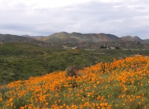
3.86 mi / 102 ft gainBell Canyon Trail is an out-and-back trail where you may see wildflowers located near San Juan Capistrano, California.Read more -
Julian, California
Hike Stonewall Peak
4.73.82 mi / 820 ft gainThis hike is one of the most popular in the Cuyamaca Rancho State Park. When you reach Stonewall Peak's summit, enjoy the view of the surrounding park and nearby Lake Cuyamaca. The hike up the east side is a popular and relatively easy trail. Although you'll be gaining 800 feet, the hike is relat...Read more -
Julian, California
Hike Cuyamaca Peak
4.55.5 mi / 1700 ft gainThis peak is one of the tallest in the county. Reaching the summit of the peak takes you to an elevation of 6500'. Although this peak isn't as challenging as others nearby, it's located in the center of San Diego, which offers up amazing views, which is the main reason to take this hike. The best...Read more -
Jamul, California
Hike the Hollenbeck Canyon Trail
4.6 mi / 626 ft gainThe trail is wide and well maintained. The first mile of the trail is well shaded by oak trees. You'll see stunning rocky peaks and rolling green hills as the trail continues. There are three creek crossings to be aware of. Cleveland National Forest is dog friendly, but bring a leash! Hunting is ...Read more -
Dana Point, California
Walk the Dana Point Preserve Trail
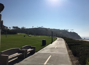
5.00.5 miOcean views the whole time, plenty of wildlife and different species of native plants make this short hike beautiful. With the hike being short enough to complete in the afternoon after a day at the beach you can see a beautiful view of the coastline north and south. There is plenty of parking in...Read more -
Jamul, California
Hiking Otay Mountain
5.015.3 mi / 2903 ft gainThe trek begins on the Otay Mountain Truck Trail at Pio Pico Resort & Campground. You can either park and hike the entire trail, or drive up to a point a couple miles and park before the road becomes steep and rough. The distance on here is if you hiked the whole way. If you have a 4-wheel dr...Read more -
Laguna Niguel, California
Colinas Ridge Trail
2.01 mi / 131 ft gainFirst, you'll be parking in the parking lot for the dog park. It's free parking and there are roughly 40 spaces, so there is plenty of parking. I've never seen more than 20 cars here at any one time. Once parked you'll find the trail head/ start on the northwest side of the lot (opposite the dog ...Read more -
Dana Point, California
Hike the Salt Creek Trail
5.03 mi / 20 ft gainStarting from the Salt Creek Beach parking lot (a paid lot that takes cash, debit, and credit cards and charges by the hour. There are pay stations at a few points in the parking lots), you head west towards the ocean...through a tunnel and down the hill towards the beach. Once you get to the bas...Read more -
Canyon Lake, California
Kabian Memorial Park Loop
5.03.48 mi / 335 ft gainKabian Memorial Park Loop is a loop trail that takes you by a lake located near Quail Valley, California.Read more -
San Diego, California
Hike to the beach at Border Field State Park
2 mi / 26 ft gainThe beach at Border Field State Park is southernmost beach in California. This beach begins (on US Maps) at the Mexican border and continues north to the mouth of the Tijuana River. The State Park shares its land with the Tijuana River National Estuarine Research Reserve which are both operated b...Read more -
Laguna Beach, California
Aliso Peak via the Valido Trail
5.01.14 mi / 325 ft gainThe Valido Trail trailhead can be found just off West street off the Pacific Coast Highway, just south of Aliso Beach. Park on West Street past the trailhead. The trail proceeds approximate .5 miles till it intersects with the Aliso Peak Trail. Go left .4 miles to the obvious summit and wooden p...Read more -
Corona, California
Hike to Santiago Peak via Holy Jim
5.015 mi / 4500 ft gainWhen you think of Orange County, you think of beaches, boardwalks, but what you may not know is that there are some great hikes in our very own backyard! My favorite is a fairly strenuous day hiking adventure that only the strong survive. Not to dissuade any interested parties, since this is a ...Read more -
Corona, California
Hike to Holy Jim Falls
3.02.9 mi / 570 ft gainTo start, directions on how to get to the trail there are two different ways, the most common , which I will explain, being through Rancho Santa Margarita you will head east on Santa Margarita Parkway, turn left at the dead end (into a parking lot for a shopping center) on Plano Trabuco Road, thi...Read more -
Trabuco Canyon, California
Hike the Bellview to Dove Lake Trail
2.5 mi / 75 ft gainThis hike will be about going from the Bellview Trailhead to Dove Lake and back. Note that once you get to Dove Lake there are numerous offshoots that can take you in different directions (you can follow the road into the Dove Canyon housing community, take a paved road back to the Bellview parki...Read more

