San Geronimo, California
Looking for the best running in San Geronimo? We've got you covered with the top trails, trips, hiking, backpacking, camping and more around San Geronimo. The detailed guides, photos, and reviews are all submitted by the Outbound community.
Top Running Spots in and near San Geronimo
-
Orinda, California
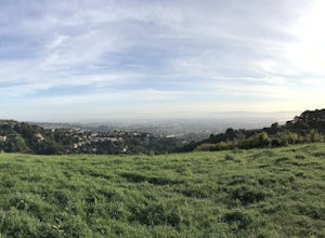
Wildcat Peak Loop
4.05.89 mi / 1050 ft gainFrom Inspiration Point, head toward Nimitz gate. Once you pass through the gate, keep an eye out for Curran Trailhead; this is the trail you'll be starting on. After about 1/8 of a mile, you'll reach a junction with the Meadows Canyon Trail. Turn right onto this trail to continue the loop. This p...Read more -
San Francisco, California
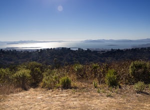
Bayview Hill Loop
4.01.24 mi / 184 ft gainBayview Hill Loop is a loop trail that starts with a paved uphill climb and views of the bay facing toward the East Bay located in the Bayview neighborhood of San Francisco, California.Read more -
Berkeley, California
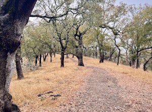
Stonewall Panoramic Trail
4.51.44 mi / 663 ft gainFrom the trailhead at Stonewall Road, the 1.5-mile trail makes for an excellent before or after-work run. But the steep hills and loose ground aren’t for those looking to find an easy nature walk. The incline starts well before the Stonewall-Panoramic trailhead, so you won’t even have time to w...Read more -
Glen Ellen, California
Corridor Ridge Loop Trail
4.02.48 mi / 289 ft gainCorridor Ridge Loop Trail is a loop trail where you may see wildflowers located near Glen Ellen, California.Read more -
Napa, California
Westwood Hills Park Loop
4.02.12 mi / 476 ft gainThis park can get a little crowded on weekends, so best to go early if possible. In terms of parking, there's a lot at the trailhead, but also plenty of available street parking. The loop can be broken up in a various ways as there are several offshoots from the main trailhead/trail leaving fro...Read more -
Santa Rosa, California
Taylor Mountain Loop
4.24.89 mi / 1096 ft gainFrom the northern entrance to the park, you can access an 18-hole disc golf course as well as a number of trails. The Eastern Trail takes you up a steep 1,000 feet to the top of Taylor Mountain, where you can see most of Sonoma County laid out before you. Mt. St. Helena is visible in the distance...Read more -
Napa, California
Alston Park Loop Trail
2.76 mi / 184 ft gainAlston Park Loop Trail, located in Napa, California, is a 2.76-mile loop trail that offers a moderate level of difficulty for hikers. The trail is primarily used for hiking, walking, and running and is accessible year-round. The trail is well-maintained and clearly marked, making it suitable for ...Read more -
Pacifica, California
Milagra Overlook Trail
5.02.51 mi / 558 ft gainFound this hike with some friends after spending some time googling in my car when we were in the area looking for a quick hike with a view! Dog friendly Free parking (but quite limited) Ocean views Known to have gorgeous wildflower blooms (we were not there during this)Porta-potty type toilet...Read more -
-
Sebastopol, California
Ragle Ranch Extended Loop
5.01.86 mi / 82 ft gainRagle Ranch Extended Loop is a loop trail where you may see local wildlife located near Sebastopol, CaliforniaRead more -
Oakland, California
East & West Ridge Loop
4.53.47 mi / 833 ft gainTucked away in the hills of Oakland, you will find one of the homes of California's Coastal Redwoods. Created by a unique geographical circumstance, this forest breathes winds funneled through the Golden Gate across the bay, which created environment opportune for Redwood growth. These Redwoods a...Read more -
Napa, California
Lake Marie Road, Marie Creek, Buckeye Trail Loop
3.55.8 mi / 961 ft gainEnter the parking lot just off of Hwy 221. Plan to pay a $5 entrance fee at the kiosk. The trail head begins at the edge of the parking lot where you'll soon be passing by the Martha Walker Native Habitat Garden on your right. Veer left to continue along Lake Marie Road where you'll enter the blu...Read more -
Martinez, California
Muir Farm And Mount Wanda: John Muir Nature Trail
2.59 mi / 512 ft gainMuir Farm And Mount Wanda: John Muir Nature Trail is a loop trail located near Martinez, California.Read more -
Pacifica, California
Mori Point Loop
4.82.54 mi / 276 ft gainStart at the parking lots close to the pier, where bathrooms are also available. Walk along the pier to watch the sunset as it begins. Next, walk along Sharp Park Beach to discover the plethora of wild flowers and friendly locals always ready to guide you on your walk. Take the stairs up to the...Read more -
Bodega Bay, California
Doran Beach
5.04.02 mi / 75 ft gainDoran Beach is nestled within the picturesque landscape of Doran Regional Park near Bodega Bay, California. Offering pristine shores and captivating vistas, this is a coastal gem that allows visitors a more protected coastal landscape than nearby Salmon Creek State Beach. Explore sandy beaches ...Read more -
San Bruno, California
Sweeney Ridge via Sneath Lane
4.53.88 mi / 646 ft gainStarting from the parking lot on Sneath Lane Trail, you’ll head through the gate and continue on the path up Sweeney Ridge. This is a 5.7 mile out-and-back trek. There is a 600 ft. elevation gain, which comes mainly in the first 1.5 miles of the trail. Your legs and lungs may hurt a bit, but if t...Read more

