San Benito County, California
The best Trails and Outdoor Activities in San Benito County, California offer a myriad of opportunities for outdoor adventures. Among the top must-visit sites is the Pinnacles National Park, known for its unique rock formations and scenic hiking trails. The High Peaks Trail is a challenging 6-mile round trip hike, featuring rocky terrain and panoramic views of the park's volcanic peaks. For a more leisurely hike, the Bench Trail offers a 2.4-mile round trip journey along the peaceful Chalone Creek. If water activities are more your style, the San Benito River offers opportunities for fishing and bird watching. The Hollister Hills State Vehicular Recreation Area is also a popular spot for off-road biking. Whatever your preference, San Benito County offers a variety of outdoor activities to suit every adventurer.
Top Spots in and near San Benito County
-
Moss Landing, California
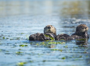
Kayak in Elkhorn Slough
4.7Elkhorn Slough is located in Moss Landing, which is in the dead center of Monterey Bay, California. Elkhorn Slough is one of California's largest wetlands and part of a National Estuarine Reserve located in central Monterey Bay, California, just a short trip from the Monterey Peninsula and the Sa...Read more -
Moss Landing, California
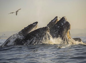
Kayak with Humpback Whales in Monterey Bay
5.0Disclaimer: Please keep a respectful distance from the whales and other sea wildlife for their protection and your own. Note, changing the animal's natural behavior is a violation of federal law.Every year, humpbacks whale migrate north from their winter and breeding grounds down in southern Mex...Read more -
Big Sur, California
Hike the Ewoldsen Trail
4.54.2 mi / 1500 ft gainThe Ewoldsen Trail is one of the more accessible yet challenging hikes in Big Sur. It is a beautiful ~4-mile loop through the redwood forest that starts in the Julia Pfeiffer state park parking lot, which is across the street from McCay falls. During the first part of the hike, you'll pass picnic...Read more -
Big Sur, California
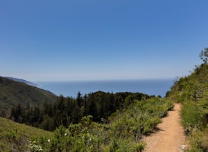
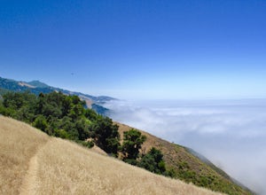
Hike the Waters Ridge Trail
5.07 mi / 2100 ft gainAccess the Waters Ridge Trail from the Ewoldsen Trail, located in Julia Pfeiffer Burns State Park. Although steep, this path is fairly short, and rewards you with spectacular views at the top. About halfway around the Ewoldsen Trail Loop, you'll come across a turnoff on the right, with a sign dem...Read more -
Big Sur, California
McWay Falls
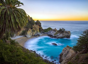
4.6McWay Falls is one of the most iconic waterfalls in BIg Sur and can be seen from Highway 1. The trail to the falls is located in Julia Pfeiffer. For all of you history buffs, Mcway Falls is named after Christopher McWay, an early settler and farmer from New York who ventured west in the late 1800...Read more -
Sand City, California
Bikepack Highway 1: Monterey to San Luis Obispo
130 mi / 9000 ft gainPlease be aware that this is NOT a route for beginning cyclist. It is a very hilly route and you will be sharing the road with cars for the entire route, the shoulder is sometimes very slim. This should not scare you from doing the trip, just be aware of the risks and dangers you might be facing....Read more -
Big Sur, California
Hike to Big Sur's Tin House
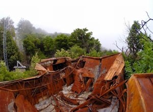
4.0When it comes to the beauty of Big Sur, a half day on Tanbark Trail to the Tin House captures it all. From the redwood forest along Partinton Creek, to the abandoned Tin House, to Highway 1 and coastal views, you can't ask for much more.The hike starts on the east side of Highway 1 - the northern...Read more -
Big Sur, California
Partington Cove Trail
5.01.09 mi / 262 ft gainPartington Cove Trail is an out-and-back trail that takes you by a waterfall located near Big Sur, California.Read more -
Big Sur, California
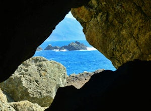
Explore The Hidden Rock Caves At Partington Cove
5.0Partington Cove which is located in Julia Pfeiffer Burns State Park, is one of Big Sur's hidden gems. It's a very short hike with enough views to show why Big Sur earned the nickname " Little Yosemite." The whole hike can easily be completed in less than an hour, although there are definitely eno...Read more -
Carmel-by-the-Sea, California
Pat Springs via Skinners Ridge
3.513.18 mi / 3645 ft gainBackpacking to Pat Springs is a way to see Big Sur and the San Lucia mountains from a perspective that few get to experience. The Ventana Wilderness is rugged and remote, yet Pat Springs is one of the most beautiful campgrounds around that will allow you to take in this amazing terrain. To get ...Read more -
Big Sur, California
3 Branches of the Limekiln
4.01.98 mi / 696 ft gainThe Limekiln Trails offer up a moderate hike with defined trails, creek crossings, and limited elevation. From the parking area, head east under the canopy of redwoods until you get to the bridge, where there’s a kiosk marking the trail. The three branches are ~0.5 miles each, making it easy to ...Read more -
Big Sur, California
Camping at Limekiln State Park
4.3This campsite is split into two sections and is located directly below a bridge along Route 1 the Pacific Coast Highway. Be cautious turning into the park as the incline and turn are quite serious.Below the bridge are campsites located both along the tree line and tiered up along the hill. Under ...Read more -
Big Sur, California
Goat Camp via Twitchwell Flat Use Trail
5.09.2 mi / 3852 ft gainTo find this trailhead, head down Highway 1 towards Limekiln State Park Campground. Between Lucia and Limekiln, there should be a shoulder off the side of the road to park overnight. Cross the street to the trailhead of Twitchwell Flat Use Trail. Bear in mind that there is abundant poison oak alo...Read more -
Big Sur, California
Camp on Prewitt Ridge
4.2After much time in Big Sur, it became quickly apparent that Prewitt Ridge is the crown jewel of camping in the area. It has even been described as "the most beautiful car camping spot on god's green earth" and that doesn't do it justice.While Prewitt Ridge is an officially designated campground i...Read more -
Big Sur, California
Explore the Big Sur River Gorge
4.71 miIf you are in the Big Sur area during the summer, exploring the Big Sur River Gorge is a must! The gorge is located in Pfeiffer Big Sur State Park, and your closest parking will be day use parking lot 3. The trailhead to the gorge can be found at the northeast end of Pfeiffer Big Sur State Park C...Read more -
Big Sur, California
Clifftop Camping & Hot Springs in Big Sur
4.7Campsite:There is nothing quite like driving or biking along US-1, the Pacific Coast Highway. Make sure you get a chance to do the drive during the day so that you can see all that Big Sur has to offer. Be careful when pulling off especially onto the shoulder and never stop on a curve in the road...Read more

