Saint Helena, California
Looking for the best hiking in Saint Helena? We've got you covered with the top trails, trips, hiking, backpacking, camping and more around Saint Helena. The detailed guides, photos, and reviews are all submitted by the Outbound community.
Top Hiking Spots in and near Saint Helena
-
Novato, California
North Levee Trail
3.78 mi / 157 ft gainNorth Levee Trail is a loop trail where you may see wildflowers located near Novato, California.Read more -
Guerneville, California
East Ridge - Pool Ridge Loop
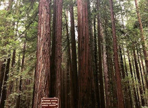
4.53.37 mi / 810 ft gainThis park most resembles Muir Woods, and if you're looking to get out of the tourist trap, head to Armstrong Redwoods and make a day of it. This 3-mile hike takes off from the sign pointing to East Ridge Trail. As you begin a slight climb up the trail, you'll be under the cover of the redwoods, s...Read more -
Guerneville, California
Parson Jones and Colonial Armstrong Redwood Trees
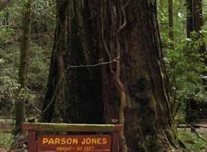
5.0The Parson Jones Tree is the tallest tree in the reserve, measuring more than 310 feet (94 m) in height. This is longer than the length of a football field! Named after a lumberman who chose to preserve this portion of the park in the 1870s, the Colonel Armstrong Tree is the oldest tree in the ...Read more -
Occidental, California
LandPaths Grove of Old Trees
5.00.7 mi / 92 ft gainThe Grove of Old trees is a privately-owned preserve in Western Sonoma County that is open to the public year round. It is not large, only about 33 acres, but it makes a wonderful spot to go on a walk and to soak in the beauty of the redwoods. To get there from downtown Occidental, drive West up...Read more -
Guerneville, California
Austin Creek State Recreation Area Loop
5.08.65 mi / 1722 ft gainThe hike starts at the Gilliam Creek Trailhead, halfway up Armstrong Woods Road on the way to Bullfrog Pond. There is an $8 fee to enter the park, to be paid at the ranger kiosk as you enter Armstrong Woods. HIKING Begin hiking by descending the Gilliam Creek Trail. The descent is long and ste...Read more -
Occidental, California
Watershed View Trail
4.01.54 mi / 174 ft gainThe Watershed View Trail is located off of Coleman Valley Road and shares a trailhead with the Hunters Camp and Creekside Loop. This trail is a 1.5-mile out-and-back, which makes for a great trail to get the family out on to get some energy out. Be prepared for a muddy trail if there has been rec...Read more -
Occidental, California
Hunters Camp and Creekside Loop
5.36 mi / 853 ft gainHunters Camp and Creekside Loop is an almost 6-mile loop off of Coleman Valley Road in Occidental, California. This trail can get pretty muddy during the rainy season, but as an added bonus, it makes the waterfall along the Creekside Trail that much better. Dogs are not permitted on this trail.Read more -
Novato, California
Schwindt, Indian Valley, and Waterfall Trail Loop
3.51 mi / 594 ft gainSchwindt, Indian Valley, and Waterfall Trail Loop is a loop trail that takes you by a waterfall located near Novato, California.Read more -
Novato, California
Buck Gulch Falls Trail
5.01.26 mi / 203 ft gainBuck Gulch Falls (also known as Fairway Falls) is an easy, scenic hike that takes you through a beautiful forest on your way to a 15-foot waterfall. This little neighborhood treasure is tucked away in Novato, CA at the end of Fairway Drive and there is ample parking near the trailhead. If you v...Read more -
Vallejo, California
Camp at Mare Island Shoreline Heritage Preserve
1 mi / 20 ft gainThis old Naval Base is now home to, well, almost nothing. As a weekend volunteer trip, myself and about 50 others got a little dirty creating 3 new campsites for you and your friends!During the day, the island has hikers exploring everywhere, but the preserve closes upon sunset and it's just you ...Read more -
Monte Rio, California
Islands in the Sky Vista Loop
4.03.83 mi / 883 ft gainThe Islands in the Sky Vista Loop in Monte Rio, California, is a moderately challenging hiking trail. Spanning approximately 3.83 miles, the loop offers a variety of terrain, including forested areas, open meadows, and rocky outcrops. The trail is well-marked and maintained, making it suitable fo...Read more -
Nicasio, California
Hike and Fish at Nicasio Reservoir
5.03 mi / 300 ft gainNicasio is a quaint town just inland of the more popular coastal town of Point Reyes. It's most known for it's wine country, rolling hills, and the home of Skywalker Ranch, George Lucas's getaway home. Most visitors of this area either pass right on through for Point Reyes or use it's scenic road...Read more -
Bodega Bay, California
Camp at Bodega Dunes Campground
These kind of getaways shouldn't be planned many weeks before the trip. So we didn't booked a campground. And from this experience we learn that you don't have to reserve a campground. Just go there - don't panic when you see campground is full sign in the entrance. There are always available spo...Read more -
Inverness, California
Tomales Point Trail
4.79.47 mi / 1165 ft gainThis hike will take you through the Tule Elk Preserve in Point Reyes Nation Seashore, and offers fantastic views of Bodega and Tomales Bay, as well as the Pacific Ocean. Start at the Tomales Point Trailhead near the Historic Pierce Point Ranch. Follow the trail for roughly three miles. This trai...Read more -
Inverness, California
McClures Beach
1.44 mi / 243 ft gainThis beach is really easy to get to. Just follow Pierce Point Road until you see the sign to the beach. It's an easy hike down from the parking lot. There is very little shade, so make sure to bring some sunscreen. Be extremely cautious with getting into the water. There is likely underwater cu...Read more -
San Rafael, California
China Camp Loop
4.09.23 mi / 1716 ft gainPark at the lot in the China Camp State Park. Hop onto the Bay View trail to gain to begin the loop trail. Switchbacks take you up to a long and easy path passing through shaded and open areas. Enjoy the grasslands speckled with oak trees and coyote brush. You can see the San Rafael bay and bridg...Read more


