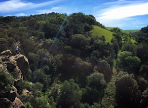
Ross, California
The best Trails and Outdoor Activities in Ross, California, are a must-visit for those seeking outdoor adventures. The top-rated attraction is the Cataract Falls trail, a moderate difficulty hiking trail that meanders through lush forests and leads to a stunning waterfall. Along the trail, you'll find a variety of unique rock formations and the cascading Alpine Lake. The trail is well-marked and offers scenic views of the surrounding landscape. Another must-visit is the Phoenix Lake, a man-made reservoir perfect for kayaking and fishing. If you're into bird-watching, the Marinwood Park is home to a variety of bird species. For a more relaxed activity, visit the Ross Common Park for a peaceful picnic. Ross, California, offers the best outdoor activities for everyone.
Top Spots in and near Ross
-
Saint Helena, California
Hike the Lake Hennessey Loop
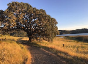
5.06.4 mi / 900 ft gainThe "lollipop" hike starts at the "Ranch House" parking lot off of Chiles Pope Valley Road - alternatively, you can access from Conn Valley Road for a shortened 5.6-mile loop. You turn off Chiles Pope Valley Road onto Moore Creek Trail, drive past a private house (you can see it on the map) and t...Read more -
Occidental, California
Watershed View Trail
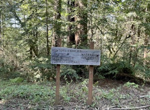
4.01.54 mi / 174 ft gainThe Watershed View Trail is located off of Coleman Valley Road and shares a trailhead with the Hunters Camp and Creekside Loop. This trail is a 1.5-mile out-and-back, which makes for a great trail to get the family out on to get some energy out. Be prepared for a muddy trail if there has been rec...Read more -
Occidental, California
Hunters Camp and Creekside Loop
5.36 mi / 853 ft gainHunters Camp and Creekside Loop is an almost 6-mile loop off of Coleman Valley Road in Occidental, California. This trail can get pretty muddy during the rainy season, but as an added bonus, it makes the waterfall along the Creekside Trail that much better. Dogs are not permitted on this trail.Read more -
Vacaville, California
Bike the Lake Berryessa Loop
55.82 mi / 1007 ft gainBegin your ride in Vacaville, California out of Alamo Creek Park (street parking is available and free). Head north on Alamo Drive and veer left onto Foothill Drive, then left (South) onto Pleasants Valley Road. After two miles, veer left onto Cherry Glen Road. Stay to the right when you reach th...Read more -
Larkfield-Wikiup, California
Creekside Trail to Canyon Trail to Ridge Trail Loop
4.04.46 mi / 850 ft gainCreekside Trail to Canyon Trail to Ridge Trail Loop is a loop trail that takes you through a nice forest located near Santa Rosa, California.Read more -
Redwood City, California
Hike the Methuselah and El Corte De Madera Creek Loop
6.2 mi / 1800 ft gainThis loop hike will provide people with the opportunity to experience the tranquility of the lower canyons of the preserve, which tend to be more isolated than the heavier-trafficked trails that are closer to the main highway. Be warned that this hike is fairly strenuous because of the large amou...Read more -
Pleasanton, California
Courdet Trail and Schuhart Trail
5.24 mi / 1122 ft gainThis is a 5+ mile out and back trail through the hills in the South Bay. The beginning of the hike has a steeper incline and then becomes more gradual later on. There is a beautiful views of the South Bay that are enjoyable in the day, but are fantastic in the evening. Some areas of the trail hav...Read more -
Calistoga, California
Camp at Bothe-Napa Valley SP
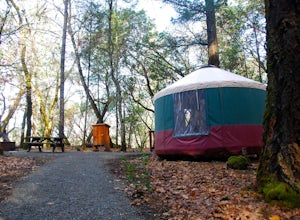
4.5Looking for a romantic getaway but you’d prefer to spend your nights around a campfire? This adventure is for you. This beautiful Napa Valley campground has it all – 10 miles of hiking trails, 1,900 acres to explore, and…new yurts! Yurts are basically cool circular tents that allow you enjoy the ...Read more -
Redwood City, California
Hike or Bike the Old Growth Redwood Loop at El Corte de Madera
4.48.8 mi / 1900 ft gainThis hike starts at the middle parking lot of the El Corte de Madera Open Space Preserve. The middle lot is located roughly a mile south on Skyline Boulevard from the Skeggs Point Vista. From the parking lot, take the Methuselah Trail for 0.3 miles until you reach the Timberview Trail. Take this ...Read more -
Forestville, California
Canoe the Russian River via Forestville
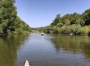
5.0Starting at Burke's Canoe in Forestville, CA this is a 10-mile self-guided canoe trip down the Russian River. You can rent your canoe from Burke's and launch from their beach. Burke's will also pick you up 10 miles down-river and shuttle you back to their parking lot.This canoe trip features lo...Read more -
Half Moon Bay, California
Watch the Sunset at Martin's Beach
4.5Martin's Beach is a beach about 7 miles south of Half Moon Bay. It features a large, very cool looking rock formation right off the coast. This beach is accessible via Martin's Beach Road, which is a small turn off on your right when southbound on Highway 1, though sometimes the road is only open...Read more -
Woodside, California
Hike through Wunderlich County Park
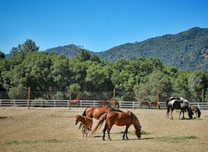
5.04.5 mi / 1400 ft gainLocated in the iconic Silicon Valley town of Woodside, Wunderlich County Park offers a number of hiking trails as well as some horseback riding trails through the wilderness. Once in the parking lot, you will see a number of stables, riding ring, as well as a beautiful historic stable that was o...Read more -
Forestville, California
Steelhead Beach
Steelhead Beach offers two great spots to access the river. There's a small beach on the right-hand side of the beach (south end) and a launch site on the left (north end) of the beach. The launch point makes for a great spot to start your float down the river. Make sure you have a shuttle car or...Read more -
Bodega Bay, California
Camp at Wright's Beach Campground
/ 32 ft gainThis campground is defined by the scenery: rugged headlands, craggy coastlines, natural arches, and quiet coves.Wright's Beach Campground features primitive camping - basic tent sites with picnic tables, fire rings, and amazing ocean views. This is a great location for Bay Area campers who want t...Read more -
Sonoma County, California
Kortum Trail
9.27 mi / 968 ft gainThe Kortum Trail in the Sonoma Coast State Park connects Goat Rock with Wrights Beach, winding along the top of the sea cliffs and affording incredible views of the California Coast and its numerous sea rocks and arches. To get there take the Pacific Coast Highway / Highway 1 to either Wright's...Read more -
Livermore, California
Condor, Volvan, Stone Corral, Coyote Loop
4.54.38 mi / 620 ft gainThis regional preserve is perfect for day hikes. There are also designated campsites and even a backpack campsite. Horses and dogs are welcome in the preserve. There are many different clearly marked trails that one can choose from. A good 4.5 mile loop is to start at the Park Residence entrance...Read more

