Porterville, California
Looking for the best camping in Porterville? We've got you covered with the top trails, trips, hiking, backpacking, camping and more around Porterville. The detailed guides, photos, and reviews are all submitted by the Outbound community.
Top Camping Spots in and near Porterville
-
Porterville, California
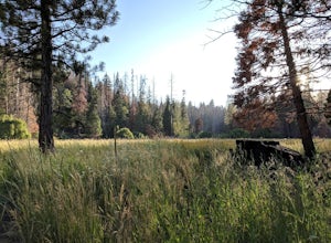
Camp at Redwood Meadow
Situated right across the street from the stunning Trail of 100 Giants, Redwood Meadows features 13 spacious campsites adjacent to a picturesque meadow. There are picnic tables, fire rings, and six yurt sites available for those who wish to bring some of the great indoors outside. Pit toilets ar...Read more -
Camp Nelson, California
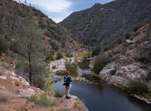
Fly Fish the Kern River above the Johnsondale Bridge
5.04 mi / 100 ft gainCheck in at the local fly fishing shop in Kernville to check the latest status, then continue up the 20 mile stretch of Mountain Hwy 99 until you cross the Johnsondale Bridge. Park, pack, then begin your 30-45 minute hike up the trail before setting your rod.After you're finished, stop by the Ker...Read more -
Kernville, California
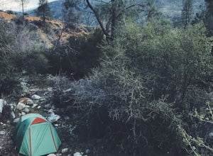
Dispersed Camp along Salmon Creek in Sequoia NF
There are several dispersed campsites found throughout the Sequoia National Forest. The majority can be found by driving on any of the OHV accessible roads. This particular campsite can be found at coordinates 35.89759, -118.4628. In order to get to the campsite, use Google Maps to get you to the...Read more -
Sequoia National Park, California
Camp at Buckeye Flat in Sequoia National Park
Entering Sequoia National Park at the Ash Mountain Entrance near the small city of Three Rivers, follow Highway 198 (Generals Highway) through the park until you see a sign for Buckeye Flat Campground off to the right. The campground sign is immediately after you see signs for Hospital Rock. Foll...Read more -
Kernville, California
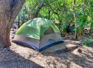
Camp at Lower Springhill
The Lower Springhill Campground is a primitive campsite situated along the Kern River in the southern area of Sequoia National Forest. Since this is a primitive campground, there is no potable water, bathrooms or garbage service. You must pack out what you bring in.The campground is easily access...Read more -
Three Rivers, California
Backpack to Franklin Lakes & Franklin Pass
11.4 mi / 2500 ft gainFranklin Lakes is part of the Sequoia National Park and can be reached from the trailhead starting near the Mineral King Ranger Station. Bear containers are required and can be rented at the Ranger Station. The hike to Franklin Lakes campground will take 6 hours or less (depending on your speed/h...Read more -
Three Rivers, California
Backpack in Mineral King
5.030 miThe trailhead is right near the Mineral King Ranger Station (on Mineral King Rd) in Sequoia National Park. Depending on where you're coming from I would recommend driving in and camping at Cold Springs Campground (which is also in close proximity to the ranger station) the night before you begin ...Read more -
Three Rivers, California
Backpack to Crystal Lakes
5.09.8 mi / 2200 ft gainThe trail to Crystal Lakes begins at the Timber Gap/Sawtooth Trailhead (7,800 feet elevation), which is located at the end of Mineral King Valley Rd. The trail immediately ascends through a meadow boasting dramatic alpine views and a roaring waterfall. Eventually you'll cross Monarch Creek and b...Read more -
Three Rivers, California
Backpack the Little Five & Big Five Lakes Loop
5.026.5 mi / 10000 ft gainDay 1: A long, rewarding day. Over the course of 11.5 miles you will complete around 10,000ft of elevation change. To start, park the car at the Sawtooth-Monarch Trailhead (7500ft) and begin on the trail, immediately ascending to Timber Gap (9500ft). Once at the gap, the trail makes it's way do...Read more -
Sequoia National Park, California
Backpack the High Sierra Trail
5.071 miThe High Sierra Trail begins at Crescent Meadow in Sequoia National Park, on the West side of the Sierra Nevada range, and ends at Whitney Portal on the East, traversing the highest and most beautiful part of the Sierras. From deep river canyons to high alpine peaks, lakes, and meadows, this hike...Read more -
Sequoia National Park, California
Hike Crescent Meadow
4.51.6 miCrescent Meadow is a collection of loops in the Giant Forest in Sequoia National Park. The trailhead is located just past the tunnel log east of General's Highway 198. The main loop is 1.6mi total. However you can take any of the loops to the General Sherman tree 3mi, Tharp's Log trail 0.5mi, or ...Read more -
Sequoia National Park, California
Hike to Emerald Lake, Sequoia National Park
4.510.4 mi / 2200 ft gainBegin this hike at the Alta Peak Trailhead in the Sequoia National Park. The trail initially takes you east-southeast through a loosely forested area that is stark and arid. Around 1.5 miles in you'll cross a small creek, but this creek may dry up in the late spring/summer. Shortly after the cree...Read more -
Sequoia National Park, California
Hike to Pear Lake via the Lakes Trail
5.012.4 mi / 2300 ft gainThe Lakes Trail to Pear Lake can be done as either an overnight stay or a day hike. For overnight, you'll need to get a permit but there are beautiful camping spots available at both Emerald Lake and Pear Lake. As a day hike, plan to spend all day since you'll undoubtedly pause at each lake for...Read more -
Sequoia National Park, California
Backpack to Big Bird Lake & Moose Lake
30 mi / 8000 ft gainThis trip requires a wilderness permit. You can get one at the Lodgepole Visitor Center where you can also rent a bear canister or use the bathroom before heading out.Wolverton Trailhead -> Big Bird Lake (~12 miles)The start of the trail is on the left side of the parking lot and towards the m...Read more -
Three Rivers, California
Hike Little Baldy
5.03.5 mi / 700 ft gainA short hike with impressive views of Sequoia National Park, the Little Baldy trail is the less touristy version of Moro Rock. When we hiked it on a beautiful Sunday morning in the summer, we had the entire summit to ourselves. Even if other hikers had been up there, it would have still felt em...Read more -
Sequoia National Park, California
Mount Silliman, Sequoia NP
5.011.24 mi / 4449 ft gainThere is available parking at the campgrounds at the Lodgepole Visitor Center. Lodgepole's elevation starts at 6720 ft. Twin Lakes Trailhead starts right at the base, which you will be following to get to Mount Silliman. Along Twin Lakes Trail are several campgrounds for your journey, you can go...Read more

