Pioneertown, California
Pioneertown, California is a top destination for outdoor adventures with some of the best trails and outdoor activities. A must-visit is the Pipes Canyon Preserve, home to a 4-mile round-trip hiking trail that boasts scenic views of the San Bernardino Mountains. Along the trail, you'll witness unique rock formations and the lush Pipes Wash, a seasonal river. The Chaparrosa Peak Trail is another gem, known for its panoramic views of the desert and mountain ranges. For those seeking a challenge, the Sawtooth Loop Trail offers a 9-mile hike with a 2000-foot elevation gain. Near Pioneertown, Joshua Tree National Park offers world-class rock climbing and stargazing opportunities. Remember to respect the natural environment and leave no trace!
Top Spots in and near Pioneertown
-
Palm Springs, California
North Lykken Trail from W. Crescent Drive
1.67 mi / 906 ft gainNorth Lykken Trail from W. Crescent Drive is an out-and-back trail that takes you past scenic surroundings located near Palm Springs, California.Read more -
Forest Falls, California
Summit Mt. San Gorgonio
4.717 mi / 5840 ft gainA hiking permit is required to hike in the San Gorgonio Wilderness. Apply for the permit early as the Vivian Creek Trail is the second most popular trailhead for the area and quotas fill up in advance. The permits are free and the entire process can be handled via fax or mail. All the information...Read more -
Cabazon, California
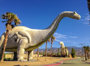
Check Out the Cabazon Dinosaurs
4.3For any fans of Pee-Wee’s Big Adventure or The Wizard, the Cabazon Dinosaurs are instantly recognizable. A roadside attraction off of Hwy 10 - 90 miles east of Los Angeles - the dinosaurs, heralded as the “World’s Biggest Dinosaurs", are a quick adventure.To get to the dinosaurs, you’ll travel on...Read more -
Riverside County, California
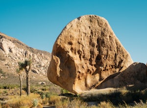
Climb at the Hall of Horrors in Joshua Tree
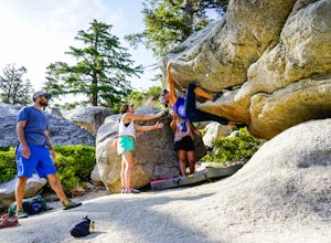
The Hall of Horrors is across the road from the well-known Saddle Rocks. There is good space in this crag, so don't be discouraged with a full parking lot. Like most places in Joshua Tree, the weather is the largest dictator on when and where you'll climb. There isn't much shade here, so waiting ...Read more -
Riverside County, California
Hall of Horrors
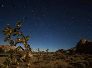
0.75 mi / 95 ft gainA trip to Joshua Tree is an adventure in itself, but if you plan so that you are shooting Joshua Tree under a full moon, you'll lose yourself in its beauty all over again. See the park's gorgeous, unique characteristics in a completely different light. Although there may seem to be infinite loca...Read more -
Riverside County, California
Camp at Ryan Campground in Joshua Tree NP
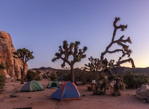
5.0The Ryan Campground is but one of many beautiful campgrounds in Joshua Tree National Park. It is located just south of the Hidden Valley use area. There are 31 sites as well as a horse camp. This campground does not have water, but does have pit toilets.For weekend trips into Joshua Tree, it is o...Read more -
Palm Springs, California
Climb at the Tramway of Mount San Jacinto
John Muir once wrote, "The view from San Jacinto is the most sublime spectacle to be found anywhere on this earth!" So it's no surprise that this is a sought after destination for hikers and climbers alike. Named after the fact that most climbers use the Palm Springs Aerial Tramway to reach this...Read more -
Palm Springs, California
Winter Climb San Jacinto from the Tram
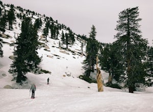
5.08 mi / 2400 ft gainIntermediate: No snow.Advanced: Lots of snow.Expert: Snow w/ high winds and low temps. GPX: https://www.gaiagps.com/datasu... San Jacinto, at 10,834 feet, is the second-highest peak in the Southern California. It's unique in that it has a rotating tram car (think slow motion disco floor) that r...Read more -
Palm Springs, California
Scramble Cornell Peak
3.5 mi / 1000 ft gainEntering Mt San Jacinto State Park via the Palm Springs Aerial Tram is one of the easiest ways to get into the wilderness area. Purchase your ticket and ride to the station where you'll be able to walk out the backdoor and onto the trail. In order to get to Cornell, your route finding skills wil...Read more -
Twentynine Palms, California
Rock Climb at Headstone Rock in Joshua Tree
4.5To find this climb, park on the east side loop of the Ryan Campground in the park. There are several parking spots here next to a bathroom. From here, take the trail straight out about 100 yards to Headstone Rock. It is clearly visible from where you park. One of the hardest parts about this clim...Read more -
Palm Springs, California
Museum Trail
1.52 mi / 860 ft gainThe Museum Trail is a very steep climb with a 1,000 feet elevation gain in just one mile but has some great views of downtown Palm Springs. The hike starts behind the Palm Springs Art Museum. This trail can also access the Cactus to Clouds Trail that goes all the way to the top of Mt. San Jacinto...Read more -
Palm Springs, California
Skyline Trail to Aerial Tramway Top Station
5.09.41 mi / 8238 ft gainSkyline Trail to Aerial Tramway Top Station is a point-to-point trail where you may see beautiful wildflowers located near Palm Springs, California.Read more -
Twentynine Palms, California
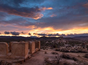
Ryan Ranch
0.75 mi / 56 ft gainIf you're in Joshua Tree, this is a great spot for sunset. A short, maybe 1/2 mile hike to the old ranch from the parking lot. We stayed at Ryan Campground and just walked in from there, about the same distance. Make sure to bring your camera, especially if there are spotty clouds in the sky a...Read more -
Forest Falls, California
Vivian Creek Trail to San Gorgonio Peak
17.83 mi / 5627 ft gainVivian Creek Trail to San Gorgonio Peak is an out-and-back trail that takes you by a waterfall located near Forest Falls, California.Read more -
Big Bear, California
Alpine Pedal Path
5.05.08 mi / 292 ft gainAlpine Pedal Path is an out-and-back trail that takes you by a lake located near Big Bear Lake, California.Read more -
Riverside County, California
Hike Ryan Mountain
4.82.86 mi / 1056 ft gainOne of the most prominent peaks in Joshua Tree National Park in Ryan Mountain. It's centrally located rising to a total of 5,456 feet above the valley floor. The trail to the peak is a moderate hike with a little over 1,000 feet elevation gain with panoramic views of Lost Horse Valley, Queen Vall...Read more

