Pinecrest, California
Looking for the best hiking in Pinecrest? We've got you covered with the top trails, trips, hiking, backpacking, camping and more around Pinecrest. The detailed guides, photos, and reviews are all submitted by the Outbound community.
Top Hiking Spots in and near Pinecrest
-
Mariposa County, California
Hike to Tuolumne Peak Plateau
11.7 mi / 1800 ft gainThe most direct route begins at Murphy Creek trailhead, on the north side of Tioga Road near Tenaya Lake. Walk north on Murphy Creek trail for 2.5 miles with minimal elevation gain. Polly Dome Lakes are a great side trip via the social trail on the right side of the trail before the first junctio...Read more -
Mariposa County, California
Sunrise Lakes to Clouds Rest
4.718.93 mi / 1775 ft gainStart out at the Tenaya Lake Trailhead, where you can head directly onto the trail for Clouds Rest or you can branch off after 2.7 miles to Sunrise Lakes. This allows you to break up the hike, spend a night relaxing and help you have an early start back on the trail. Once re-connected to the Clo...Read more -
Mariposa County, California
Half Dome & Clouds Rest Loop
22.7 mi / 7000 ft gainStart and end this loop from the Sunrise Lakes TH along the Tioga Road, and in between you'll travel over 26 miles through Yosemite's backcountry gaining and losing over 7,000 feet in elevation. Unlike typical mountain summit hikes where it's climb climb climb to the top and then descend, this w...Read more -
Yosemite Valley, California
Tenaya Lake
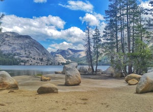
4.63.08 mi / 0 ft gainTenaya Lake is located alongside Tioga Road in the park's Tuolumne Meadows region. There is a family-friendly trail that surrounds the lake. Though some spots along the trail on the western shore may require fording the waters, the 2.5-mile trip is an easy hike for all to enjoy. Many others pre...Read more -
Mariposa County, California
Clouds Rest via Tenaya Lake
5.014.5 mi / 1775 ft gainThe "younger" brother of the world famous Half Dome, Clouds Rest is in fact a solid 1,000 feet taller despite receiving significantly less attention. If you know about this hidden gem however, you're in luck. Starting out from the Tenaya Lake trailhead will save you crowds on the trail and the ...Read more -
Mariposa County, California
Clouds Rest to Half Dome
18.52 mi / 4000 ft gainBecause this is not a loop, you will need to figure out a shuttle situation. There are two options for this: 1. Drive your car to the Tenaya Lake Trail Head, and leave it parked there. Once you reach the Valley you will be car-less, but then the next day you can take one of the free shuttles u...Read more -
Mariposa County, California
Four Mile Trail to Panorama Trail Loop
5.016.03 mi / 5177 ft gainFour Mile Trail to Panorama Trail Loop is a loop trail that takes you by a waterfall located near Yosemite Valley, California.Read more -
Mariposa County, California
Camp at Glacier Point
4.79.17 mi / 3491 ft gainEveryone that knows Yosemite, knows Glacier Point. An overlook that attracts thousands of people per day that drive up via Glacier Point Road is rarely vacant of the hustle and bustle of people. However, there is a loop hole here, and when the stars align you can have Glacier Point ALL to yoursel...Read more -
Mariposa County, California
Glacier Point via Four Mile Trail
5.09.59 mi / 3200 ft gainGlacier Point is one of the highlights of Yosemite. The point is located at the end of Glacier Point Road. This viewpoint allows you to survey the entire Yosemite Valley and gives the viewer a captivating sight of Half Dome. It's a little bit of a tourist trap (especially during the summer season...Read more -
Mariposa County, California
Hike to Union Point via Four Mile Trail
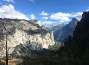
6 mi / 2332 ft gainFour Mile Trail is steep, but hikers efforts are more than rewarded. Union Point sits above Yosemite Valley at 6,332 feet - offering sweeping views of El Capitan and the valley entrance to the left, and North Dome / Half Dome & Clouds Rest to the right. You can also see Yosemite Falls straigh...Read more -
Yosemite Village, California
Witness Yosemite's Firefall
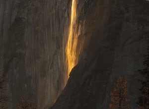
5.00.1 mi / 0 ft gainOver 5 million visitors flock to Yosemite National Park in California's Sierra Nevada Mountain Range every year to take in the geological splendor. While most visitors get to see the park's waterfalls, very few ever get to witness the Firefall. For two weeks between mid-late February, a small wat...Read more -
Bridgeport, California
Backpack to Green Lake and Virginia Pass
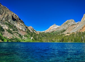
17 mi / 4452 ft gainDay 1 Green Creek Trailhead to Green Lake When we went on this hike, it was primarily to explore the area and see if it would be a feasible entrance to Northern Yosemite for extended backpacking trips. However, it also is a great two night trip to a lovely area of the Hoover Wilderness. Best...Read more -
Yosemite Valley, California
Mirror Lake
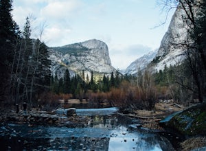
4.62.56 mi / 190 ft gainMirror Lake is a very popular spot in the Yosemite Valley and definitely a must see to check off your explore list. Crowds are much smaller if you go during the winter, but some parts of the water might be iced over. The trailhead you take to get there is well marked and can be found at the far ...Read more -
37.739698,-119.564018
Snow Creek Trail
5.020.43 mi / 2700 ft gainThis is truly a beautiful hike. Although it’s not the easiest, you are rewarded by the views. From the Mirror Lake trailhead (shuttle stop #17), it is 0.9 miles to the Snow Creek trailhead and 1.7 miles to the Snow Creek overlook where you can camp in close proximity. Once you reach the top, you...Read more -
Wawona, California
Pothole Dome
5.01.01 mi / 250 ft gainGetting There From the Tuolumne Meadows Visitor Center, head west on Tioga Road/ Hwy 120 towards Tenaya Lake. You'll only travel about 1 mile down the road until you see Tuolumne Meadows open up again on your right, and there will be a very large gravel pull out where you can park. Pothole Dome ...Read more -
Yosemite Valley, California
Hike to Basket Dome
9.45 miGetting There Starting in Yosemite Valley, head to the Snow Creek trailhead just past Muir Meadows. Start the hike early in the morning, since it gets pretty hot in the summer and the last part of the hike is in the sun. The Trail You'll hike more than 140 switchbacks to reach the top of Ba...Read more

