Pearblossom, California
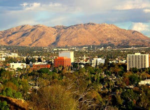
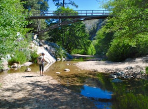
Pearblossom, California is home to some of the best outdoor activities and attractions. From scenic trails to must-visit parks, there is something for everyone. Hike the trails of the San Gabriel Mountains, explore the local parks, and discover the best outdoor adventures. Enjoy the stunning views and take in the breathtaking views of the San Bernardino Mountains. Visit the local attractions and explore the outdoor activities available in and near Pearblossom. Whether you're looking for a peaceful walk in the park or an adrenaline-filled adventure, Pearblossom has something for everyone.
Top Spots in and near Pearblossom
-
Los Angeles, California
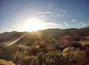
Stoney Point Park Loop
4.00.73 mi / 141 ft gainOnce you've parked along Topanga Canyon Blvd, make your way down the street and start the trail off near the steel gate, close to the horse stables. As you make your way in, you will notice some rock climbers practicing on the lower elevation rocks. Make your way around this rocky park, counter-...Read more -
Culver City, California
Culver City Stairs
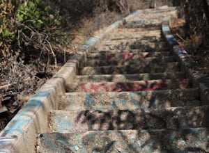
4.11.32 mi / 344 ft gainThe Culver City Stairs are an outdoor staircase designed into the trails leading up to the Baldwin Hills Scenic Overlook. This particular staircase is uniquely constructed to blend into the landscape and is comprised of 282 uneven stairs. The stairs vary in height from 3 inches to nearly 2 ft...s...Read more -
Los Angeles, California
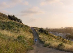
Kenneth Hahn Recreation Area Loop
2.85 mi / 328 ft gainThe Kenneth Hahn Recreation Area is just outside of downtown LA, a perfect location for hiking, trail running, and biking. The trail loops up to the top of a hill, where hikers get sweeping views of LA. Dogs are allowed, but must be kept on leash. This is also a great location for trail running...Read more -
Los Angeles, California
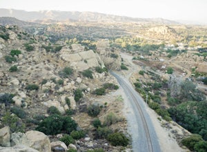
Hike up Chatsworth Park North
1 miFrom the parking lot, make your way through the park until you reach the bottom of a hill filled with huge rocks and boulders. It is very hard to miss.From here, you can pick any trail you wish. They will all lead up to the top. There's a lot of rock scrambling involved, as well as boulder hoppin...Read more -
Los Angeles, California
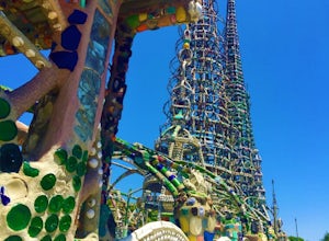
Watts Towers
3.0Watts Towers are a quick 15-20 minute ride from Downtown Los Angeles on the Metro. Since I love weird, interesting things, plus the towers are in my backyard, I had to take a trip to check them out! When getting off the train, I half expected to see the towers spiraling off in the distance. After...Read more -
Apple Valley, California
Deep Creek Hot Springs
4.23.64 mi / 948 ft gainDeep Creek Hot Springs is nestled along the Mojave River at an elevation of 3,000 feet in the San Bernardino Mountains. This year-round mineral water retreat consists of three pools the size of large hot tubs, that range in temperature from around 96 degrees in the first pool to 102 in the third....Read more -
Los Angeles, California
Hike to Vanalden Vista
2 mi / 300 ft gainTo get to the trailhead take Vanalden Ave until it dead ends. Follow the trail at the end of the road as it winds up into the mountains and to the left. You can easily find the trail on Google Maps, so you can use this as a guide. The trail will fork to the left after half a mile. The trail, Vana...Read more -
Lake Hughes, California
Hike the Pacific Crest Trail from Horse Trail to Bear Campground
11.63 mi / 2396 ft gainThis is part of the Pacific Crest Trail. If you're through-hiking or sectional hiking, you'll have to hit it eventually. Try and avoid it in the late summer or early fall because of heat, and gnats. Find a way to check the bug report, we got marauded by gnats 90% of the way (early October) and ap...Read more -
Los Angeles, California
Murphy's Ranch
4.83.21 mi / 679 ft gainThis three-mile out-and-back hike begins at the beginning of a very nice neighborhood in Santa Monica. You will be trekking on a dirt road for about 1.5 miles until you reach some stairs that will be visible on your left-hand side. You will need to descend down those (what seem to be never-ending...Read more -
1501 Will Rogers State Park Road, California
Backbone Trail via Will Rogers State Park
5.03.02 mi / 656 ft gainYou'll make your way up Will Rogers State Park Road, located just minutes from Santa Monica, Brentwood, Westwood, Malibu, Palisades, and much of west Los Angeles. Once on the road, head all the way to the top and you'll dead end into the parking lot. Always worth supporting State Parks with the p...Read more -
Los Angeles, California
Inspiration Point Loop Trail
2.36 mi / 486 ft gainThe Inspiration Point 2.3 mile loop hike in Will Rogers State Park is a family-friendly hike or after-work run near Los Angeles, California. It’s a great dirt trail for all skill levels and features scenic views and beautifully budding wildflowers. You’ll get to escape the city and take in the br...Read more -
Riverside, California
Hike Mt. Rubidoux
4.32.7 mi / 500 ft gainFeaturing over 161 acres and over 3.5 miles of combined paved and dirt trails, Mount Rubidoux Park in Riverside, CA is a beautiful natural environment and adventure location. Although some say this is just a "hill", this Inland Empire gem offers a quick escape from the pace of city life. Just m...Read more -
Topanga, California
Top of Topanga Overlook
1 mi / 1613 ft gainThe Top of Topanga Overlook is where you can simply park your car, and sit in one of the benches to view the San Fernando Valley. But there is one hiking trail in that area which lets you get better vantage points, as well as a quick workout. Once you get to the overlook, park your car and safel...Read more -
Anaheim, California
Oak Canyon Bluebird and Wren Trail
1.42 mi / 187 ft gainThe Oak Canyon Bluebird and Wren Trail features beautiful wildflowers and is accessible year-round. The trail is well kept and offers lots of shady spots. The first portion of this hike will take you up a hill, and then to a fork. One direction will take you around a reservoir and another will ta...Read more -
San Bernardino County, California
Aztec Falls
3.31.23 mi / 16 ft gainFrom Lake Arrowhead, take the 173 to Hook Creek Road until you dead end onto Squint Ranch Road. Take a right at the first fork in the road, and park in the lot for Splinters Cabin. The dirt road can be a bit rocky and might not be the best for small cars. Once you're there, be sure to display you...Read more -
Los Angeles, California
Temescal Canyon Loop
3.93.76 mi / 810 ft gainThere are a couple of different ways that you can hike in Temescal Canyon. For this one, the loop begins from Temescal Canyon Trail at Sunset Boulevard and is approximately 3.76 miles. This loop is not dog friendly. Additional Options for Hiking Temescal Canyon: The basic loop – 2.6 milesTh...Read more

