Owens River, California
Top Spots in and near Owens River
-
Sequoia National Park, California
Mount Silliman, Sequoia NP
5.011.24 mi / 4449 ft gainThere is available parking at the campgrounds at the Lodgepole Visitor Center. Lodgepole's elevation starts at 6720 ft. Twin Lakes Trailhead starts right at the base, which you will be following to get to Mount Silliman. Along Twin Lakes Trail are several campgrounds for your journey, you can go...Read more -
Lone Pine, California
Hike to The Tuttle Creek Ashram
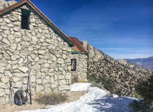
4.33 mi / 1500 ft gainThe Tuttle Creek Ashram is an abandoned stone building, "church" or place of enlightenment tucked away in the beautiful Eastern Sierra. Sitting at an elevation around 8000 feet, construction on the beautiful building was first started in 1928. The building took 20 years of hard manual labor to fi...Read more -
Lone Pine, California
Camp at Tuttle Creek Campground
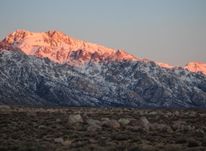
4.5Tuttle Creek Campground is a beautiful place to camp during any time of year. The campground offers uninterrupted breath taking views of the entire Eastern Sierra Nevada and Owens Valleys. Whether you are looking for a place to crash for the night while traveling down the 395, rock climbing in th...Read more -
Madera County, California
Thousand Island Lake via Agnew Meadows
5.019.6 mi / 3642 ft gainStart from Agnew Meadows about 7 miles away. You can take the High Trail out as part of the River Trail with a long detour passing by several other scenic lakes, including Shadow Lake, Garnet Lake, and Ruby Lake. You will arrive at Thousand Island Lake a few hours after lunch, just in time to set...Read more -
Madera County, California
Ediza Lake via Agnew Meadows
4.013.54 mi / 1804 ft gainStart at the Agnew Meadows Trailhead. You will need to arrive before 7:30AM or take the Shuttle from Mammoth Mountain. Start out by heading north on the John Muir Trail. You will pass Shadow Lake; walk around the south side of the lake for mountain views. Then, follow the trail up Shadow Creek u...Read more -
Madera County, California
Ansel Adams' Garnet Lake
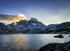
5.014.46 mi / 2717 ft gainGarnet Lake is one of the premier stops along the Pacific Crest Trail. However, even if you don't have time for an entire thru-hike (like most of us), this beautiful lake is still easily accessible as an overnight trip! While there are many possible routes for reaching Garnet Lake, the Agnew Me...Read more -
Madera County, California
Cecile Lake via Agnew Meadows
16.11 mi / 2667 ft gainLocated in the heart of the Ansel Adams Wilderness, Cecile Lake can be reached from a variety of trailheads. I chose to start out in Agnew Meadows. From here, the trail criss-crosses through a serene lowland environment with several crystal clear streams. After passing Olaine Lake, veer left an...Read more -
Madera County, California
Climb Mount Ritter
Mt Ritter is a long climb, but it is worth the effort. Start out by establishing camp at Ediza Lake prior to your ascent. The SE Glacier route (first ascent by John Muir) follows the path of least resistance up the SE side of Mt Ritter.The route first gains a broad bench below Ritter and Banner P...Read more -
Madera County, California
Backpack to Waugh Lake
5.011 mi / 1000 ft gainThere are several trailheads you can start at to get to the lake, but we chose the River Trail in Agnew Meadows because it was the only trailhead that hadn't met the quota yet. You can check on permit's and trailheads here. If the River Trail is booked other great options are Shadow Creek, Fish C...Read more -
Mammoth Lakes, California
Agnew Meadows to Tuolumne Meadows
5.030.27 mi / 4757 ft gainUnlike most through hikes that require two cars or hitchhiking, you can accomplish this with only one car by using a YART. Another benefit is that by entering in Mammoth, it is usually much easier to get permits as opposed to starting in Yosemite where permits can be harder to get. Then once yo...Read more -
Hume, California
Big Stump Loop Trail
5.01.71 mi / 305 ft gainBig Stump Loop Trail is a loop trail where you may see wildflowers located near Dunlap, California.Read more -
Sequoia National Park, California
Hike to Emerald Lake, Sequoia National Park
4.510.4 mi / 2200 ft gainBegin this hike at the Alta Peak Trailhead in the Sequoia National Park. The trail initially takes you east-southeast through a loosely forested area that is stark and arid. Around 1.5 miles in you'll cross a small creek, but this creek may dry up in the late spring/summer. Shortly after the cree...Read more -
Sequoia National Park, California
Hike to Pear Lake via the Lakes Trail
5.012.4 mi / 2300 ft gainThe Lakes Trail to Pear Lake can be done as either an overnight stay or a day hike. For overnight, you'll need to get a permit but there are beautiful camping spots available at both Emerald Lake and Pear Lake. As a day hike, plan to spend all day since you'll undoubtedly pause at each lake for...Read more -
Sequoia National Park, California
Backpack to Big Bird Lake & Moose Lake
30 mi / 8000 ft gainThis trip requires a wilderness permit. You can get one at the Lodgepole Visitor Center where you can also rent a bear canister or use the bathroom before heading out.Wolverton Trailhead -> Big Bird Lake (~12 miles)The start of the trail is on the left side of the parking lot and towards the m...Read more -
Benton, California
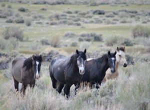
Photograph Wild Mustangs in Mono County
Since these are wild horses, tracking them can be difficult. However, they tend to play and graze in a certain field in Mono County, right outside of Mammoth Lakes and Yosemite! From CA-395 turn onto CA-120 towards Mono Lake. Take this road for 21 miles until you reach Dobie Meadows Road, a one l...Read more

