Owens River, California
Looking for the best hiking in Owens River? We've got you covered with the top trails, trips, hiking, backpacking, camping and more around Owens River. The detailed guides, photos, and reviews are all submitted by the Outbound community.
Top Hiking Spots in and near Owens River
-
Inyo County, California
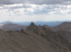
Scramble up Mt. Muir
5.018.5 mi / 6200 ft gainFrom the Whitney Trail - beyond trail crest - you will see a big cairn (right side). If you make it to the first "window of Mt. Whitney" you have gone too far. The cairn marks the start of an class 2 use trail up to the Mt. Muir headwall.The headwall is a fun climb with good handholds and has lit...Read more -
Inyo County, California
Winter Summit Mt. Whitney
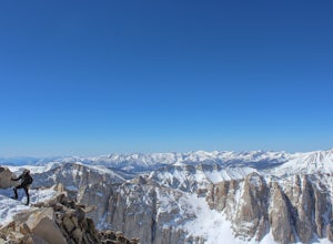
22 mi / 6500 ft gainDay 1: We arrived at the Lone Pine Visitors Center at the intersection of HWY 395 and HWY 136 just south of Lone Pine, CA. We issued ourselves our overnight permits to climb Mt. Whitney and picked up our Wag Bags. You can self issue yourself the free permit Nov. 2 through Apr 30. Climbing during ...Read more -
Mammoth Lakes, California
Devils Postpile Loop
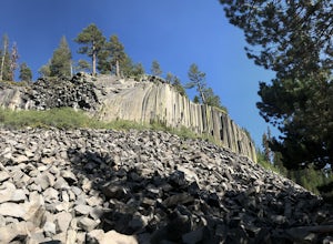
5.01.28 mi / 243 ft gainDevils Postpile Loop is a loop trail that takes you by a river located near Mammoth Lakes, California.Read more -
Tulare County, California
Hike to the Summit of Big Baldy, Kings Canyon National Park
4.55 mi / 650 ft gainThis short and easy trail to the summit of Big Baldy in Kings Canyon National Park is not to be missed if you are in the area.The trail winds through forest and boulders as it climbs the north shoulder of Big Baldy. When you think you have reached the end, and you see people sitting down with the...Read more -
Hume, California
General Grant Loop Trail
0.58 mi / 171 ft gainGeneral Grant Loop Trail is a loop trail that takes you by a river located near Cedar Grove, California.Read more -
Hume, California
Walk the General Grant Tree Trail
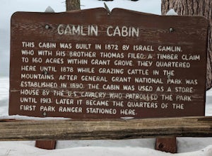
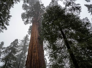
5.00.5 miThe trailhead starts at the back of the parking area, a sign will direct you.This short yet beautiful walk will lead you past amazing sights. Starting counter clockwise you will quickly pass the Fallen Monarch. Feel free to walk inside this massive fallen tree. As you continue you soon reach G...Read more -
Tulare County, California
Hike the Sugar Bowl Loop in Kings Canyon NP
4.56.5 mi / 1480 ft gainFirst and foremost, to get to this trailhead you need to drive down a 2-mile, one lane dirt road that is quite steep. It is highly recommended you do this in an AWD or 4WD vehicle, especially since the road can be muddy from snowmelt or after a recent rain. We have a 2WD car but used chains for e...Read more -
Shaver Lake, California
Balsam Forebay
4.01.05 mi / 62 ft gainAccess to the forebay starts at the trail head from the parking lot 6,700 ft up, also from the parking lot there is access to two different sets of boulder patches separate from the ones encountered along the hike in. Hike Start the 1 mile out and back hike from the parking lot following the t...Read more -
Tulare County, California
Tokopah Falls
4.23.77 mi / 617 ft gainThis hike starts from the Lodgepole area of Sequoia National Park. Parking is easy at the easternmost end of the paved road prior to entering the campground. From the south side, the trail starts off by crossing the Marble Fork of the Kaweah River to the north side. It then loosely follows the r...Read more -
Sequoia National Park, California
Mount Silliman, Sequoia NP
5.011.24 mi / 4449 ft gainThere is available parking at the campgrounds at the Lodgepole Visitor Center. Lodgepole's elevation starts at 6720 ft. Twin Lakes Trailhead starts right at the base, which you will be following to get to Mount Silliman. Along Twin Lakes Trail are several campgrounds for your journey, you can go...Read more -
Lone Pine, California
Hike to The Tuttle Creek Ashram
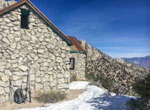
4.33 mi / 1500 ft gainThe Tuttle Creek Ashram is an abandoned stone building, "church" or place of enlightenment tucked away in the beautiful Eastern Sierra. Sitting at an elevation around 8000 feet, construction on the beautiful building was first started in 1928. The building took 20 years of hard manual labor to fi...Read more -
Madera County, California
Thousand Island Lake via Agnew Meadows
5.019.6 mi / 3642 ft gainStart from Agnew Meadows about 7 miles away. You can take the High Trail out as part of the River Trail with a long detour passing by several other scenic lakes, including Shadow Lake, Garnet Lake, and Ruby Lake. You will arrive at Thousand Island Lake a few hours after lunch, just in time to set...Read more -
Madera County, California
Ediza Lake via Agnew Meadows
4.013.54 mi / 1804 ft gainStart at the Agnew Meadows Trailhead. You will need to arrive before 7:30AM or take the Shuttle from Mammoth Mountain. Start out by heading north on the John Muir Trail. You will pass Shadow Lake; walk around the south side of the lake for mountain views. Then, follow the trail up Shadow Creek u...Read more -
Madera County, California
Cecile Lake via Agnew Meadows
16.11 mi / 2667 ft gainLocated in the heart of the Ansel Adams Wilderness, Cecile Lake can be reached from a variety of trailheads. I chose to start out in Agnew Meadows. From here, the trail criss-crosses through a serene lowland environment with several crystal clear streams. After passing Olaine Lake, veer left an...Read more -
Madera County, California
Climb Mount Ritter
Mt Ritter is a long climb, but it is worth the effort. Start out by establishing camp at Ediza Lake prior to your ascent. The SE Glacier route (first ascent by John Muir) follows the path of least resistance up the SE side of Mt Ritter.The route first gains a broad bench below Ritter and Banner P...Read more -
Madera County, California
Backpack to Waugh Lake
5.011 mi / 1000 ft gainThere are several trailheads you can start at to get to the lake, but we chose the River Trail in Agnew Meadows because it was the only trailhead that hadn't met the quota yet. You can check on permit's and trailheads here. If the River Trail is booked other great options are Shadow Creek, Fish C...Read more

