Oceanside, California
Looking for the best hiking in Oceanside? We've got you covered with the top trails, trips, hiking, backpacking, camping and more around Oceanside. The detailed guides, photos, and reviews are all submitted by the Outbound community.
Top Hiking Spots in and near Oceanside
-
Ramona, California
Mount Woodson's East Approach
3.03.96 mi / 1385 ft gainMount Woodson is a well-known hiking trail in San Diego County. It is known for its breathtaking views and the famous potato chip rock. The Trail on the east side of the Mountain is fairly steep but is about half the distance of the trail on the west side of the mountain. To get to the trail on ...Read more -
Palomar Mountain, California
Hike Thunder Spring and Chimney Flat Loop
3.04 mi / 900 ft gainPalomar Mountain is the hidden gem of San Diego. Well, not so hidden per se- but most don't know that the little climb up the mountain can transport you from the prevalent brush-filled terrain of SD to a lush, diverse forest.The great thing about Palomar is that every day you visit could be compl...Read more -
Palomar Mountain, California
Hike to French Valley
5.03.8 mi / 450 ft gainWhen it comes to Palomar Mountain State Park, most people stick to Doane Lake and Upper Doane Valley. Yet on the far right of the parking lot at Doane Pond, there is actually a trailhead that will guide you to a completely different section of the park. The Lower Doane Valley trail is, in my opti...Read more -
Ramona, California
Iron Mountain Peak Trail
4.15.67 mi / 1030 ft gainIron Mountain is the longest wilderness trail in Poway, CA. The parking lot is free and provides bathroom and water fountain amenities. The distance from the parking area to the summit is approximately 3.2 miles. Beginning with a wide smooth trail, slowly transitioning into semi-technical incline...Read more -
Temecula, California
Dripping Springs Trail
4.013.68 mi / 3287 ft gainThe trail immediately begins to climb out of the campground on a well-graded incline. The next mile contains some climbing leading to a set of switchbacks. A long strenuous climb ensues until the 3200' elevation is reached. The trail then makes an easy southward traverse to the basin before resum...Read more -
Dana Point, California
Walk the Dana Point Preserve Trail
5.00.5 miOcean views the whole time, plenty of wildlife and different species of native plants make this short hike beautiful. With the hike being short enough to complete in the afternoon after a day at the beach you can see a beautiful view of the coastline north and south. There is plenty of parking in...Read more -
Lake Elsinore, California
Hike Bear Canyon Trail to Sitton Peak
6.4 mi / 2200 ft gainA MUST hike for any orange country resident! The hike starts of off Ortega HWY 74 at the Bear Canyon Trail head on the same side of the road as the Ortega oaks candy store. Its recommended you park in the lot across the street from the trail head (tip:there is a working water spicket in the parki...Read more -
Lake Elsinore, California
Sitton Peak
9.36 mi / 2011 ft gainIt's amazing what you can find in your own backyard if you really do you research. In Orange County there are so many awesome hiking options that are often overlooked. The Bear Canyon to Sitton Peak Trail in the San Mateo Wilderness is one of those. Sitton tops out at 3,273 feet and it's a 5 mil...Read more -
Palomar Mountain, California
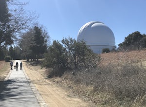
Hike to Palomar Observatory from the Palomar Observatory Campground
5.04.4 mi / 718 ft gainSituated in the Palomar Mountains of Cleveland National Forest, Palomar Observatory Campground offers many amenities for enjoyable camping and exploring the area. A portion of the campsites loop has been cleared of trees with level cement pads to allow campers to set up their own telescopes. Dr...Read more -
Poway, California
Hike around Goodan Ranch
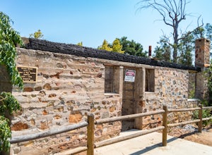
5.03 miStarting at the Sycamore Canyon Trail head, you will see the sign and gate that leads to Goodan Ranch. Head down the gravel road for 1.1 miles, until you reach a 3-way directional split. Heading straight for another .5 miles will take you directly to the ruins of the old Goodan house. Here you wi...Read more -
Laguna Niguel, California
Colinas Ridge Trail
2.01 mi / 131 ft gainFirst, you'll be parking in the parking lot for the dog park. It's free parking and there are roughly 40 spaces, so there is plenty of parking. I've never seen more than 20 cars here at any one time. Once parked you'll find the trail head/ start on the northwest side of the lot (opposite the dog ...Read more -
Dana Point, California
Hike the Salt Creek Trail
5.03 mi / 20 ft gainStarting from the Salt Creek Beach parking lot (a paid lot that takes cash, debit, and credit cards and charges by the hour. There are pay stations at a few points in the parking lots), you head west towards the ocean...through a tunnel and down the hill towards the beach. Once you get to the bas...Read more -
Laguna Beach, California
Aliso Peak via the Valido Trail
5.01.14 mi / 325 ft gainThe Valido Trail trailhead can be found just off West street off the Pacific Coast Highway, just south of Aliso Beach. Park on West Street past the trailhead. The trail proceeds approximate .5 miles till it intersects with the Aliso Peak Trail. Go left .4 miles to the obvious summit and wooden p...Read more -
San Diego, California
Mission Trails 5 Peaks
15 miThe 15-ish mile route we took made it a great workout, but it didn’t crush us. We left the apartment at 6 am and were back home with plenty of time to prep cook and eat a big dinner before 5 pm. Although I completed the hike in 1 day(and I highly recommend it)many people completed each hike indi...Read more -
San Diego, California
South Fortuna Mountain
5.04.59 mi / 997 ft gainHiking at sunset/night is a great way to beat both the heat and the crowds. On a clear day, you can see from Mexico to Catalina Island! If you stay long enough, you can see all of San Diego's city lights turn on, or the marine layer fog creeps into the canyons. South Fortuna Peak is part of Miss...Read more -
Santee, California
Oak Canyon in Mission Trails Regional Park
5.03.22 mi / 249 ft gainStarting on Father Junipero Serra Trail, drive 0.7 miles west to the Old Mission Dam parking lot on the left. The park closes the gates at 7pm, so make sure to park early, or plan your hike in such a way that you don't get locked in! If you think you'll need longer, you can park out on the main r...Read more
Top Activities
Oceanside, California
O’side (as locals affectionately call it) is a destination of discovery where you can explore everything from awe-inspiring sea life through exciting ocean adventures, California history at the “King of Missions,” and surf culture at the California Surf Museum. As a playful and diverse destination, we value personal expression and originality, inviting you to play in a real SoCal beach town and Respect the O’riginals.
Learn More


