Oakhurst, California
Looking for the best hiking in Oakhurst? We've got you covered with the top trails, trips, hiking, backpacking, camping and more around Oakhurst. The detailed guides, photos, and reviews are all submitted by the Outbound community.
Top Hiking Spots in and near Oakhurst
-
Yosemite Village, California
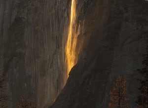
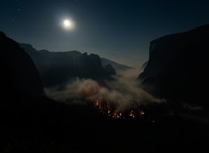
Witness Yosemite's Firefall
5.00.1 mi / 0 ft gainOver 5 million visitors flock to Yosemite National Park in California's Sierra Nevada Mountain Range every year to take in the geological splendor. While most visitors get to see the park's waterfalls, very few ever get to witness the Firefall. For two weeks between mid-late February, a small wat...Read more -
YOSEMITE NATIONAL PARK, California
Illilouette Falls in Yosemite National Park
4.55.07 mi / 1400 ft gainThe hike begins at Glacier Point. Find the marker for the Panorama Trail just beyond the viewing steps (to the right, if you’re looking at Half Dome). The first section of the hike will be lined with open views of Half Dome, Vernal Falls and Nevada Falls. It will be hard not to stop to listen ...Read more -
Mariposa County, California
Reverse Summit of Glacier Point in Yosemite National Park
4.517 mi / 6100 ft gainYosemite's Panorama Trail is undoubtedly one of the most scenic and worthwhile trails in the entire national park. The stretch that reaches from the valley floor to the top of Glacier Point involves 8.5 miles and a monumental amount of elevation gain. If you want to see the entire stretch of trai...Read more -
Mariposa County, California
Glacier Point via Four Mile Trail
5.09.59 mi / 3200 ft gainGlacier Point is one of the highlights of Yosemite. The point is located at the end of Glacier Point Road. This viewpoint allows you to survey the entire Yosemite Valley and gives the viewer a captivating sight of Half Dome. It's a little bit of a tourist trap (especially during the summer season...Read more -
Mariposa County, California
Hike to Union Point via Four Mile Trail
6 mi / 2332 ft gainFour Mile Trail is steep, but hikers efforts are more than rewarded. Union Point sits above Yosemite Valley at 6,332 feet - offering sweeping views of El Capitan and the valley entrance to the left, and North Dome / Half Dome & Clouds Rest to the right. You can also see Yosemite Falls straigh...Read more -
Mariposa County, California
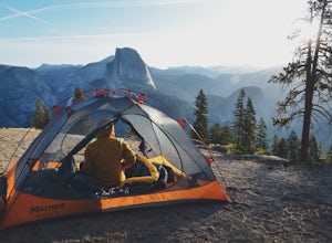
Camp at Glacier Point
4.79.17 mi / 3491 ft gainEveryone that knows Yosemite, knows Glacier Point. An overlook that attracts thousands of people per day that drive up via Glacier Point Road is rarely vacant of the hustle and bustle of people. However, there is a loop hole here, and when the stars align you can have Glacier Point ALL to yoursel...Read more -
Mariposa County, California
Four Mile Trail to Panorama Trail Loop
5.016.03 mi / 5177 ft gainFour Mile Trail to Panorama Trail Loop is a loop trail that takes you by a waterfall located near Yosemite Valley, California.Read more -
Yosemite Valley, California
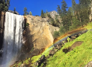
Mist Trail to Vernal Falls
4.93.11 mi / 1319 ft gainThis is one of the most epic short hikes that you can do in Yosemite. Highly recommend it for anyone staying in the valley or visiting with enough time for a 2-3 hour hike. While the distance isn't long, you will stop a lot along the way to take in the beauty and also spend time at the top of the...Read more -
Mariposa County, California
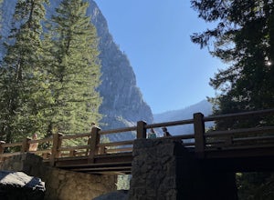
Vernal Fall Foot Bridge Trail via Mist and John Muir Trail
5.02.4 mi / 761 ft gainVernal Fall Foot Bridge Trail via Mist and John Muir Trail is a loop trail that takes you by a waterfall located near Yosemite Valley, California.Read more -
37.732842,-119.557782
Panorama Trail
4.816.87 mi / 3200 ft gainThe Panorama Trail is an outstanding hike that takes you from the Yosemite Valley floor up to Glacier Point. Or you can hike it downhill going from Glacier Point to Yosemite Valley. You can camp and make it an overnight trip or do it as a day trip by leaving a car at one end and taking a park sh...Read more -
Mariposa County, California
Little Yosemite Valley Campsite and Half Dome
4.613.88 mi / 4800 ft gainFirst things first. You will need to get a wilderness pass by entering the lottery for Half Dome access. If you don't get a pass via lottery just go to the Yosemite Valley visitor center, tell the clerk you are backpacking to Little Yosemite Valley and that you would like to hike up Half Dome. Th...Read more -
Yosemite Valley, California
Thru-Hike the John Muir Trail
5.0203.17 mi / 44944 ft gainTo thru hike the JMT is probably one of the sickest trips to do! It's not a heavy commitment like the PCT or AT but it's also no week long vacation from work, backpacking the woods of your local forests either. There's a sweet spot in thru hiking and I believe this trail gives the full taste. You...Read more -
Yosemite Valley, California
Vernal & Nevada Falls via Happy Isles
4.67.23 mi / 2815 ft gainThis popular hike starts near Happy Isles in Yosemite Valley. The first mile of the trail is paved and almost entirely uphill. You will come to the footbridge which tends to be very crowded. About 0.2 miles beyond the footbridge, the Mist Trail and the John Muir Trail diverge. Follow the Mist Tra...Read more -
Yosemite Valley, California
Half Dome via the Mist Trail
4.815.94 mi / 4800 ft gainBe sure to arrive early early in the morning to beat the crowds or if you want to break up the hike, first-come, first served campsites are available at Little Yosemite Valley Campground - make sure to check out the details in that adventure and obtain a wilderness permit. Even if you are just da...Read more -
Mariposa County, California
Backpack to Yosemite's Eagle Peak via Yosemite Falls
12.6 mi / 3779 ft gainGet a permit. Any overnight backpacking in Yosemite requires a permit from the Wilderness Center. Before you leave make sure to get one! Get a bear canister! Bears are active in Yosemite and all backpackers must take the required measures to keep food away from them! Start at Camp 4. Eagle Pe...Read more -
37.741904,-119.601967
Upper Yosemite Falls
4.75.98 mi / 2700 ft gainYou can find the trailhead to Upper Yosemite Falls near Camp 4. There is plenty of free parking here and you can also take a shuttle to stop #7. Be sure to start this hike early in the day as it is strenuous and can get really hot as the day goes on. Bring plenty of water and snacks and take many...Read more

