Newbury Park, California
Newbury Park, California is home to some of the best trails and outdoor activities. The top must-visit is the Satwiwa Loop Trail, a moderate 1.5-mile loop that offers scenic views of the Santa Monica Mountains and the Pacific Ocean. The trail passes by a historic Chumash Native American site and a stunning wildflower meadow. For a more challenging hike, the Boney Mountain Trail is a 6-mile round trip with panoramic vistas and unique rock formations. The Dos Vientos Community Park is a great place for family picnics, while the Conejo Creek North Park features a duck pond and beautiful gardens. For birdwatching and wildlife viewing, the Rancho Sierra Vista/Satwiwa is a must. Don't miss the chance to explore these outdoor adventures in and near Newbury Park.
Top Spots in and near Newbury Park
-
Santa Paula, California
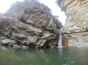
Santa Paula Punch Bowls
3.66.5 mi / 1037 ft gainThis is a 6.5 mile trail, out and back. Parking is available along Ojai St, and the trail starts at the entrance of Thomas Aquinas College. Follow the paved road that goes around the school, until you reach a fork on the road, then stay right. The trail will take you through Ferndale Ranch, just ...Read more -
Ventura, California
Stand Up Paddleboard the Ventura Harbor
The Ventura Harbor provides a protected entry/exit to the Pacific Ocean and is a great place to start a paddleboarding adventure. Marina Park, at the end of Pierpont Boulevard, has a ton of parking, a free public launch, and there are boards to rent along the harbor. From the launch you can head...Read more -
Los Angeles, California
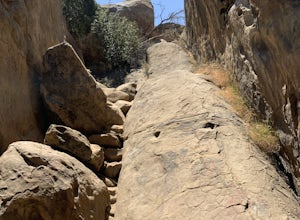
Hike up Chatsworth Park North
1 miFrom the parking lot, make your way through the park until you reach the bottom of a hill filled with huge rocks and boulders. It is very hard to miss.From here, you can pick any trail you wish. They will all lead up to the top. There's a lot of rock scrambling involved, as well as boulder hoppin...Read more -
Topanga, California
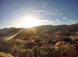
Top of Topanga Overlook
1 mi / 1613 ft gainThe Top of Topanga Overlook is where you can simply park your car, and sit in one of the benches to view the San Fernando Valley. But there is one hiking trail in that area which lets you get better vantage points, as well as a quick workout. Once you get to the overlook, park your car and safel...Read more -
Los Angeles, California
Stoney Point Park Loop
4.00.73 mi / 141 ft gainOnce you've parked along Topanga Canyon Blvd, make your way down the street and start the trail off near the steel gate, close to the horse stables. As you make your way in, you will notice some rock climbers practicing on the lower elevation rocks. Make your way around this rocky park, counter-...Read more -
Topanga, California
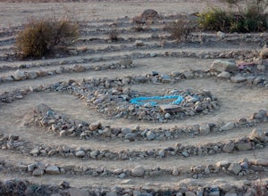
The Labyrinth at Tuna Canyon Park
1.45 mi / 299 ft gainThis is a simple but steep 2.4 mile round-trip hike to a clearing on a mountaintop in Topanga/Malibu, about an hour's drive west of downtown LA. At the end of the hike you'll reach a clearing with incredible views. On a cloudy or foggy day, it feels like you're floating above the clouds; on a cle...Read more -
Ventura, California
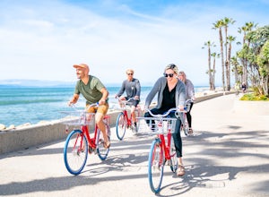
Bike the Ventura Promenade
0.5 mi / 0 ft gainThe Ventura Promenade is a .5 mile long biking and walking trail that runs from the Ventura Pier to Sufer's Point, eventually connecting to the Ventura River & Ojai Bike Trail. It is also part of the the larger "Omer Rains Trail" which runs some 3.5 miles to the south through Buenaventura Sta...Read more -
Los Angeles, California
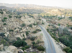
Stoney Point via North End
4.01.42 mi / 240 ft gainStoney Point via North End is an out-and-back trail where you may see local wildlife located near Chatsworth, California.Read more -
Ventura, California
Surf Ventura Point
4.0Surfer’s Point, off Figueroa Street, includes one of California’s premier surfing and windsurfing spots. A landscaped promenade and the Omer Rains Bike Trail connect this sandy beach to the Ventura Pier. Promenade Park, next to the beach commemorates the site of an ancient Chumash village. Beach ...Read more -
Ventura, California
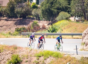
Bike the Ventura, Santa Paula, and Ojai Loop
48.8 mi / 2081 ft gainThe Ventura - Ojai - Santa Paul loop is a classic half-century loop throughs some of the most beautiful cycling roads on the Central Coast. Beginning in Ventura and heading on the off-road (but paved) Ventura / Ojai trails, this loop then heads into downtown Ojai before following Ojai Valley Road...Read more -
Ventura, California
Bike the Rincon Trail
5.028.4 mi / 720 ft gainThe Rincon Trail between Ventura and Santa Barbara is part of the wonderful Pacific Coast Bike Route, and features two-wave paved cycling lanes with beautiful views up and down the central coast. There are numerous places to stop along the way for food and relaxing, including the great seaside to...Read more -
Ventura, California
Bike the Lake Casitas Loop
1.048.9 mi / 3635 ft gainThe Lake Casitas Loop s a fantastic cycling trail leading from Ventura, California through Ventura Canyon, around Lake Casitas and up over Casitas Pass, down through Rincon Canyon to the ocean and south on Rincon Trail back to Ventura. It covers almost all of the ecological zones and topographica...Read more -
Topanga, California
Eagle Rock in Topanga State Park
4.45.99 mi / 1106 ft gainEagle Rock is located in Topanga State Park in the Santa Monica Mountains, and it is a unique formation that provides an amazing panoramic view of Santa Monica. On a clear day, the Catalina Islands and Palos Verdes Peninsula are visible. You can park on along the street of Entrada Rd. or pay $10 ...Read more -
Topanga, California
Parker Mesa Overlook via Trippet Ranch
4.06.75 mi / 1181 ft gainThis is a 6.8 mile round-trip hike that starts at Trippet Ranch in Topanga Canyon. Even though the range in elevation is 400 feet from peak to trough, the up and down trail totals to approximately 1800 feet elevation gain making this a beginner to intermediate adventure. The trail itself is pre...Read more -
Ventura, California
Bike the Ventura River and Ojai Bike Trails
32.6 mi / 1030 ft gainThe Ventura River and Ojai Valley Trail, effectively the same trail, is a gorgeous 32 mile trail that runs from Seaside Park in Ventura to downtown Ojai. It runs along and across the Ventura River and through the Ventura Canyon, with views up and down numerous side canyons and ravines. The trail ...Read more -
Ventura, California
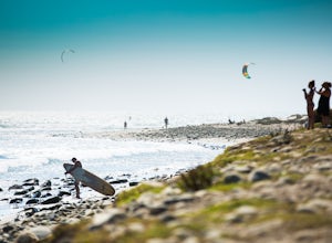
Kiteboard Surfer's Point
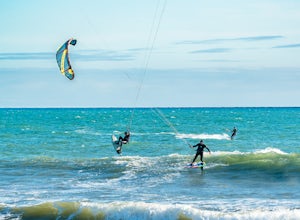
Surfer's Point aka Ventura Point is a well-known kite boarding/surfing (and surfing) spot due to its (when conditions are right) great wave quality, favorable wind direction (sideshore with occasional side-off), friendly locals, rider capacity, and a nearby point break with. When conditions are e...Read more

