Mount Whitney, California
Top Spots in and near Mount Whitney
-
Lone Pine, California
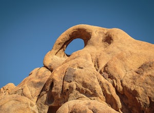
The Eye of the Alabama Hills Arch is a quick hike or drive from the popular Mobius Arch just off Movie Flat Road. The rocks around the arch offer outstanding views of the surrounding Alabama Hills and Sierra Mountains. To get to the arch follow the directions for Mobius Arch which is a great firs...
Read more
-
Seven Pines, California
5.0
26.66 mi
/ 10653 ft gain
This trail starts at the lowest, and generally regarded hardest, trailhead in the Southern Sierras. You quickly gain elevation in what many describe as manageable but relentless. The first section of the hike has nice shade and adequate water access. Very enjoyable company to boot!
Once you cros...
Read more
-
Inyo County, California
Mt. Langley sits four hours north of Los Angeles and is one of the easier 14ers to bag in California. Mt. Whitney absorbs most of the foot traffic, so enjoy the relative quiet and seclusion.The trailhead starts at Horseshoe Meadows/Cottonwood Lakes Trailhead Campgrounds and meanders for 7.5 miles...
Read more
-
Lone Pine, California
5.0
14.7 mi
/ 1906 ft gain
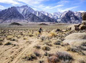
This 14.7 mile loop has some fun single track descents through the gorgeous Alabama Hills. It kicks off with a climb up the road, which can easily be shuttled if you have more than one car or someone to brave a hitched ride up the road.
From the trailhead start, you'll encounter quite a bit of l...
Read more
-
Independence, California
5.0
2.22 mi
/ 112 ft gain
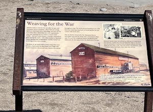
Manzanar Japanese Relocation Site: Manzanar Trail is a loop trail that takes you past scenic surroundings located near Independence, California.
Read more
-
Independence, California
Trip Guide
***Please note, all images after the first one are arranged in chronological order of the trip so you can easily follow along
Day 1
Depending on where you are coming from your day one is most likely going to be setting up your car shuttle from Whitney Portal to Onion Valley. Our fi...
Read more
-
Independence, California
Make sure to obtain an overnight permit up to 6 months in advance. You will have to pick up your permit at one of the Inyo National Forest Visitor Centers (here) before you begin.
Once you have your permit in hand, drive to the Onion Valley Trailhead (see map), which is about 15 miles west of th...
Read more
-
Independence, California
4.0
16.38 mi
/ 4078 ft gain
This adventure begins at Onion Valley Campground outside of Independence, CA. The parking is abundant and the road is snow dependent. Snow will be plowed as long as it is not currently being hit with a massive storm. Dogs are allowed on trail up to Kearsarge Pass (4.5 miles from the trailhead). H...
Read more
-
Independence, California
5.0
26.02 mi
/ 7106 ft gain
The hike starts at Onion Valley campground and includes a good deal of elevation (two passes around 12,000 feet). You start climbing at the outset, and keep climbing for the first couple of hours before hitting Kearsarge Pass. Here you begin a long descent, then traverse above some beautiful lake...
Read more
-
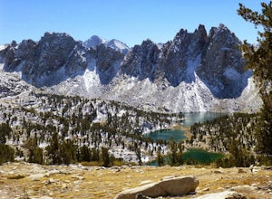
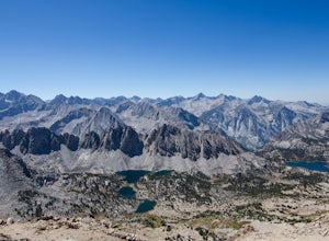
Independence, California
Starting at 9,200 feet at Onion Valley Campground, take Kearsarge Pass Trail. The hike begins immediately with a substantial increase in elevation, switchbacking up the mountain. On the way up rest and enjoy the beautiful alpine lakes, which include Gilbert, Flower, Heart and Big Pothole Lake. Fl...
Read more
-
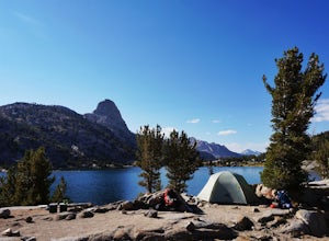
Fresno County, California
You'll have to deal with some crowds at Rae Lakes but that is because this is an amazing setting to spend the night. If sharing this place with others is the worst of your worries then you're doing pretty well. Hikers flock here for the incredible swimming, views of iconic peaks like Fin Dome and...
Read more
-
Three Rivers, California
5.0
9.8 mi
/ 2200 ft gain
The trail to Crystal Lakes begins at the Timber Gap/Sawtooth Trailhead (7,800 feet elevation), which is located at the end of Mineral King Valley Rd. The trail immediately ascends through a meadow boasting dramatic alpine views and a roaring waterfall. Eventually you'll cross Monarch Creek and b...
Read more
-
Three Rivers, California
5.0
26.5 mi
/ 10000 ft gain
Day 1: A long, rewarding day. Over the course of 11.5 miles you will complete around 10,000ft of elevation change. To start, park the car at the Sawtooth-Monarch Trailhead (7500ft) and begin on the trail, immediately ascending to Timber Gap (9500ft). Once at the gap, the trail makes it's way do...
Read more
-
Three Rivers, California
The drive takes about 90 minutes to get to the trailhead from Three Rivers, CA so plan accordingly and make sure you get there early. Lower Mineral Lake is located below Sawtooth Peak in Sequoia National Park.Once you're parked and ready to jump on the trail, head to the Sawtooth Trailhead. You'l...
Read more
-
Three Rivers, California
Franklin Lakes is part of the Sequoia National Park and can be reached from the trailhead starting near the Mineral King Ranger Station. Bear containers are required and can be rented at the Ranger Station. The hike to Franklin Lakes campground will take 6 hours or less (depending on your speed/h...
Read more
-
Three Rivers, California
The trailhead is right near the Mineral King Ranger Station (on Mineral King Rd) in Sequoia National Park. Depending on where you're coming from I would recommend driving in and camping at Cold Springs Campground (which is also in close proximity to the ranger station) the night before you begin ...
Read more

