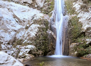
Monrovia, California
Looking for the best hiking in Monrovia? We've got you covered with the top trails, trips, hiking, backpacking, camping and more around Monrovia. The detailed guides, photos, and reviews are all submitted by the Outbound community.
Top Hiking Spots in and near Monrovia
-
Whittier, California
Sycamore Canyon Trail in Turnbull Canyon
2.03.47 mi / 627 ft gainThe Sycamore Canyon Park Trailhead can be found at the end of the dirt parking lot off Workman Mill Road. The entrance is off a small road which is pretty easy to miss, but there is a sign off the main road. Soon after you start on the trail, the path opens up onto a larger dirt road for vehicle ...Read more -
Whittier, California
Hellman Park Trail
3.04 mi / 850 ft gainThis trail is great if you're looking for a quick, but intense workout. The hike itself is only 4 miles out- and-back and can be easily completed within a couple of hours. However, be prepared for a steep and steady incline for the first 1.5 miles. The trail itself is pretty wide, and if you sho...Read more -
Altadena, California
Gabrieleno Trail: Switzer Falls to Hahamonga Watershed
5.010.14 mi / 814 ft gainGabrieleno Trail: Switzer Falls to Hahamonga Watershed is a point-to-point trail that takes you by a waterfall located near La Canada Flintridge, California.Read more -
Los Angeles County, California
Switzer Falls
3.43.66 mi / 728 ft gainJust off the Angeles Crest highway, you’ll find one of LA’s best waterfalls, Switzer Falls. There is a parking lot just next to the trailhead. If you go on the weekend and run into a crowd, there’s parking near the highway, adding a little distance to your trek. Once you’ve walked through the Sw...Read more -
Los Angeles County, California
Bear Canyon via Switzer Falls Trailhead
6.67 mi / 1273 ft gainParking: Parking is available at the Switzer Falls Picnic Area, or in the two overflow lots on the hill. You will need an Adventure Pass to leave your car parked here. Make sure to follow posted signs - there are some parking spots that do not allow overnight parking. Amenities: Bear Canyon has...Read more -
Los Angeles, California
City View and Walnut Forest Trails Loop
4.02.59 mi / 568 ft gainThe City View and Walnut Forest Trails in Ernest E. Debs Regional Park are just outside of downtown Los Angeles, and are perfect for all abilities. The trails are most commonly used by dog walkers, trail runners, mountain bikers and families. The top of the hike features a unique pond. Dogs are a...Read more -
La Cañada Flintridge, California
Teepee Trail
5.02.55 mi / 1145 ft gainHidden in the small community of La Canada, California, the trailhead is pretty hidden! From the 210, take the exit for Highway 2/Angeles Crest Highway. Head north (towards the mountains) for about a mile. As the highway begins to curve, you will come across a small side-street, Harter Lane. Turn...Read more -
Los Angeles, California
Sunset Hike in Ascot Hills
3.5Ascot Hills Park is a great hidden gem located a few miles east of Los Angeles. There is a parking lot with plenty of parking but the gates close at sunset, which is a great time to go, so if you plan on staying later, park outside the gates where there is ample street parking. Depending on the s...Read more -
La Verne, California
Marshall Canyon Trail
4.05.99 mi / 722 ft gainFor this adventure you can choose to start in a multiple of places; for the easiest parking use Oak Mesa Park located next to Oak Mesa Elementary School. From the parking lot cross the soccer field towards the bridge on the north east end of the school. Once across the bridge follow Los Robles ea...Read more -
Azusa, California
Smith Mountain Trail
6.69 mi / 3189 ft gainSmith Mountain Trail is an awesome day hike located near Glendora, California. This out-and-back trail offers great views of the Los Angeles National Forest and the potential for continuation to Bear Creek for even more variety of scenery. Smith Mountain is a moderately strenuous hike with an el...Read more -
Pearblossom, California
Camp at Horse Flats Campground
3.0The Horse Flats Campground is located 29 miles up Highway 2 from Interstate 210. You will turn left at the Santa Clara Divide Road(this intersection is also known as 3 Points). 3 miles down the road you will turn left to enter the campground. I have camped here a few times and its always been pre...Read more -
Glendale, California
Mt. Thom and Tongva Peak
6.06 mi / 1480 ft gainMount Thom and Tongva Peak are accessed by using the 6.2 mile out and back trail, Las Flores Motorway located in the north part of Glendale, CA. Roadside parking is not allowed near the trailhead, you will need to park in the nearby residential area along Sunshine Drive about 0.15 miles away from...Read more -
Azusa, California
Lewis Falls
1 mi / 732 ft gainLocated deep in the Angeles National Forest above Azusa, this short but at times challenging hike rewards you with a beautiful fifty-foot waterfall. The base of the waterfall is only a foot at its deepest, so I wouldn't rush to bring a bathing suit with you. Protected by the heavy forestry around...Read more -
Los Angeles, California
Secret Swing in Elysian Park
4.20.16 mi / 360 ft gainFor the most direct directions to the swing, plug in "Swing on top of Elysian Park" into google maps, which will take you directly to the trailhead. If you want to do it the more old fashion way, the swing is on top of a hill at the intersection of Angels Point Drive and Park Row Drive in Elysian...Read more -
Pearblossom, California
Snowshoe Buckhorn Ridge Trail
2.5 mi / 700 ft gainLocated 1 mile east of the Mt Waterman Ski Resort, Buckhorn Ski Hill is a great place to enjoy a leisurely stroll through a snow-covered forest, complete with views of towering Mt Waterman. To get here take I-210 toward La Canada, exit on to California Highway 2 (Angeles Crest Highway) heading no...Read more -
Glendale, California
Beaudry Loop
5.79 mi / 1572 ft gainThe Beaudry Loop trail features a bench at the top with 360 degree views of the greater LA area. The trailhead is a little hidden on Beaudry Blvd. As Beaudry Blvd turns into Beaudry Terrace, you'll see cars parked at the paved trailhead. There is very little shade on the trail so bring ample sun...Read more


