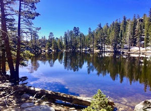
Menifee, California
Menifee, California offers some of the best trails and outdoor activities. One of the top must-visit spots is the Motte Rimrock Reserve. This scenic hiking trail provides stunning views of unique rock formations and a diverse array of plant life. The trail is moderately difficult, making it a great outdoor adventure for those looking for a bit of a challenge. Another popular attraction is the Menifee Lakes, perfect for fishing and boating. For a more leisurely outdoor activity, visit the Audie Murphy Ranch Park, a well-maintained park with walking paths and picnic spots. Don't miss these fantastic outdoor activities when in Menifee.
Top Spots in and near Menifee
-
Riverside County, California
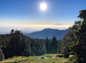
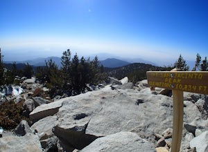
San Jacinto Peak via Marion Mountain Trailhead
11.25 mi / 4505 ft gainSan Jacinto Peak is the second highest peak in Southern California which sits at 10,833'. There are several trails to summit San Jacinto, but Marion Mountain is the shortest but also a tough one. You will start the hike at an elevation of 6300' and continuously climb 4500' in less than 6 miles. ...Read more -
Trabuco Canyon, California
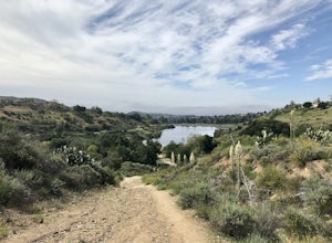
Hike the Bellview to Dove Lake Trail
2.5 mi / 75 ft gainThis hike will be about going from the Bellview Trailhead to Dove Lake and back. Note that once you get to Dove Lake there are numerous offshoots that can take you in different directions (you can follow the road into the Dove Canyon housing community, take a paved road back to the Bellview parki...Read more -
Silverado, California
Bedford Peak Trail
5.06.78 mi / 1972 ft gainThe Bedford Peak Trail in Silverado, California is a challenging hike that offers a variety of natural features. The trail spans 6.78 miles round trip and has an elevation gain of 1,972 feet. It is rated as difficult due to its steep inclines and rocky terrain. The trail begins in a dense oak w...Read more -
Cabazon, California
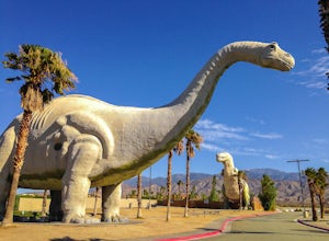
Check Out the Cabazon Dinosaurs
4.3For any fans of Pee-Wee’s Big Adventure or The Wizard, the Cabazon Dinosaurs are instantly recognizable. A roadside attraction off of Hwy 10 - 90 miles east of Los Angeles - the dinosaurs, heralded as the “World’s Biggest Dinosaurs", are a quick adventure.To get to the dinosaurs, you’ll travel on...Read more -
Mountain Center, California
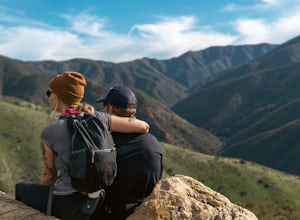
Tahquitz Peak via Devils Slide Trail
5.08.31 mi / 2238 ft gainTahquitz Peak via Devils Slide Trail is a moderately trafficked 8+ mile out and back trail located near Idyllwild, California. This trail is one of the most popular hikes in the San Jacinto area that features a fire lookout tower at the peak and amazing views of the valley below. At an elevation...Read more -
Mountain Center, California
Mount San Jacinto via Devil's Slide
4.514.57 mi / 4475 ft gainMt. San Jacinto is the second tallest peak in Southern California at 10,834’. Although this route requires a fair amount of work, the effort is more than rewarded by the expansive views, forest, meadows, and dramatic topography. You will need an Adventure Pass ($5/day) to park at Humber Park, as...Read more -
Trabuco Canyon, California
Bell Canyon Trail
3.86 mi / 102 ft gainBell Canyon Trail is an out-and-back trail where you may see wildflowers located near San Juan Capistrano, California.Read more -
San Juan Capistrano, California
Hike the Pinhead Peak Trail at Ronald W. Caspers Wilderness Park
4.02 mi / 220 ft gainRonald W. Caspers Wilderness Park is the perfect place to getaway from the hubbub of LA. Enjoy the scenic drive north on Ortega Highway before reaching the entrance gate to the park. Parking Fees are currently $3 on Weekdays and $5 on Weekends. Camping Fees vary depending on your group size. The...Read more -
Silverado, California
Harding Falls Trail
5.05.96 mi / 1378 ft gainThe lot provides free parking, with plenty of spaces available throughout the day. The first few miles feature a descent into the canyon on a defined trail out in the open. The way back up is a decent incline in the sun! Be prepared, because even though 6+ miles may not seem too hard, this h...Read more -
Corona, California
Skyline Drive Trail
3.09.07 mi / 1946 ft gainThis trail is shared by hikers, mountain bikers and trail runners. Rock climbers can find areas to boulder off the trail. Bring lots of extra water as this trail is rather dusty and can get very hot. This is a good training hike for those looking to do some backpacking. The trail is open year-r...Read more -
Trabuco Canyon, California
The Luge: Santiago Truck Trail Loop
5.07.46 mi / 1371 ft gainThe Luge: Santiago Truck Trail Loop is a loop trail that takes you through a nice forest located near Lake Forest, California.Read more -
Forest Falls, California
Vivian Creek Trail to San Gorgonio Peak
17.83 mi / 5627 ft gainVivian Creek Trail to San Gorgonio Peak is an out-and-back trail that takes you by a waterfall located near Forest Falls, California.Read more -
Mountain Center, California
Apache Peak Trail
9.4 mi / 2966 ft gainApache Peak Trail is an out-and-back trail where you may see wildflowers located near Mountain Center, California.Read more -
Forest Falls, California
Summit Mt. San Gorgonio
4.717 mi / 5840 ft gainA hiking permit is required to hike in the San Gorgonio Wilderness. Apply for the permit early as the Vivian Creek Trail is the second most popular trailhead for the area and quotas fill up in advance. The permits are free and the entire process can be handled via fax or mail. All the information...Read more -
Palm Springs, California
Palm Springs Tram to Idyllwild
5.010.09 mi / 1404 ft gainPalm Springs Tram to Idyllwild is a point-to-point trail where you may see wildflowers located near Palm Springs, California.Read more -
Palm Springs, California
Hidden Lake via Willow Creek Trail
3.35 mi / 518 ft gainHidden Lake via Willow Creek Trail is a loop trail that takes you by a lake located near Palm Springs, California.Read more

