Mecca, California
Looking for the best hiking in Mecca? We've got you covered with the top trails, trips, hiking, backpacking, camping and more around Mecca. The detailed guides, photos, and reviews are all submitted by the Outbound community.
Top Hiking Spots in and near Mecca
-
Twentynine Palms, California
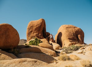
Skull Rock Trail at Joshua Tree National Park
5.01.7 mi / 131 ft gainYou can park at the Jumbo Rocks Campground to start this quick hike. There are two parking locations for this campground and it will be easiest if you use the first one you see, rather than going farther off the road and right next to the campsites. To start the hike, start going north and immedi...Read more -
Riverside County, California
Cap Rock Nature Trail
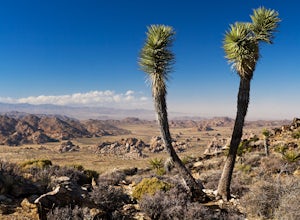
3.00.75 mi / 161 ft gainThere are two Joshua Trees guarding the trail, which makes for a perfect photo op. There are some monzogranite rock formations (of which the park is famous for). Watch for bunnies and lizards! The trail is handicap accessible, so parents with young children in strollers or those in wheelchairs ca...Read more -
Palm Springs, California
Araby Trail
4.58 mi / 1545 ft gainThis hike takes you up to Bob Hope’s massive mushroom shaped house. The neighborhood also includes a house where Steve McQueen lived and the Elrod House featured in the James Bond film “Diamonds are Forever”. It’s a fairly easy hike up to Bob’s but really climbs after you pass the estate. You c...Read more -
Palm Springs, California
Murray Hill via Araby Trail
5.08.85 mi / 2844 ft gainMurray Hill is the highest point in the surrounding trail system. You can access it from Araby Trail or anyone of the others in the area. It's about 9 miles round-trip and a healthy 2,850 vertical feet gain. From the top of the Shannon Trail bear right until you reach the Wildhorse Trailhead. Go...Read more -
Borrego Springs, California
Hike to Maidenhair Falls via Hellhole Canyon in Anza Borrego Desert State Park
5.1 mi / 974 ft gainThis 5.1 mile hike begins near the visitor center of Anza Borrego Desert State Park and gains 974 feet of elevation while climbing up a canyon to a small waterfall. It is an interesting hike as you can see the plant life change as you get closer to the waterfall. There are parts where the trail g...Read more -
Palm Springs, California
Araby and Berns Trail Loop
4.76 mi / 1293 ft gainAraby and Berns Trail Loop is a loop trail that takes you past scenic surroundings located near Palm Springs, California.Read more -
Palm Springs, California
Earl Henderson and Shannon Trail Loop
4.31 mi / 1257 ft gainThis is a short but sweet trail close to the Araby and Garstin Trails. Great views of Palm Springs and the San Jacinto Mountains. Parking area is off of Lansdale Street. From here, head down the Earl Henderson Trail and you will see where in connects with the Shannon Trail. You can choose to swit...Read more -
Palm Springs, California
Murray Hill Loop
8.16 mi / 2260 ft gainMurray Hill Loop is a loop trail that takes you past scenic surroundings located near Palm Springs, California.Read more -
Riverside County, California
Hall of Horrors
0.75 mi / 95 ft gainA trip to Joshua Tree is an adventure in itself, but if you plan so that you are shooting Joshua Tree under a full moon, you'll lose yourself in its beauty all over again. See the park's gorgeous, unique characteristics in a completely different light. Although there may seem to be infinite loca...Read more -
Riverside County, California
Winter Hike to Ryan Mountain
2.86 mi / 1056 ft gainHike starts at the base of Ryan Mountain. The trail runs along side the mountain, offering great views overlooking Joshua Tree. Once you hit the summit, you'll get great panormaic views of the national park as the top of Ryan Mountain is at an elevation of 5457ft. The trail is open during all se...Read more -
Riverside County, California
Hike Ryan Mountain
4.82.86 mi / 1056 ft gainOne of the most prominent peaks in Joshua Tree National Park in Ryan Mountain. It's centrally located rising to a total of 5,456 feet above the valley floor. The trail to the peak is a moderate hike with a little over 1,000 feet elevation gain with panoramic views of Lost Horse Valley, Queen Vall...Read more -
Mountain Center, California
Lion Peak Trail
9.39 mi / 1722 ft gainLion Peak Trail is an out-and-back trail that is moderately difficult located near Mountain Center, California.Read more -
Palm Springs, California
Coffman Trail from Andreas Canyon Rd
3.56 mi / 525 ft gainCoffman Trail, located in Palm Springs, California, is a popular hiking destination. The trail is approximately 3.56 miles long and is rated as moderate in difficulty. It begins at Andreas Canyon Road and winds its way up the mountainside, offering panoramic views of the surrounding desert landsc...Read more -
Palm Springs, California
Andreas Canyon
5.01.03 mi / 154 ft gainAndreas Canyon in Indian Canyons is located very close to Palm Springs in the Agua Caliente band of Cahuilla Indians Reservation. It is one of the few places with abundant shade and running fresh water in an otherwise dry desert landscape. Enjoy a longer hike to a waterfall (Seven Falls) or stay ...Read more -
Palm Springs, California
Seven Falls via Murray Canyon Trail
4.01 mi / 587 ft gainA very scenic 4-mile round trip with a rewarding waterfall after a 2.5-mile hike/stroll. Lucky visitors may catch a glimpse of the Peninsula Big Horn Sheep (an endangered species), mule deer or other wild animals still roaming the high ground above the canyon. Less visited, Murray Canyon has its ...Read more -
Twentynine Palms, California
Split Rock Loop
5.01.94 mi / 220 ft gainStarting out at the Split Rock Trail parking lot, you'll see Split Rock, which might be the most visited boulder in the park. Everyone makes a visit to it and while it is absolutely amazing, it's great to take the hour or two to wander around to more amazing scenery. Immediately upon starting t...Read more

