Los Gatos, California
Looking for the best running in Los Gatos? We've got you covered with the top trails, trips, hiking, backpacking, camping and more around Los Gatos. The detailed guides, photos, and reviews are all submitted by the Outbound community.
Top Running Spots in and near Los Gatos
-
San Francisco, California
Glen Canyon Park Trail
5.01.76 mi / 394 ft gainGlen Canyon Park Trail is a loop most commonly used for running or hiking in the southwestern side of San Francisco, California. Parking for the loop is street parking, so be sure to take any valuables out of the car with you. Note: There are restrooms available at the Glen Canyon Recreation Ce...Read more -
San Francisco, California
Mount Davidson
4.51.03 mi / 299 ft gainMount Davidson Park is located in the southwestern part of the city nestled between Diamond Heights and Portola Dr. The climb isn't too difficult, but to reach the top of the 928ft summit, you should wear close-toed shoes and be ready for some loose gravel or mud if it's been raining. The hike is...Read more -
San Francisco, California
Fort Funston Trail
4.71.81 mi / 253 ft gainFort Funston is an SF gem I discovered when looking for a dog friendly hike near the city. Located west of Lake Merced, you'll find a gorgeous Northern California beach oasis where you and your dog can run wild and free :). Parking is located at the top of the park where you'll descend a steep se...Read more -
Walnut Creek, California
Juniper to the Summit Loop Trail and Meridian Ridge
6.56 mi / 2037 ft gainJuniper to the Summit Loop Trail and Meridian Ridge is a loop trail that is strenuous located near Diablo, California.Read more -
San Francisco, California
Twin Peaks Loop
4.02.04 mi / 259 ft gainThere are a ton of ways to get here (and obviously that can affect the total distance) but this is starting from Clarendon. Follow along up Twin Peaks boulevard where you'll see the peaks upon your approach. Keep an eye out for traffic as there may be visitors driving toward and away from Twin Pe...Read more -
San Francisco, California
Fairy Gates Trail
5.00.89 mi / 328 ft gainFairy Gates Trail is an out-and-back trail that takes you through a nice forest located near San Francisco, California.Read more -
San Francisco, California
Twin Peaks and Mt. Sutro Loop
4.26 miAre you thinking, hit up two of the bigger peaks in SF, what a great idea? Well, you thought right! The first mile and a half is uphill as you charge to the top of Twin Peaks. This 6% grade leads to a 460 ft elevation gain. The good news is, if it's not foggy, the views of the bay are stunning, e...Read more -
San Francisco, California
Grand View Park ("Turtle Hill")
5.00.21 mi / 7 ft gainA recipe for happiness in the "cool grey city of love." To the seasoned San Franciscan there is no finer view in the Bay Area than that from San Francisco's front porch, Turtle Hill or "Grand View Park". If the North American continent / plate is a ship, then Grand View Park is the prow giving e...Read more -
San Francisco, California
16th Avenue Tiled Steps
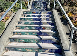
4.60.09 mi / 79 ft gainThe 16th Avenue Tiled Steps also known as the Moraga steps are an impressive community achievement, and an equally killer workout. Take an easy lap up the stairs to check out the amazing art, take in the views from the top, then get down to business. You'll be glad you made the trek over to this ...Read more -
Salinas, California
Hike or Trail Run around Toro Park
Just a short drive from downtown Monterey you will find yourself amongst the rugged yet serene hills ofToro Park. For a $2 admission fee you will have access to 20+ miles of trails that climb through canyons and run along ridgelines to peaks with views of the ocean in the distance. While the map ...Read more -
Walnut Creek, California
Run the Mt. Diablo Foothill Loop
5.06.2 mi / 875 ft gainContinue by car down Castle Rock Road until it dead ends at the beginning of the trail. Parking is usually easy to find. If full, there is another overflow lot about 500 ft back the way you came in.You'll walk a good half mile down the trail before getting the main gate. As you're walking, you'll...Read more -
San Francisco, California
Hidden Garden Steps
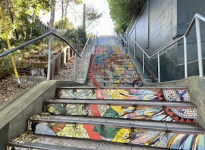
4.30.1 mi / 39 ft gainThese tiles steps are ironically iconic, as they are called the "Hidden" Garden Steps. They are one of 3 tiled staircases that San Francisco is famous for. The others are the 16th Ave Tiled Steps and the Lincoln Park Steps. Tip: When calling an uber, try to get dropped off at the top of the ste...Read more -
Walnut Creek, California
Castle Rock Trail
5.06.06 mi / 971 ft gainLocated near Walnut Creek, the trail is easily accessible from anywhere in the Bay Area. The trail is kept open year-round, and happens to be part of the American Discovery Trail and the Coast to Crest trail. If you are not done hiking, connecting trails allow you to summit Mt. Diablo. This tra...Read more -
San Francisco, California
Run the Coit Tower Stairs
3.8There are 2 sets of stairs for Coit Tower on Sansome St. The first set is at Greenwich and the second is at Filbert. The Filbert steps are a little deeper per step and are mostly wood and concrete. The Greenwich steps are a little tougher because of the shallower, brick stairs as you get toward t...Read more -
Lafayette, California
Lafayette Reservoir via Nature Area Rim Trail
5.05 mi / 758 ft gainLafayette Reservoir is perfect for canoeing, mountain biking, trail running, and hiking. The Reservoir trail system is also used for nature walks and birding. The loop has several high points that have amazing views. The trails become very muddy after wet weather - so tread with caution. Th...Read more -
Berkeley, California
Stonewall Panoramic Trail
4.51.44 mi / 663 ft gainFrom the trailhead at Stonewall Road, the 1.5-mile trail makes for an excellent before or after-work run. But the steep hills and loose ground aren’t for those looking to find an easy nature walk. The incline starts well before the Stonewall-Panoramic trailhead, so you won’t even have time to w...Read more

