Los Altos, California
Looking for the best hiking in Los Altos? We've got you covered with the top trails, trips, hiking, backpacking, camping and more around Los Altos. The detailed guides, photos, and reviews are all submitted by the Outbound community.
Top Hiking Spots in and near Los Altos
-
San Francisco, California
McLaren Park: Philosopher's Way Loop
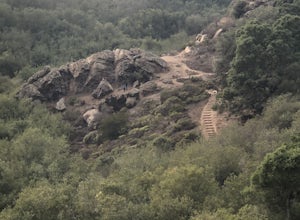
5.02.25 mi / 315 ft gainBeyond McLaren's family friendly playgrounds and picnic areas, there are miles of trail to explore. The Philosopher's trail is a well-marked loop (notice the stone markings along the trail with arrows etched into them). There are several parking lots available where you can jump onto the loop. No...Read more -
Daly City, California
Mussel Rock Loop
4.01.95 mi / 322 ft gainMussel rock, a three-story, 50 million year old rock that has been carried some 500 miles northwest from Southern California, is where the San Andreas fault meets the Pacific Ocean. It's also an excellent spot to drink some wine and catch a sunset. From San Francisco, take Highway 1 south towar...Read more -
Oakland, California
Run the Circumnavigation of Redwood Regional Park's Ultimate Trail Loop
5.07.5 mi / 1600 ft gainIt’s difficult to have a car in San Francisco, but oh-so worth it when it comes to weekend getaways, especially with all the Bay Area has to offer. This is a super accessible trail system just 30 minutes outside of the city that makes for a fun, easy trail run or hike.Redwood Regional Park, part ...Read more -
Oakland, California
Hike Redwood Regional Park via the Dunn Loop
5.03.6 mi / 606 ft gainThe Redwood Regional Dunn Loop is just outside of Oakland, and can be reached from anywhere in the Bay Area for a fun day or half-day trip. The trail is open year-round. In the spring, wildflowers are abundant. The trail has a great mix of sun and shade. Dogs are allowed, but must be kept on leash.Read more -
Aptos, California
Hike to Nisene Marks' Maple Falls
4.68.5 mi / 900 ft gainAs you enter the park, you'll need to pay $8 for parking via a self-pay envelope, so it's recommended that you bring exact change. At the park booth, be sure to grab a map. The hike can be a little tricky with no cell service and limited trail signage. Once you've grabbed your map, keep driving p...Read more -
Santa Cruz, California
Hike Natural Bridges to Lighthouse Field
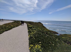
3.54.8 mi / 121 ft gainThis is a paved trail that can be used for hiking, jogging, or walking. It offers over 2 miles of beautiful California coast. Walk through flowers, see the jagged cliffs, and of course the lighthouse at the end! This walk can be done from either direction. Start at Natural Bridges and head We...Read more -
Capitola, California
Camp at New Brighton Campground
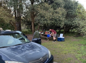
/ 0 ft gainThis Capitola camping spot is the place to be if you're looking to do a variety of activities in a variety of landscapes. You can swim, fish, or explore the nearby forest of Monterey Pine and coastal Oak. In the evening, walk into Capitola for live music and great fish tacos. The S.S. Palo Alto,...Read more -
San Francisco, California
Bernal Heights Park
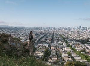
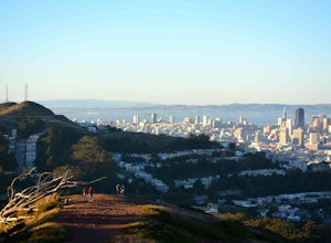
4.70.95 mi / 128 ft gainBernal Heights Park is an excellent week night adventure for those who need an escape from the city. Sit atop this small, grassy peak in peace and look out over the San Francisco skyline. Park on the street bordering the park and follow a pathway that leads up to the top. You will be instantly g...Read more -
Capitola, California
New Brighton Beach Trail
0.85 mi / 112 ft gainNew Brighton Beach Trail is an out-and-back trail that takes you past scenic surroundings located near Aptos, California.Read more -
Moraga, California
Bollinger Creek Loop Trail
1.43 mi / 213 ft gainLas Trampas Regional Wilderness offers an extensive trail system for hikers, horseback riders and mountain bikers. The trail is open year round and dogs are allowed. The Las Trampas and Bollinger faults spread apart to reveal a wonderful wilderness area with ancient remnants of beaches. The entir...Read more -
San Francisco, California
Lake Merced Loop
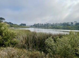
4.74.53 mi / 180 ft gainLake Merced Loop is a loop trail in the southwestern part of San Francisco. This trail is used for running and walking. You'll see plenty of people getting exercise or taking their dog for a stroll. There are also benches and tables around the loop. The lake itself is fresh water and is used for...Read more -
San Francisco, California
Glen Canyon Park Trail
5.01.76 mi / 394 ft gainGlen Canyon Park Trail is a loop most commonly used for running or hiking in the southwestern side of San Francisco, California. Parking for the loop is street parking, so be sure to take any valuables out of the car with you. Note: There are restrooms available at the Glen Canyon Recreation Ce...Read more -
San Francisco, California
Mount Davidson
4.51.03 mi / 299 ft gainMount Davidson Park is located in the southwestern part of the city nestled between Diamond Heights and Portola Dr. The climb isn't too difficult, but to reach the top of the 928ft summit, you should wear close-toed shoes and be ready for some loose gravel or mud if it's been raining. The hike is...Read more -
Oakland, California
East & West Ridge Loop
4.53.47 mi / 833 ft gainTucked away in the hills of Oakland, you will find one of the homes of California's Coastal Redwoods. Created by a unique geographical circumstance, this forest breathes winds funneled through the Golden Gate across the bay, which created environment opportune for Redwood growth. These Redwoods a...Read more -
San Francisco, California
Fort Funston Trail
4.71.81 mi / 253 ft gainFort Funston is an SF gem I discovered when looking for a dog friendly hike near the city. Located west of Lake Merced, you'll find a gorgeous Northern California beach oasis where you and your dog can run wild and free :). Parking is located at the top of the park where you'll descend a steep se...Read more -
San Francisco, California
Corona Heights Park
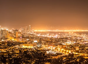
5.00.65 mi / 115 ft gainCorona Heights Park is a park located north of the Castro and South of Buena Vista Park. The peak of the hill is windy, but it offers an unobstructed panoramic view of the city of San Francisco from downtown to Twin Peaks. It is perfect for taking panoramic pictures of San Francisco at night. Y...Read more

