Lancaster, California
The best trails and outdoor activities in Lancaster, California, offer a variety of scenic landscapes and challenges for hikers of all skill levels. The Pacific Crest Trail, a must-visit, winds through the Antelope Valley, showcasing stunning desert views and unique rock formations. The trail is moderately difficult, making it suitable for seasoned hikers. Prime Desert Woodland Preserve offers easy trails, perfect for family outings, and a chance to spot local wildlife. For water-based activities, Apollo Community Regional Park features a beautiful lake for fishing and boating. Near Lancaster, the Vasquez Rocks Natural Area Park is a top destination for rock climbing and horseback riding. These outdoor adventures in and around Lancaster offer something for everyone.
Top Spots in and near Lancaster
-
Pasadena, California
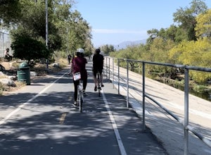
Central Arroyo Seco Community Recreation Loop
5.00.66 mi / 36 ft gainBeautiful views of the Rose Bowl and surrounding San Gabriel Mountains. A protected .75 mile loop, that offers an easy path, to stroll along. You’ll find convenient water filling stations, clean bathrooms, and a fitness area, along the path. Easy parking all around.Read more -
Pasadena, California
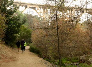
Arroyo Terrace Trail
5.01.54 mi / 194 ft gainArroyo Terrace Trail is a loop trail that takes you by a river located near Pasadena, California.Read more -
La Verne, California
Bridge to Nowhere via East Fork Trail
4.49.65 mi / 1798 ft gainThe trail on this 10-mile hike is predominately slow and steady, but can be a little rocky, so be prepared to scramble. When you’re fording the river, the water level can range from knee to chest high, especially in the wet months. A good pair of waterproof hiking boots is helpful, but water shoe...Read more -
Los Angeles, California
Los Angeles River: West Bank Trail
5.014.4 mi / 331 ft gainLos Angeles River: West Bank Trail is an out-and-back trail that is good for all skill levels located near Los Angeles, California.Read more -
La Verne, California
Cattle Canyon Trail
6.7 mi / 1066 ft gainWithin the San Gabriel Mountains from Highway 39 and along East Fork Road is Cattle Canyon. To go through Cattle Canyon, you can access the trail head just south of the Bridge to Nowhere trail head along East Fork Road right after it intersects with Glendora Mountain Road. There is a small parkin...Read more -
Pasadena, California
Lower Arroyo Seco Loop
4.02.88 mi / 230 ft gainNestled next to the CA-134, this trail presents a relaxing atmosphere while only a 30 minute drive from Downtown Los Angeles and a 5 minute drive from Old Town Pasadena. From bird-watching to archery, this trail provides a peaceful atmosphere with no lapse in beauty. The trail which is around 1....Read more -
Azusa, California
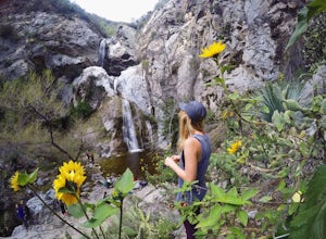
Fish Canyon Falls
2.04.08 mi / 801 ft gainThis trail is currently closed! Learn more on the U.S. Forest Service website. Follow Encanto Parkway towards the hills until you come to a junction with a sign labeled "trail" that points towards a parking lot to your right. Parking is free, though on weekends it may be difficult to find a spot...Read more -
Los Angeles, California
Stoney Point via North End
4.01.42 mi / 240 ft gainStoney Point via North End is an out-and-back trail where you may see local wildlife located near Chatsworth, California.Read more -
Los Angeles, California
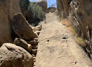
Stoney Point Park Loop
4.00.73 mi / 141 ft gainOnce you've parked along Topanga Canyon Blvd, make your way down the street and start the trail off near the steel gate, close to the horse stables. As you make your way in, you will notice some rock climbers practicing on the lower elevation rocks. Make your way around this rocky park, counter-...Read more -
Los Angeles, California
Griffith Park Old Zoo Loop
4.02.52 mi / 666 ft gainThe Griffith Park Old Zoo Loop is a 2.52-mile moderately trafficked loop trail located in Griffith Park, Los Angeles. Due to its length and minimal elevation gain of ~670 feet, the hike is open to all skill levels. The trail is primarily used for walking, hiking, and trail running, The Griffith P...Read more -
Los Angeles, California
Mount Hollywood via the Fern Canyon Trail
5.05.02 mi / 1581 ft gainAt 1,625 feet Mt Hollywood is the second highest point in Griffith Park and provides picturesque views of the Hollywood Sign, Griffith Park Observatory, Downtown Los Angeles and the San Gabriel Mountains. The hike to the Mt Hollywood Summit begins on the northeast side of Griffith Park near the ...Read more -
Los Angeles, California
Glendale Peak via Henry's Trail
4.02.07 mi / 915 ft gainGlendale Peak is often passed over by people hiking to Mt. Hollywood, and while it is not as high as its neighbor summit, it boasts arguably better views that you will enjoy all to yourself. While not really a full hiking trail and more of a small detour, Henry's Trail is worth the small uphill c...Read more -
Los Angeles, California
Hike up Chatsworth Park North
1 miFrom the parking lot, make your way through the park until you reach the bottom of a hill filled with huge rocks and boulders. It is very hard to miss.From here, you can pick any trail you wish. They will all lead up to the top. There's a lot of rock scrambling involved, as well as boulder hoppin...Read more -
Los Angeles, California
Hollyridge Trail to the Hollywood Sign [Closed]
4.13.5 mi / 383 ft gainThis trail is closed as is the Beachwood Gate which is used to access the Hollyridge Trail will be permanently closed on April 18th, 2017 due to a court order. Check out Hollywood Sign via Brush Canyon Trail for an available option. There are three ways to get to the Hollywood Sign. This route ...Read more -
Los Angeles, California
Beacon Hill via Coolidge Trail
5.02.84 mi / 587 ft gainThe starting point for your run is at the Griffith Park Southern Railroad. From the parking lot walk east crossing Crystal Springs Drive and find the Coolidge Hiking Trail. Begin running up Coolidge Trail toward Upper Beacon Trail making sure to stay straight at the first intersection (0.2 miles)...Read more -
Los Angeles, California
Wisdom Tree
4.80.95 mi / 528 ft gainIn Griffith Park, park along Lake Hollywood Drive and walk the paved quarter mile up Wonder View Drive to the start of Wonder View Trail. Here, walk through the yellow gate and make the first right after the road turns to dirt. Head up this unmarked single track path heading east up the mountain....Read more



![Hollyridge Trail to the Hollywood Sign [Closed]](https://images.theoutbound.com/contents/101823/assets/1421740399247?w=300&h=220&fit=crop&q=60&s=2a530c5406ca77dd7baf662c74a58ba1)
