Lake Arrowhead, California
Top Spots in and near Lake Arrowhead
-
Pearblossom, California
4.5
7.37 mi
/ 1870 ft gain
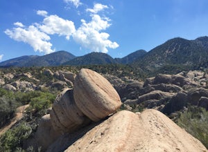
What a hidden gem! A martian landscape full of faultline desert rock formations and joshua trees against a mountainous backdrop of the San Gabriels. Devil's Punchbowl Natural Area features a 1 mile well-marked, well-maintained single track loop trail inside the Punchbowl (great for kids) and a 7 ...
Read more
-
Pioneertown, California
Here in California we have a lot of desert to sift through. When trying to figure out how to navigate the mass, you have to know the places worth fighting the brutal heat or chilling cold. Pioneertown will lure you in regardless. You will see why as you make your way up the 4-mile winding road of...
Read more
-
Riverside County, California
San Jacinto Peak is the second highest peak in Southern California which sits at 10,833'. There are several trails to summit San Jacinto, but Marion Mountain is the shortest but also a tough one.
You will start the hike at an elevation of 6300' and continuously climb 4500' in less than 6 miles. ...
Read more
-
Silverado, California
5.0
6.78 mi
/ 1972 ft gain
The Bedford Peak Trail in Silverado, California is a challenging hike that offers a variety of natural features. The trail spans 6.78 miles round trip and has an elevation gain of 1,972 feet. It is rated as difficult due to its steep inclines and rocky terrain. The trail begins in a dense oak w...
Read more
-
-
Pearblossom, California
5.0
3.01 mi
/ 755 ft gain
Burkhart Trail is well-defined and easy to follow through an unbelievable old growth of Jeffrey pines, incense-cedars and surprisingly, redwoods! At 0.25 miles, there is a steep spur trail near a large pile of boulders that leads to a popular swimming area, often frequented by guests of the campg...
Read more
-
Pearblossom, California
Located 1 mile east of the Mt Waterman Ski Resort, Buckhorn Ski Hill is a great place to enjoy a leisurely stroll through a snow-covered forest, complete with views of towering Mt Waterman. To get here take I-210 toward La Canada, exit on to California Highway 2 (Angeles Crest Highway) heading no...
Read more
-
Azusa, California
2.0
4.08 mi
/ 801 ft gain
This trail is currently closed! Learn more on the U.S. Forest Service website.
Follow Encanto Parkway towards the hills until you come to a junction with a sign labeled "trail" that points towards a parking lot to your right. Parking is free, though on weekends it may be difficult to find a spot...
Read more
-
Pearblossom, California
5.0
5.87 mi
/ 1499 ft gain
Mt. Waterman is accessed along Highway 2 in the Angeles National Forest. Heading east from La Canada look for mileage marker 58.0 (34 miles from La Canada) just past the closed ski resort. Park at one of the large paved turnouts on your left. Display an Adventure Pass ($5 at Ranger Station or Big...
Read more
-
Anaheim, California
The Oak Canyon Bluebird and Wren Trail features beautiful wildflowers and is accessible year-round. The trail is well kept and offers lots of shady spots. The first portion of this hike will take you up a hill, and then to a fork. One direction will take you around a reservoir and another will ta...
Read more
-
Pearblossom, California
There's a small parking lot just below Cloudburst Summit on the way to Mount Waterman. Start your adventure there. I'd be hard-pressed to say it's more than 15 yards from the sign for the summit (7018' AMSL).
There's a fire road, if you're newer to altitude and don't know how to read a map (or e...
Read more
-
Palm Springs, California
John Muir once wrote, "The view from San Jacinto is the most sublime spectacle to be found anywhere on this earth!" So it's no surprise that this is a sought after destination for hikers and climbers alike.
Named after the fact that most climbers use the Palm Springs Aerial Tramway to reach this...
Read more
-
Palm Springs, California
Intermediate: No snow.Advanced: Lots of snow.Expert: Snow w/ high winds and low temps.
GPX: https://www.gaiagps.com/datasu...
San Jacinto, at 10,834 feet, is the second-highest peak in the Southern California. It's unique in that it has a rotating tram car (think slow motion disco floor) that r...
Read more
-
Palm Springs, California
Entering Mt San Jacinto State Park via the Palm Springs Aerial Tram is one of the easiest ways to get into the wilderness area. Purchase your ticket and ride to the station where you'll be able to walk out the backdoor and onto the trail. In order to get to Cornell, your route finding skills wil...
Read more
-
Palm Springs, California
5.0
10.09 mi
/ 1404 ft gain
Palm Springs Tram to Idyllwild is a point-to-point trail where you may see wildflowers located near Palm Springs, California.
Read more
-

