La Quinta, California
Looking for the best photography in La Quinta? We've got you covered with the top trails, trips, hiking, backpacking, camping and more around La Quinta. The detailed guides, photos, and reviews are all submitted by the Outbound community.
Top Photography Spots in and near La Quinta
-
Riverside County, California
Wall Street Mill
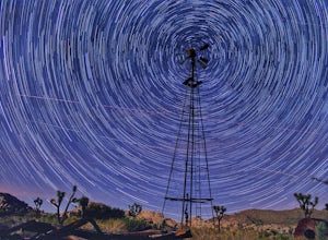
4.02.43 mi / 131 ft gainHike along the easy Wall Street Mill Trail for about one mile and you will reach the mill - if you are into night photography, this is an amazing subject that will bring you back again and again, always capturing something different. Explore around off trail - there are tons of boulders to play a...Read more -
Riverside County, California
Camp at Joshua Tree's Jumbo Rocks
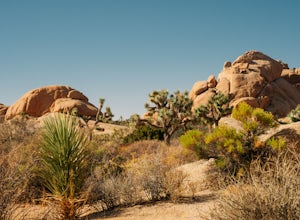
4.8Set your tent up next to a wall of tall boulders. This campground can offer a little shade, which is key especially during the warmer months. At the campground, there are 124 first-come, first-serve sites for $10 per night. Each campsite comes available with a picnic table and fire ring. The camp...Read more -
Riverside County, California
Hike the Barker Dam
1.28 mi / 85 ft gainThe Barker Damn trail is a 1.5 mile loop trail across flat terrain which makes it great for the whole family. The hike starts out from the Barker Dam parking lot which is shared with the Wall Street Mill trailhead. You can find the Barker Dam trailhead just to the left of the bathrooms. After ...Read more -
Twentynine Palms, California
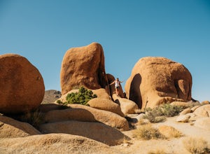
Skull Rock Trail at Joshua Tree National Park
5.01.7 mi / 131 ft gainYou can park at the Jumbo Rocks Campground to start this quick hike. There are two parking locations for this campground and it will be easiest if you use the first one you see, rather than going farther off the road and right next to the campsites. To start the hike, start going north and immedi...Read more -
Twentynine Palms, California
Willow Hole Trail in Joshua Tree National Park
6.8 mi / 341 ft gainThe Willow Hole hike begins at Boy Scout trailhead and winds past and through the Wonderland of Rocks to a marshy stand of willows. The trail is flat, but with little shade so be sure to bring lots of water! As you leave the parking lot you'll enter an expansive stand of Joshua Trees that grows...Read more -
Twentynine Palms, California
Tour Keys Desert Queen Ranch in Joshua Tree National Park
Joshua Tree National Park flawlessly combines otherworldly landscapes, incredible recreational opportunities, and a colorful, wild-west history. Before it was a national park, Joshua Tree was home to cattle rustlers, gunslingers, miners, and rugged homesteaders. One of the most quirky characte...Read more -
Riverside County, California
Camp at Joshua Tree's White Tank Campground
5.0White Tank Campground is in the perfect spot to get a taste of all that Joshua Tree has to offer. As a central location to nearby hiking and climbing, it is easy to access the various parts of the park. Removed from the border of the park, White Tank doesn't attract as many visitors as the more p...Read more -
Riverside County, California
Night Shoot at Arch Rock
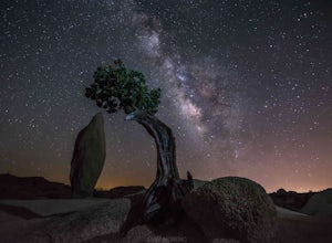
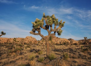
4.7If you're setting up camp, be sure to check out White Tank Campground, which is home to one of the most epic rock formations. The Arch is located here. It's only about 1/2 round trip of walking to this spot. Geology Tour Road offers some flat wide open views of Joshua Trees in all directions. If ...Read more -
Borrego Springs, California
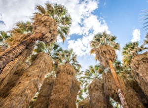
Hike through Borrego Palm Canyon
5.03.25 mi / 450 ft gainBorrego Palm Canyon Trail is located just north of the park visitor center, making it a convenient place to begin your exploration of the Anza-Borrego Desert. To reach the trailhead, drive through Borrego Palm Canyon Campground, the largest developed campground in the park, where an $8 day use fe...Read more -
Borrego Springs, California
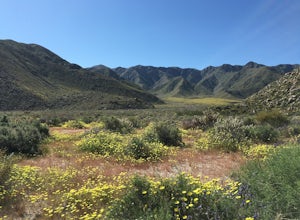
Camping in Anza-Borrego State Park
5.0With over 600,000 acres, Anza-Borrego Desert State Park is the largest state park in the contiguous United States. 500 miles of dirt roads, 12 wilderness areas and miles of hiking trails provide visitors with an unparalleled opportunity to experience the wonders of the Colorado Desert. The park i...Read more -
Borrego Springs, California
Hike the Panorama Overlook in Anza Borrego Desert State Park
1.6 mi / 636 ft gainThis is an out and back 1.6 mile round trip with 636 feet of elevation gain. The top has excellent views of Anza Borrego. It is close to the visitor center.Read more -
Twentynine Palms, California
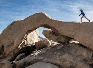
Arch Rock Nature Trail
4.31.24 mi / 92 ft gainThis is a rock formation very popular with young crowds at Joshua Tree. The views from this hike are spectacular. If you hike this trail at sunset, the gorgeous colors of the ski are reflected onto the rocks. There is a plaque along the trail detailing rock formations and facts about the parks ...Read more -
Twentynine Palms, California
Split Rock Loop
5.01.94 mi / 220 ft gainStarting out at the Split Rock Trail parking lot, you'll see Split Rock, which might be the most visited boulder in the park. Everyone makes a visit to it and while it is absolutely amazing, it's great to take the hour or two to wander around to more amazing scenery. Immediately upon starting t...Read more -
Riverside County, California
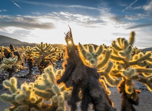
Photograph the Cholla Cactus Gardens
4.40.25 mi / 0 ft gainThe Cholla Cactus Garden is something everyone can appreciate and enjoy. The trail is in total about a 0.25 loop, but you are certainly free to wander around more. Plan on spending at least 30 minutes to an hour enjoying the scenery. If you are a photographer, you will be enthralled by the light...Read more -
Yucca Valley, California
Backpack the California Riding and Hiking Trail in Joshua Tree
36.97 mi / 2792 ft gainThe starting point for this hike is at the Black Rock campground, 5 miles from the town of Yucca Valley. You'll need to self register for a free backcountry permit before starting. The first section of the trail follows a wash then the trail narrows and, after only a mile or two, you'll begin cl...Read more -
Banning, California
Lake Fulmor Loop Trail
5.00.53 mi / 89 ft gainLake Fulmor is a small lake in the San Jacinto Wilderness near Idyllwild, CA. The trail loops around the lake offering spectacular views and is good for all skill levels. There are picnic tables, grills, and a small dock where you can peer out over the lake or cast a line. To fish in Lake Fulm...Read more

